Friday, January 20, 2017

Yellowstone in Winter, Yellowstone National Park, Montana and Wyoming

1/21 - 1/29/2017 Hikes and excursions from Old Faithful and Mammoth areas inside Yellowstone National Park

GPS Coordinates:  (Latitude,  Longitude,  elevation)
  Old Faithful area:  44.46050   -110.82886,  7348 ft.

Pet-Friendly: No, unfortunately.  Dogs are allowed in the park, but not in the Snow Lodge, which is the only place you can stay.  

Motorcycle Friendly: Nooooo.  While you can technically ride your bike in the park, in winter you can only go as far as the Mammoth area, only 5 miles inside the park from the northwest entrance.  In winter, snow tires are required on that short five mile stretch to the facilities at Mammoth.


Hiking Statistics:  We went on several hikes around the various geyser basins and a few other features at the park, but mostly short hikes after being taken to the area on snow coach.  In addition to hiking some of the packed trails, we also did some snowshoe hiking and cross-country skiing.

Bethany and Rick at Kepler Cascades
At first, I wasn't going to write up a blog post on any of the hikes and excursions we did during our stay at the Old Faithful area Snow Lodge.  After all, this is a hiking blog, and any write-up I would do is likely to sound more like a travel brochure than a hiking resource.  That being said, we did do a fair amount of hiking in the park.  On the trip back home, I was deliberating whether to write this post, and leaning against doing so, when my wife Bethany said, "don't you do your blog as a resource for hikers, and as a way for you to keep track of your discoveries and what you learn each time you go out?"  She continued, "When we were planning this trip, wouldn't you have liked something like that to give us a little guidance?" Well, hmm, yes.  As a matter of fact, I had looked for some reviews, guides, and other resources to let us know what to expect and how we should prepare.  Other than the National Park Service (NPS) web pages, and those maintained by Xanterra, the company with the concession for operating facilities in the park, I found almost nothing of use.  Bethany went on and delivered the clincher, "Whether you write a blog post or not, we need to write down all the tips and tricks we learned this time so we are better prepared next trip."  As you can see, I'm writing a blog post for the trip.  When she's right, she's right. 


Old Faithful erupting - note the
lack of people around it
First, let's look at what is open and what you can get to during the winter months in Yellowstone.  Getting there is not that complicated because there is only one way to do it and you won't be the one navigating your way there.  You probably have heard that the park is "open" from late April through early October each year.  That fact is, the park never closes.  What does close is the roads and facilities.  Check this link for exact dates for the year you are traveling there, but most of the facilities at the major areas for lodging, dining and visitor experience will close in early October.  The roads close to normal vehicle traffic at varying dates, but generally late October or early November.  The road between the Tower and Canyon areas goes over Dunraven Pass and gets so much snow that they just have to give up on it.  In winter it is closed even to "over-snow" vehicles.  That particular road usually gets around 80 feet of snow, so it will not generally re-open until Memorial Day weekend.  After dusk every day, the groomers go out and groom all the roads in the park with big machines similar to those used to groom the slopes at ski resorts, leveling out the ruts and making a nice flat, packed surface for the over-snow vehicles.


Bison use their head to move snow out of the way
to find grass to eat
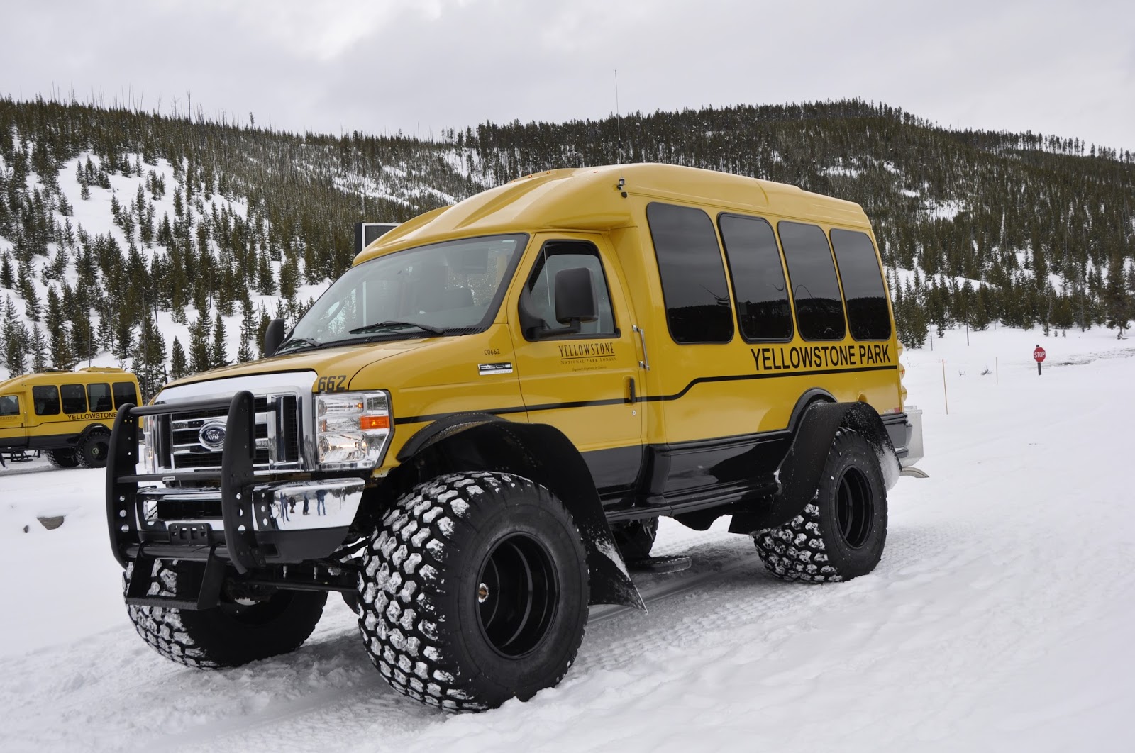
So, if the only traffic allowed in winter is over-snow vehicles, how do you get there?  The NPS concessionaire, Xanterra, only operates within the park itself and runs snow coaches between the Mammoth Lodge and the Old Faithful area Snow Lodge.  This is approximately a four-hour ride in a snow coach, which they run every morning and every afternoon going each way between those facilities.  The snow coaches are driven by extremely knowledgeable guides that point out various park features, answer questions, and make stops along the way for restroom stops and to view various attractions.  Note that the only heated restrooms I know of are at the Madison Junction warming hut and the Canyon area visitor center, which is kept partially open.  At Canyon the restrooms are open, and they have placed a bunch of picnic tables on the floor of the visitor center so you can eat a box lunch inside.  The snow coach shuttles make different stops each way, so if you take the snow coach each way as we did, you get to stop and see virtually everything along the route from Mammoth, through Norris Junction, Madison Junction, then up to the Old Faithful area and the Snow Lodge.


Godbeams shine through the steam and
rime frost near the mud volcano
There are also other commercial snow coach services that operate out of West Yellowstone, MT and Jackson, WY, that will take guests to the Snow Lodge via the west and south entrances, respectively.  These companies also operate various excursions to take guests to other areas within the park as well.  There are also commercial operators that take groups into the park on snowmobiles from West Yellowstone, as well as into the Gallatin National Forest outside Yellowstone Park.  During this time of year, there are generally more snowmobiles on the
Bison along the Firehole River
The majestic Old Faithful inn is completely closed all winter
streets of West Yellowstone than there are cars, but that doesn't mean you can take your own snowmobile into the park.  The current NPS rules require snowmobiles to be led by an NPS certified commercial guide because they have strict rules on the operation of snowmobiles within the park, including when, where, and how they can be operated.  They all have to be back out of the park by dusk.  We have stayed in West Yellowstone during summer visits to the park, and know that a significant amount of time is spent each day just getting from the west entrance to Madison Junction and back, to branch out to see other parts of the park.  The Snow Lodge is much more centrally located and was a much better springboard into the park on various excursions.  For our summer trips, we find the Yellowstone Lake Hotel area the best place to stay.


LPT type snow coach
Now that you have made it to the Snow Lodge, now what?  Well, for one thing, you won't be going too far without getting on a snow coach.  There are plenty of trails in the vicinity of the Snow Lodge that you can get out on.  All of the walkways and boardwalks in the Upper Geyser Basin have the snow packed to the point you can get around the whole area by just hiking.  This includes going out to Black Sand  Basin, another nearby geyser basin, and the loop trail through the forest on the mountain to the Observation Point behind Old Faithful.  You can also hike on the
Tracked type snow coach for deeper snow
snow-packed trail all the way down to the Morning Glory Pool, about halfway toward Biscuit Basin, another large geyser basin downstream along the Firehole River.  A groomer behind a snowmobile grooms this trail every day for park visitors.  Further traffic on these trails and other trails going out to Mystic Falls, Fairy Falls, Issa Lake, and all the other trails in this area require snowshoes or cross-country skis.  Xanterra will do snow coach "ski shuttle" drops where they drop you off at various points miles away, then you ski back to the lodge.  

Firehole River
We actually did a fair amount of hiking without snowshoes or skis.  You do have to be careful, however; what happens is the snow will get packed down so you can hike on it, but snow drifts into the packed down area, and that also gets packed down.  So you end up with the "packed snow trail" being almost as deep as the unpacked snow on each side of it.  Along the boardwalk areas, the packed snow was about as high as the handrails, and it is only halfway through the winter.  There are very few other people out on the trails, but when you do encounter someone going the opposite direction, you have to do a kind of sideways shuffle when you pass them so that neither of you steps out into the unpacked snow.  If you do, you'll immediately sink down to about thigh level and have to climb back up on the packed snow trail.  I'm a little clumsy as well as absent-minded and did this many, many, times.  We eventually got pretty good at the "side-shuffle dance" when passing by other folks.  


A group of bison is called an "Obstinacy".
This is why.
While there is a good deal of hiking available in the Old Faithful area where the Snow Lodge is, to see the rest of the park you will have to get on a snow coach.  There are many excursions that Xanterra operates from the Snow Lodge.  We signed up for several of these that sounded interesting but found out that they go on routes that overlap, so we did a little rearranging of our reservations so that we went on snow coach excursions that went to every part of the park that was accessible but didn't overlap any more than necessary.  That left us free to do as much hiking, snowshoeing, and skiing as we could on our own.  Xanterra replaced their fleet of snow coaches this year.  They use the new snow coaches with large, low-pressure tires for most areas, but use ones with triangular pitched treads instead of wheels for areas with deeper snow.


Fox near Fishing Bridge at Yellowstone Lake
There is wildlife everywhere in the park, and they don't seem to mind humans very much.  I have noticed the same thing in the summer, so it isn't just a wintertime thing.  We have elk, coyotes, fox, etc. in Arkansas as well, but there is no way they would let us get as close as the animals in the park do.  It's like they know they have nothing to fear from humans in the park and just don't care.  Bison are everywhere; at one time, there were only 20 bison in the wild, but there are now approximately 5,000 in Yellowstone.  In the early 1900s, the park service recognized these mammals for the magnificent animals they are and decided
Coyotes near the Madison River
Note they are using the path plowed out by a bison
they might want to do something to preserve the species.  They built the famous Buffalo Ranch in the north part of the park, started rebuilding the herd, and eventually released them back into the wild and protected them.  Now they are maintained at an ideal number for the size of the park and pretty much rule the place.  Even the grizzlies and the wolf packs won't take on the trouble of trying to take down a full-grown bison.  This has been such a great success story the NPS uses a bison on their official logo.  The NPS rangers want you to maintain a distance of at least 25 yards from any wildlife, but sometimes that is difficult.  The bison are so ubiquitous you see
Trumpeter Swan taking flight from the Firehole River
them all over the park.  They often walk on the roads because it's a lot easier on the packed snow than plowing through the deep snow.  If a bunch of them hold up your snow coach, well, just hurry up and wait.  Oddly enough, a group of bison is called an "obstinacy".  Believe me, that is a much more fitting collective noun than simply "herd".  They seem as docile as they can be, but these are animals that can easily outrun you and literally weigh more than a ton.  Their heads alone weigh about 200 pounds.  There have been people gored by bison in the park.  Those instances are very rare, and probably well deserved, but we still maintained our distance as well as we could.


The Lion Geyser erupting - Upper Geyser Basin
Thermal features are always a big hit in the park, and in winter they are even more noticeable due to the cold.  As you probably know, Yellowstone sits on top of a giant super volcano that goes off every 640,000 years or so.  The last time was about 640,000 years ago (hmm...).  The heat from all that super hot magma very close to the surface manifests itself in a spectacular way.  The majority of the geysers on the entire planet, about 2/3 of the world's geysers, are right here in Yellowstone.  Of those, 90% are in the major geyser basins along the Firehole River in the Old Faithful area.  Wherever you go in the park, you can see the plumes of steam from various thermal features, made even more visible this time of year by the extreme cold.  All this thermal activity is why the major rivers and creeks in Yellowstone never freeze over.  Here is a map of all the major thermal features in the Old Faithful area:
Thermal Features in the Old Faithful Area

Across the Great Divide!
Rick and Bethany at Lake Issa
The thermal features close to the Snow Lodge made for a few hiking trips of varying lengths while we were there.  Going down to Morning Glory Pool is about a three-mile round trip hike, and the Black Sand Basin is about four miles.  While there, I took the opportunity to do a little cross-country skiing as well, something I had never done before.  After some quick training from a great instructor, I took off for Biscuit Basin.  If you are a skier, there are a lot of trails to take advantage of in the most spectacular scenery to be found on the face of the earth.  If you are a rookie like me, it's still fun, but definitely one of those things that get better with practice.  I really struggled with it at first, but as I found my rhythm and started letting the skis do the work, it became a lot easier and more enjoyable.  By the time I finished a seven mile trip around Biscuit Basin and back to the Snow Lodge, I was really getting the hang of it.  I'll definitely want to do more cross-country on future trips.  


Firehole Falls
Back home in the Arkansas Ozarks, waterfalls are my mainstay and primary hiking focus.  Here in Yellowstone, many of the waterfalls were still flowing thanks to the thermal activity all over the park.  We visited Gibbon Falls, Firehole Falls, Kepler Cascades, and the Upper and Lower Falls of the Yellowstone River.  We ran out of time this trip, but next time we'll plan on skiing out on the backcountry trails to Mystic Falls and Fairy Falls.  Some of the smaller waterfalls on small creeks actually freeze up over the winter, but most of them, particularly those on the major rivers, have about the same flow as they do in the summer.  The normally huge Lower Falls on the Yellowstone River has a huge ice dome that builds up over the winter.  I found that photographing waterfalls in the high country winter is more difficult because the snow all around them doesn't provide much contrast to the white, frothy water flowing over the falls.


Sapphire Pool in Biscuit Basin
The reasons to go to Yellowstone in winter are clearly numerous.  In addition to the wildlife, waterfalls, thermal features, stunningly beautiful scenery, and unique experiences, another major factor for us is the absence of people.  Last summer, Yellowstone set another record with over four million visitors to the park.  It is indeed an incredible place to visit in the summer, but one of the things that set the winter season apart is that all those people are not there.  For example, in the summertime, there are about 30,000 people that witness the eruption of the Old Faithful geyser every day, but this time of year there were never more than a handful of people whenever we strolled out to see Old Faithful erupt.  I much prefer the solitude and serenity of a wilderness location without the people.  Don't get me wrong; even though I previously had visited Yellowstone only in the summer, it was still my favorite place on earth.  However, having visited during the winter, we both agree it is even better this time of year.

I mentioned that we had learned quite a bit on our first trip to Yellowstone in the winter.  There were a few lessons learned, and I'll detail those so that next time we will be even better prepared, and hopefully this will help others get the most out of this winter wonderland.  Here are my tips and tricks:

  • Make reservations early.  Christmas time at the Snow Lodge is special, so if you want to go during the two weeks around Christmas, you need to 
    Rick at Solitary Geyser
    make reservations the previous winter.  If you procrastinate, you may not be able to get any room at all, especially for this highly sought after timeframe.
  • Stay at the Snow Lodge itself.  We booked a premier lodge room, but there are lower priced cabins available and we considered that.  Speaking with other guests who didn't make reservations early enough and had no choice but to book a cabin, they all wished they were in the lodge itself.  Otherwise, every time you need to eat a meal, catch a snow coach, etc., you have to bundle up and make the trek over to the lodge.  If it is -17 degrees, that's kind of a hassle.
  • Dress for the weather.  Do not be deceived by some of the photos of us
    without hats or gloves.  Those were momentary things for photo taking purposes only.  It is cold in Yellowstone in the winter.  Sometimes,
    Timing is everything with photography.
    Sometimes, it's cold enough to make
    your nose run.  Know what I mean?
    extremely cold.  Layering clothing is the key, and we were well prepared in this regard.  Thermal underwear (long johns) is a good start.  The more wind and water resistant your clothing is, the better.  I never wore more than long johns and jeans, and my legs never got cold.  For an all day excursion, I did wear flannel-lined jeans.  Ski pants would be more water and wind resistant, but I just don't like wearing them.  Look for a good parka or snorkel coat with multiple pockets that has plenty of good insulation and extends down to thigh level for overall protection of the trunk of your body.  I generally wore two layers on my upper body plus my snorkel coat.  I have a packable down vest that takes up very little room, but if needed is a really good third layer for my upper body.   I only used it once, but was glad to have it then.
  • Gloves and boots need insulation too.  I had a good pair of gloves with
    Godbeams in the steam at
    Dragon's Mouth Hot Spring
    150g of 'Thinsulate' insulation that worked very well.  Bethany had gloves and boots with Thinsulate and had little problem with the cold, but I had decided to go with my Vasquez hiking boots.  I love the boots, they are waterproof and between the heavy leather and Gortex, I thought they would be plenty well insulated.  Well, I was wrong.  They were OK for a couple of hours of hiking in single-digit temperatures but after that, my toes would start to really feel the cold.  Next time I'll take some well-insulated snow boots.  As part of your foot insulation, take heavy socks.  You can get heavy, extreme-cold rated hiking socks at sporting goods stores.
  • Take hand warmers and toe warmers.  Sometimes, no matter how good your boots and gloves are, they need a little help.  These little packets of warmth activate when you take them out of their sealed package and generate heat by an exothermic reaction for several hours.  I don't advertise or endorse any products in my blog, but HotHands brand were the ones that seemed to have the best results when I did my research, and we got a case of the ones rated for 10-hour life to
    Bison near the Middle Geyser Basin
    Note the rime frost buildup - their insulation is so good,
    this will not melt until sunlight warms it enough.
    Bison don't even feel the cold until -20F to -40F.
    take with us.  We both used the hand warmers, as sometimes you need to take your hands out of the gloves when doing camera work and it helps to have one in your pocket.  
    I also used the toe warmers a few times, but Bethany only needed them once on an all-day excursion. 
  • The cold can zap your battery.  If you do any photography (and who can resist in a place like this?), expect to have shorter battery life.  In addition to keeping your hands warm, those little hand warmers you put in your pockets can help here as well.  Keep your battery and spare battery in a pocket with a hand warmer and it will last much longer.
  • Take sunscreen, lotion, and sunglasses.  Because it is very cold and very high altitude, it is also very dry and very little protection from the sun's UV rays.  It was overcast about 3/4 of the time we were there, but when the sun is out, the reflection off the snow is blinding.  Even without many sunny days, my face got pretty sunburnt.
  • Plan your time in the park before deciding to take snowshoes or ski equipment.  Remember you will be transitioning from your vehicle to snow coaches.  If you catch a flight into Bozeman and take the shuttle to
    Geyser by the Firehole River
    Snowshoe trip
    Mammoth to catch the snow coach, you have even more luggage transitions to mess with.  We took our own snowshoes and only ended up using them a couple of hours.  We would have been better off not hassling with the added bulk and weight and just renting them at the Snow Lodge's gift shop.  I did try a little skiing for the first time, and for only $35 I got one-on-one lessons from Matt, an excellent instructor, and rental of skis, boots, and poles for 24 hours.  Since I only used them one afternoon, that was definitely the way to go.  
  • With subzero temperatures and even a slight breeze, your face and nose
    Bethany with half-face mask
    protection and no fogging
     will freeze without protection.  Scarves and ski masks tend to take the moisture from your breath and freeze solid, but something we found that works great is a neoprene face mask, also called face protectors and face warmers.  Bethany and I used half-face face masks, and they were very effective.  The face mask is also much better if you wear glasses since it seals along your cheek bone.  Scarves and ski masks tend to let your exhaled breath go up into your glasses.  Not only will your glasses fog up, they will quickly freeze in a layer of ice over your lenses.  The face mask allows exhaling more normally through your nose and mouth, away from your face and away from your glasses.
  • Staying at the Snow Lodge is a little pricey.  In my opinion, it is well worth
    Lower Falls of the Yellowstone River
    Note the huge ice mound at the base
    the cost, but you have limited options for lodging and dining, so be aware and prepared.  Just getting to the snow lodge and back is a $117 seat for each person, each way.  For a four hour ride, that's actually a lot cheaper than a taxi would be, but some people are surprised at the cost.  You have to make reservations at the Snow Lodge, so the room cost shouldn't be a surprise.  The options for dining are very limited.  The Snow Lodge has only one dining room; you have to make reservations for dinner, but not for breakfast or lunch.  The Obsidian Dining room menus are available online.  The only other option is the Geyser Grill in the Snow Lodge, but it is primarily fast food fare and has limited hours of operation.  The menu for the Grill can also be viewed online.  Unless you take a suitcase full of bread, peanut butter, and jelly, these two are your only options for dining.  It's not like you can jump in the car and make a run to Chik-fil-a or Denny's.  I will add that the food in the Snow Lodge Obsidian Dining Room is superb.  I never met the chef, but he/she did a great job on every dish (and I tried almost all of them), so it is worth the sticker price for sure.  Interestingly enough, any dish with bison (especially bison chili) seemed particularly delicious.  Go figure.
  • The Snow Lodge was never designed to be the technologically connected
    Bethany and Rick near Fountain Paint Pots
    Note the buildup of rime frost in Bethany's hair
    from steam freezing on the hair
    lodging that most modern hotels are.  Hopefully, that will never change.  There are no televisions nor air conditioners in any room at any location in the park, summer or winter.  Air conditioning is not needed at this altitude, and neither are TVs.  If you aren't there to experience nature in it's most primal, raw, and beautiful state, do yourself a favor and go elsewhere.  There are landlines in each room, and there are mini-cells at Old Faithful, Grant Village, Canyon, and Lake that give cell coverage for about a mile radius.  Wifi is available at the lodge for a per-day fee.  We spent eight days with no TV, no phone calls, no computers or tablets, and it was marvelous.  There is something about sitting by the big fireplace in the Snow Lodge lobby actually talking to another human face-to-face that is oddly energizing and invigorating.
  • Yaktrax will help with traction.  We did not take Yaktrax, a traction device 
  • Bison near Nez Pearce Creek
    that slips over the bottom of your shoes or boots, and for the most part did not have much trouble on the packed snow and ice.  That being said, one of our guides supplied us with a pair when we went out for a "Steam, Stars, and Winter Soundscapes" excursion as a safety measure since we would be hiking on packed snow and ice at night.  They certainly did help with traction and were easy to stretch over the soles of our boots and easy to remove.  During the day, just watching where we walked and being careful on icier surfaces was sufficient and neither of us slipped and fell.  They are fairly inexpensive so, you might consider them especially for boots that don't have the deep treads that ours did.
  • Take your passport.  No, you won't have to have it to enter the park.  It seems like another planet, let alone another country, but it's actually on Earth right here still in the good old USA.  But at a couple of areas, such as the Canyon visitor center, they leave the passport stamp and inkpad out so the ranger there can stamp your passport.  
  • Take your Senior Pass (aka Golden Passport, Parks Pass, America the Beautiful Pass, and many other names).  It is still a national park, and
    the government does like to take your money.  If you don't have a pass of some sort, it will cost you $30 every time you go in from Gardiner to Mammoth.  We stayed in Gardiner a couple days before catching the snow coach at Mammoth.  We entered the park a few times to explore the Mammoth and Lamar Valley areas, and fortunately, I had my Senior Pass with me.  If you are over 62 years old and don't have one, get one.  They cost only $10 (and extra $10 for special handling) and can be obtained at a multitude of offices.  They are lifetime passes to get into not only national parks but a bazillion other campgrounds and other recreation sites controlled by virtually every federal government agency.  I got mine from the USGS online store but could have gotten it at National Forest offices in my area.  It will get you and your car full of people into the national parks for free the rest of your life, so that's what you call a pretty good deal.
Blacktail Deer near Mammoth
The staff that permanently resides in the Old Faithful area over the winter season deserves mention as well since they contributed greatly to our enjoyment on this trip.  Typically, there are about 250 employees that reside in the Old Faithful area over the winter season.  There were slightly more employees than guests, and we got to know quite a few of them.  They have dormitories and apartments at the Old Faithful area and eat only in an employee cafeteria.  Unless they drive one of the snow shuttles to Mammoth or can hitch a ride in an open seat on their day off, they aren't going anywhere.  You might think that being stuck in a place with few entertainment outlets, and an inability to go anywhere, might get a little depressing.  On the contrary, I don't think I have ever seen a happier,
Big Horn Sheep
more pleasant group of people all trying their best to make sure we had a good time.  Their attitudes were so positive, I asked some of them about it.  Ben, a guide from Arkansas that we had for a full day in the Canyon and Lake areas, wintered over with his wife, who was also an employee.  In his words, "I get to drive a huge 4x4 with a captive audience that thinks I know everything and tell stories all day while I see the most awesome scenery in the world.  They even pay me for it instead of the other way around."   April, another of our guides, said "I wake up every day in an actual winter wonderland, I ski from my apartment to work and pass bison on the way.  I teach people about the park and get to see
Pronghorn Antelope
the look of amazement on their face.  That's my job, believe it or not."  Most employees had been at Yellowstone for more than one winter.  I'm sure there are some rookie employees that just can't handle not being able to go to Macy's or watch the newest episode of their favorite TV show, but the ones that stick with it are the ones that love being there, and it shows.  They love their jobs, and they love living there.  On their days off, most of them get out and ski, hike, or ride along if they find an empty seat on a snow coach excursion.  In other words, they do what we do, only they are better at it and do it for free.  They contributed greatly to our enjoyment of this trip.


Bull Elk between Mammoth and Tower areas
We took the morning snow coach back to Mammoth, so we got back to our vehicle around noon.  Since we planned to spend the night in nearby Gardiner, Montana, that left us all afternoon to do a little more exploring in the Lamar Valley.   The top section of the "Grand Loop Road", the paved road in the park between Mammoth and Tower, is kept plowed and open all year.  The road from the Tower area to the northeast entrance is likewise kept open all year.   Since the Beartooth Highway is closed all winter, this is the only route out for the small communities of Silver Gate and Cooke City, just outside the northeast park entrance.  This road runs down the Lamar Valley, which typically has a lot of wildlife, as well as some park sights such as Undine Falls, Wraith Falls, and Blacktail Mesa.  We spent the afternoon going through this section of the park before heading out of the park to our lodging for the night.


Diamond Dusting with Bethany
on the trail up to the Observation Point
We really learned a lot this trip and had many new experiences.  The altitude, extreme cold, low humidity, and unique features of the park combine to form phenomena we were not familiar with.  We had seen hoar frost before, where fog freezes onto surfaces like tree branches and pine needles.  There was plenty of that here, and also rime frost, where steam from the thermal activity condenses and freezes on tiny ice crystals, forming ever larger frost "gems".  We also got to experience a phenomenon that I didn't even know existed.  I had never heard of a form of frost called diamond dust.  It occurs when the temperature drops quickly and what little moisture is in the air flash freezes to very tiny particles of ice that form right in the air and float slowly down, glittering in the air like diamonds. There I was, on the mountain above Old Faithful, in a pristine winter wonderland, alone with the woman I love, with this stuff like pixie dust all around us.  I am incredibly blessed to have a magical moment like this even once in a lifetime.


Morning Glory Pool
As you can see, the park is always open, and you can actually get to quite a bit of it even in the winter months.  One of the things I like about Yellowstone is getting away from the crowds on the backcountry trails.  Many of those are inaccessible during winter, but you might be surprised at how many you can actually go on with skis.  They have a saying at the park that "98% of the visitors see only 2% of the park".  That is very, very true.  The vast majority of visitors traverse the Grand Loop Road with their vehicles and see only those sights that are within walking distance of a parking area at the features along the road.  As spectacular as
Bridge over Firehole River
Note the snow is as high as the handrails
those sights and features are, you can only see 2% of the park from the Grand Loop Road.  No one goes away from this, the first national park, disappointed.  That being said, try to wrap your head around the fact that the other 98% of the park is equally awesome.  If you go in the summer, be part of that 2% and see the grandeur of this jewel of the NPS without all those other 98%.  That's what we try to do.  In the winter, you are more limited to the Grand Loop Road unless you are a much more experienced skier, but only a fraction of 1% of the summertime crowds are there with you, so it all works out.

Roosevelt Arch at northwest entrance
"FOR THE BENEFIT AND ENJOYMENT OF THE PEOPLE"
It's our park, people.  Please take care of it.
We were at the Snow Lodge for eight days.  That was about right for seeing and doing just about all we could, but I would have liked to stay longer just to do more of everything.  We were enjoying the winter visit to the park so much, it was a little hard to leave and head home.  All in all, our experiences in Yellowstone were fantastic.  We had a great time and thinking back on it, I really can't remember a vacation or road trip that I enjoyed more.  On the drive home from Mammoth, we discussed the adventures we experienced, talked about what we would do different, and planned our next winter trip to Yellowstone.


Tuesday, December 13, 2016

Arkansas Sphinx, between Hagerville and Sand Gap, Arkansas Ozarks

12/13/2016 - Arkansas Sphinx

GPS Coordinates: (Latitude, Longitude, Elevation)  
  Parking Location #1:  35.63916   -93.29101
  Parking Location #2:  35.65107   -93.29597
  Small bluffline break:  35.64045   -93.29036
  Arkansas Sphinx:  35.64059   -93.28896,  1715 ft.

Pet Friendly: Dogs on or off leash should be OK. 

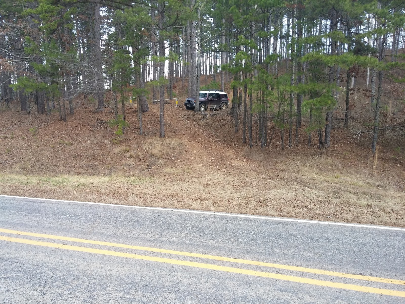
Motorcycle Friendly:  Yes. Parking location #2 is right on Highway 123, and there is a nice flat parking space at the junction of CR-5741 to park at, across the highway from the trail you will be taking.  Parking location #1 is a little over a half mile down a not-so-good dirt road, but easily doable on your big bike for the short distance.

Hiking Statistics: There are three segments of today's hike, and most folks will only need one of them so I will detail each separately:
 - Route #1 to the Arkansas Sphinx is only 0.17 miles (945 feet) long, with an elevation gain of 350 feet.
 - Route #2 to the Arkansas Spinx is 1.27 miles, with an elevation gain of 638 feet.  There is one section of trail near the base of the knob that goes downhill slightly, then back uphill.
 - If you take one route in and the other out, as I did today, the road distance between the two parking locations is 1.15 miles, with a highest-to-lowest distance of 191 feet.  It does go downhill from parking location #1 to Highway 123, and slightly uphill on Highway 123 to parking location #2.

GPS files (.gpx format) - maps with GPS tracks are at the bottom of this post
  GPS track for route #1 to Arkansas Sphinx
  GPS track for route #2 to Arkansas Sphinx

The Arkansas Sphinx
Since there is no water in the creeks for the waterfalls, I went another direction today.  There are many nice hikes in the Ozarks to places that don't need water to be an attraction, and today I just wanted to get out in the woods.  I had recently seen a rerun episode of Exploring Arkansas that featured the rock formation known as the Arkansas Sphinx.  Then, last week, I went to a slide show presented by Tim Ernst and noticed that one of his new photo books had the Arkansas Sphinx on the cover.  To top it off, I got a copy of Danny Hale's new hiking guidebook in the mail a couple of days ago, and when I cracked it open it was on the page for the Arkansas Sphinx.  I can take a hint.  Clearly, the Cosmos wanted me to go to the Sphinx, and who am I to argue with fate?  To top it off, my friend and frequent hiking partner, Dan Frew, was the guy that found this hunk of rock many years ago and dubbed it the Arkansas Sphinx.  Not wanting to tempt the wrath of The Cosmos, I packed up and headed out.  Bethany was taking Boomer to the vet to look at an injured leg, so I was on my own today.

Parking Location #2
To get to the parking location, the driving directions are pretty simple.   
  - For Parking Location #2, from the community of Pelsor (Sand Gap), go 16.2 miles south on Highway 123, then turn left onto an old road with a gate opposite the junction with Johnson County CR-5741.  This is 3.3 miles past the Haw Creek Campground.  If you are coming from the other direction on Highway 123, this junction is 10.5 miles north of Hagerville.
  - For Parking Location #1, go 0.6 miles south on Highway 123 from Parking Location #2, and turn onto CR-4840.  Go another 0.6 miles on CR-4840, and you are at Parking Location #1.


The Arkansas Sphinx
There are a couple of routes to the Arkansas Sphinx.  If you just want to go see it and cross it off your bucket list, I would recommend what I call route #1.  It is the most direct, and definitely the shortest.  Route #2 is not long, 1.3 miles, but route #1 is much shorter at only 0.17 miles.  Both routes are very steep as you go up near the top of Hess Knob that the Arkansas Sphinx sits on.  Route #2 also climbs almost twice as much, altitude-wise, as route #1, but the first part is spread out over almost a mile of trail.  Today, I wanted to get at least a moderate hike, so I went on route #2 for the hike in.  Because I prefer to see as much different scenery as possible, I hiked back out on route #1, then hiked along the road from parking location #1 to parking location #2.


Spectacular views - through the eye of the Sphinx
From parking location #2, you hike along an old logging road up to a food plot at about 0.7 miles in.  This old road is in decent shape and would be easily drivable with a good 4WD vehicle, but is always blocked off by the forest service.  They go in occasionally and bush-hog the food plot and road, but that's about all the maintenance it gets.  In any case, I have never seen the gate open on it, but it does make for an easy hiking trail.  Going out the other end of the food plot, the old road is more of an ATV trail but still makes for easy hiking.  You can take this ATV trail up all the way to the top of the knob.  When you get toward the base of the top part of the knob, there is a dense thicket growth in front of you, and the ATV trail makes a hard left turn.  Stay on the ATV trail, and it winds around the base a short distance, dipping down and then turning up the mountain, taking you all the way to the top.  I saw no recent signs of ATV traffic, but it was in fairly good shape for hiking.  


Arkansas Sphinx
Just stay on this ATV trail and you will be okay.  The trail takes you to the top of the knob, and from there you can see the Arkansas Sphinx on the slope on the other side of the mountain.  This route takes you higher up on the mountain, called Hess Knob, and from here you can see forever.   Hess Knob juts up to an elevation of almost 2000 feet, and you can see quite a distance in all directions.  The views are quite spectacular, and if you climb up to the Sphinx by route #1, you should climb the additional 200 feet or so to check out the scenery.  The Arkansas Sphinx itself is just a big chunk of sandstone, but it's a pretty awesome looking rock.  I'm no geologist, but I assume this is all that remains of a large sandstone layer, everything else having eroded away over time.  There are a couple of holes through it, one in the "tail", and one running through the north-south mid-section.  To be honest, I think it looks as much like a duck as it does The Sphinx, but "Arkansas Sphinx" has a much more impressive ring than "Arkansas Duck Rock".  So, good choice of names all those years ago, Dan.


Parking Location #1
Note the two trees with an "S" marking the trail.
After spending a good deal of time taking in the views and climbing on the Arkansas Sphinx, I headed back.  This time, I took route #1.  There is a pretty good volunteer trail going straight downhill from the Sphinx, and it is visible enough this time of year to easily follow it.  When the trail goes over a small bluffline below the Arkansas Sphinx, it zigzags down a small break along the bluff.  I think this route is somewhat steeper, but it's also for a much shorter distance.  When the trail starts off from the road, it is not quite as visible as it is higher up, but someone has helped you out by marking some trees.  At parking location #1, there is a big white "S" spray painted on a tree.  The trail goes around this tree on the left, then breaks right and goes to another big tree with an "S", and swings left around this second tree.  After that, it is very visible and easy to follow.  One word of caution; on the lower part of this route, it is thick with 'Devil's Walking Sticks' on both sides of the trail.  If you are not familiar with these small trees/bushes, they are indeed the work of the devil.  They have very sharp thorns on the trunks and branches and will poke right through heavy gloves.  Just be aware they are there and don't grab any small trees for support.

After coming down the trail to parking location #1, I hiked along CR-4840 and then back up Highway 123 to where I had parked the FJ Cruiser at parking location #2.  Even with this additional distance, I only hiked a total of 2.7 miles.  I would rate this as a moderate hike only due to the steepness of the trail, no matter which route you take to get there.  The trails in both routes are in fairly good condition, so hikers of all ages should be able to do this hike if they can make the climb.  
Blue - Route #1 to Arkansas Sphinx
Red - Route #2 to Arkansas Sphinx


Friday, December 9, 2016

Devon Falls, Hamilton Falls, Twin Falls, and Richland Falls, Richland Wilderness area, Ozarks near Lurton, Arkansas

12/7/2016 - Twin Falls, Devon Falls, Richland Falls, Hamilton Falls

GPS Coordinates:  (Latitude, Longitude, Elevation)
  Parking and Trail Head:  35.80737,  -92.93940,  1516 ft.
  Twin Falls: 35.80594, -92.96412,  1184 ft.
  Richland Falls: 35.80075, -92.96010,  1155 ft.
  Jim Bob (Long Devil's) Falls:  35.80804,  -92.96831,  1316 ft.
  Devon Falls:  35.81724,  -92.96145,  1435 ft.
  Don Hamilton Falls:  35.81199, -92.96375,  1320 ft.
  Big Devil's Bluff Falls:  35.81098,  -92.96294,  1322 ft.
  Mystic Falls:  35.80479,  -92.96518,  1275 ft.
  Mystic Cascades:  35.80519,  -92.96510,  1219 ft.
  Get onto trace road from FR-1205:  35.80864,  -92.94396,  1531 ft.
  Leave trace road to Hamilton Falls:  35.81261,  -92.96180,  1462 ft.
  Leave trace road to Twin Falls:  35.80931,  -92.95933,  1536 ft.
  Trail branch to the top of Long Devil's Falls: 35.80555, -92.96223,  1185 ft.
  Unnamed Falls at drainage near trail head:  35.80871   -92.94082
  Falling Water Falls:  35.72193   -92.93645

Pet Friendly:  Free roaming pets off leash, like Boomer, should be okay if they can do some climbing and scrambling.  I would not take dogs that need to stay on a leash or dogs that aren't up to some rigorous bushwhacking.

Motorcycle Friendly: No.  The road is definitely too rough, and there are many miles of it between the pavement and the parking location.  Not to mention the fact that the parking spot itself is not made for a large bike.

Hiking Statistics:  From top to bottom, The Richland Wilderness Area is over 1200 feet of elevation change.  Today we hiked 7.4 miles with a "highest to lowest" elevation change of just over 519 feet.  The "lower FR-1205" route is mostly on the level, with only a couple of big climbs of over 200 feet.  I would rate this hike as a difficult bushwhack, just due to the length and the ruggedness of the terrain.  We were hiking for 5 hours and 21 minutes, but quite a bit of that was photography and sightseeing time.  

GPS files (.gpx format) - Map with these routes is at bottom of this post:
  Richland Wilderness Area waypoints
  Falling Water Creek Area waypoints
  GPS track file for Lower FR-1205 route to Twin Falls 
  GPS track file for Upper FR-1205 to Hamilton Falls to Twin Falls
  GPS track file for Twin Falls to Upper FR-1205

Update: A blog post with what I consider an "optimal" route to visit all the waterfalls of this area can be seen here.

Hamilton Falls - with Dan Breedlove
Today I went back to one of my favorite places, the Richland wilderness, with hiking companion Dan Breedlove.  Dan had contacted me last weekend to see if I wanted to get out somewhere, and this area was one of the first to come to mind.  Dan was a native of the Arkansas Ozarks and an avid hiker and outdoorsman.  Yet somehow, like most Arkansans, he had still not been to this little jewel of the wilderness system.  The Richland Creek Wilderness was created by an act of congress in 1984, giving us almost 12,000 acres of beautiful Arkansas Ozarks that the wilderness act protections keep pristine and beautiful.  Bringing someone that appreciates the natural beauty of areas like this here for the first time is pretty cool.


Twin Falls
The "Left Twin" waterfall photographed
from behind the "Right Twin" waterfall
Although we had finally got some rain to break the drought, it had been such a long dry spell that  the creeks and streams were still far below their normal late fall flowrates.  My thinking was that the larger creeks and rivers with much larger drainage areas would be okay, and those with waterfalls right on the larger creeks would be a good bet. As it turned out, this was probably the best location in the Ozarks to catch some really nice waterfalls with some decent flow.  It was also a great day for hiking and waterfall photography.  The temperature stayed in the 30's all day, it was cloudy all day, and the water in the creeks was running clear.  My last trip to this area had similar conditions but was in late spring.  To see the contrast in the area from late spring to late fall, you can see the blog post for that hike here.


Richland Falls
I have documented five routes to Twin Falls on previous posts.  The one we took today was my most recently documented route, and the one I now prefer.  This one runs from FR-1205, north of the Richland Creek campground, across the large bench high above Richland Creek, then down into the Big Devil's Fork drainage.  It eliminates the need to cross Falling Water Creek and Richland Creek and is a shorter, better, route than hiking from Iceledo Gap or Hill Cemetery.  Unless you have a pretty good 4WD, the road to Hill Cemetery from Iceledo Gap is not advisable.  It is always in bad shape now and is a veritable swamp after a good rain.  As bad as the road to Hill Cemetery is, I'm sure the FJ Cruiser is up to it; still, I like the direct routes from FR-1205 better.

If you are curious about the other four routes to this great hiking area, here's a quick review and links to the posts for detailed directions:
  3) Direct hike from FR-1205 (the "Upper FR-1205 Route")
  4) Hike down the spur from Sandstone Castle
  5) Direct hike from FR-1205 (the "Lower FR-1205 Route")
Today, Dan and I used the same route to Devon Falls as my visits here in March 2015 and June 2016

Hamilton Falls
I won't bore you with the details of the hike since we followed the same routes as my last couple of visits.  I have provided plenty of links for those blog posts above for your reading pleasure.  I will say that I did try something different today to see if we could hike more on the level around the top of the first drainage you cross near the parking location.  Yes, I'm old and lazy, and try to avoid going down into hollows just to hike back up the other side.  We ended up expending much more effort trying to find an easier way, so just stick to the route detailed in my previous posts.  It seems that I get an awful lot exercise by trying to avoid exercise.  

Devon Falls
On my last trip here in June, I had a difficult time keeping track of the old trace road along the bench because of the late spring foliage.  Today it was much easier to keep on the trace road, but I still managed to lose track of it a couple of times.  That's a little embarrassing when you are supposed to be the guide, but at this time of year, it isn't that big a deal.  As long as you stay on the bench, it is fairly easy bushwhacking.  You'll want to find the old road again where it wraps around the mountain, as it leads you right to Devon Falls.  Devon Falls was our first stop, and I was surprised at how much flow it had despite being in a side drainage and not on the main creek itself.  This is my wife's favorite waterfall, and one of my sentimental favorites as well for personal reasons, and it never fails to make me smile.  Today, we even saw some frost flowers near Devon Falls.  These were not as ornate as some that I have seen, but these rare oddities of nature always amaze me.  

Hamilton Falls
From Devon Falls, we headed back the way we came and bushwhacked down into the Big Devil's Fork hollow to Don Hamilton Falls.  Hamilton Falls was just beautiful today.  Water flows over an almost perfectly flat rock to form this waterfall, so even with very little flow the water will spread over the face of the falls and look nice.  Today, we had much better flow than that and Hamilton Falls did not disappoint.  It was at this point that I realized we had picked maybe the only location in Arkansas that had enough water in the creeks for a waterfallapalooza kind of a day.  The water level in Big Devil's Fork was plenty low enough to allow us to hike down the creek instead of having to retreat above the bluffline, so that is the way we went downstream.  Sometimes, this creek is just too high to allow this, but this is the route I prefer, just for the additional scenery if nothing else.

Twin Falls - with Rick
Photo by Dan Breedlove
We passed Big Devil's Bluff Falls on the way downstream.  I noticed when we had crossed it's drainage earlier that it had very little water.  There was some flow going over this waterfall today, but not enough for me to deem it "photo worthy".  Continuing downstream, I noticed at one point the creek bed was almost completely dry.  The water resurfaced prior to going over Twin Falls, but that gives you an idea of groundwater conditions in this part of the Ozarks.  When we crossed the little spit of land between the two waterfalls at Twin Falls, I noticed the campsite there appeared as it had for the past few visits, and I don't believe it has been used for at least a few years.  My perception is that over time, I see fewer indications that folks have been into this area.  One part of me likes that, as I like my wilderness completely unspoiled by mankind and don't at all mind having it all to myself.  Another part of me finds it a little sad that people tend to take the easier hikes and never get to experience a truly spectacular place like this.

Richland Falls
Since we were already at the top of the Twin Falls bluff, we decided to go ahead and hike over the hill to Richland Falls.  There are two volunteer trails from Twin Falls to Richland Falls, one over the spur between them and the other along Richland Creek and Devil's Fork.  I usually hike over to Richland Falls by one route, and back to Twin Falls by the other, just for a little variance in the scenery.  The water in Richland Falls was amazing.  It had just enough flow to get the waterfall covering the entire width of Richland Creek, but not so high that it obscured the waterfall itself.  The water was also crystal clear.  Richland Creek is closer to a river than a creek, and when it gets really high and rolling, Richland Falls can look like little more than a speed bump.  If you look at the photo of Richland Falls from my hike in March 2015, you can see some of that.

Twin Falls
From Richland Falls, we hiked back along the creeks to Twin Falls.  I have seen Twin Falls with a lot more flow, and a lot more impressive, but every time I have seen it I am awestruck.  While I have a penchant for waterfalls in general, there are a few that just seem to permeate through me in a way that I find difficult to describe.  Bower's Falls, Fuzzybutt Falls, Thunder Canyon Falls, and Compton's Double Falls are that way, and Twin Falls perhaps more that way than any other.  I have made no secret of the fact that out of the hundreds of waterfalls I have visited in Arkansas, this is my favorite.  Today was no different; even with less than normal flow in the creeks, Twin Falls is still awesome.

Falling Water Falls
From Twin Falls, we made our way back to where we parked.   Climbing the mountain to get from Twin Falls back up to the old trace road is the most unpleasant part of the hike.  I wish I could find an easier way through the rock jumble as you head back up the mountain, but so far that has eluded me.  At least today it was cool enough, which helps.  All in all, this was another great day to be out in the wilderness, in one of my favorite 'happy places'.  I'm generally tired when I finish this hike, but always happy.  I have been here a bazillion times, but I'll be back again.  This is one of those places like the Upper Buffalo Wilderness that you just can't get enough of.  

Falling Water Falls
On the way home, we stopped by Falling Water Falls.  If you drive by it, it's kind of a required stop.  Today, no one else was around and we had the area all to ourselves.  This is literally a drive up waterfall, as Falling Water Road goes by within just a few feet of the waterfall.  Falling water creek also has a very large watershed, so this one was also in fine form today.  As I mentioned earlier, we picked the one area in Arkansas with good water in the waterfalls.
GPS Tracks for land routes to Twin Falls
Red - Hill Cemetery to Twin Falls
Yellow - Upper FR-1205 route to Hamilton and Twin Falls
Blue - Upper FR-1205 route to Twin Falls
Black - Lower FR-1205 to Twin Falls

GPS Tracks for my routes into the Richland Creek Wilderness