Thursday, August 24, 2017

Little Cow Creek swimming holes, Car Wash Falls, Haw Creek, and Pack Rat Falls, Arkansas Ozarks near Fort Douglas

8/24/2017 - Two great swimming holes on Little Cow Creek, even more waterfalls along the way back.

GPS Coordinates: (Latitude, Longitude, Elevation)  
  Parking Location: 35.72578   -93.28148,  1318 ft.
  Bluffline break (east): 35.73007 -93.28952,  951 ft.  
  Little Cow Falls (5 Waterfalls): 35.72959 -93.28977,  961 ft. 
  Elsie Falls: 35.72975 -93.29030,  1016 ft.
  Norman Falls: 35.72983 -93.29095,  1053 ft.
  Cincinnati Freedom Falls: 35.72676 -93.28989,  995 ft.
  Little Cow Creek Cascade: 35.72624 -93.29025,  1006 ft.
  Falls #5: 35.72219 -93.29110  1118 ft.
  Falls #6: 35.72606 -93.29034,  1009 ft.  
  Bluffline Break (west): 35.72847 -93.28967,  968 ft.
  Queenie Falls: 35.72816 -93.28943,  968 ft.
  Falls #8:  35.72797   -93.28817,  1076 ft.
  Ormsby Cascades:  35.72986   -93.29051,  1029 ft.
  Car Wash Falls:  35.70529, -93.25474
  Haw Creek Falls:  35.67782, -93.25520
  Parking Location for Pack Rat Falls:  35.67663, -93.25463,  817 feet

  Pack Rat Falls:  35.67267, -93.25335,  1005 feet

Pet Friendly: Dogs off leash should be OK. If your dog needs to be on a leash, it is doable but difficult because this is all bushwhack hiking. There are some steep bluffline breaks.  Boomer has been here several times without problems.

Motorcycle Friendly: No, not at all friendly to your big bike. The parking
location is several miles down dirt roads.

Hiking Statistics: The Little Cow Creek watershed is just over 1100 feet elevation change from top to bottom.  Today we hiked about 1.5 miles with a highest-to-lowest difference of only 378 feet. Due to the ruggedness of the terrain and the box canyon between Little Cow Falls and Cincinnati Freedom Falls, there are a couple of climbs down below blufflines and back up.  This is a rugged area, and the bluffline breaks you need are somewhat steep but manageable if you are careful. There are no trails, but it is relatively easy bushwhacking in most areas.  Overall, I would rate this a moderate bushwhack. 

GPS files (.gpx format) - maps with GPS tracks are at the bottom of this post
  Cow Creek area waypoints
  Little Cow Creek track

Related Blog posts:
  Rock Creek Area and Car Wash Falls 4/12/2017

Update 11/15/2019 - Last winter, there was tornado damage in the woods along Pine Ridge Road where the parking location for Little Cow Creek is.  They have logged the downed trees around the parking spot, and it is actually easier to park there now.  The very top of the hike-down drainage has a few downed trees still, but it is not difficult to get past them.  Below the top of the hike-down drainage, nothing was damaged. 

Swimming time at Cincinnati Freedom Falls!
- with Rick and Boomer
If you have followed my hiking blog for a while, you no doubt know that this time of year I have very few blog posts.  That is because summertime in Northwest Arkansas is typically very hot, very humid, and very dry.  Sometimes I go on short hikes this time of year that don't have waterfalls as the primary feature, and usually, I don't think those need a blog post for documentation.  This year has been anything but usual.  It has been the coolest, wettest summer anyone around here can recall.  Unfortunately, some personal business has kept me in the Texas hill country instead of Arkansas for much of the summer, so I missed out on most of this extraordinary summer hiking season.  Now I'm back for a few weeks, and it has just rained a bunch the last few days, and the weather forecast for today has highs in the 70s.  I may be old and slow, but I can tell when nature is sending me a clear message to get out and enjoy the day.  

Car Wash Falls
I keep a list of potential hiking spots, and part of that list is a "go back and check this out" section.  Since I discovered the Little Cow Creek polyfoss last fall, I have visited it several times and led friends there as well.  But every time I have visited this great new area, I have wondered just how deep the pools are below the major waterfalls on the main creek, and whether they might be good swimming holes.  Today, Boomer and I loaded up in the FJ to finally get that question answered.  We both love to swim and enjoy swimming in a nice swimming hole on a clear mountain stream much more than a crowded swimming pool.  One of my old go-to's, Falling Water Falls, has become much too popular and thus crowded on many summer days.  Note that I consider a half dozen people to be "too crowded", so I have some more secluded and less well-known locations to swim at.

Haw Creek Falls
Getting to Little Cow Creek is fairly straightforward and easy, but is several miles down dirt roads.  I think pretty much any vehicle can get there, but be aware that the road is just a gravel county road.  
  - From the community of Pelsor (Sand Gap), go 16.2 miles south on Highway 123, then turn right onto FR-1003, aka Johnson County CR-5741.  This is 3.3 miles past the Haw Creek Campground.  If you are coming from the other direction on Highway 123, this junction is 10.5 miles north of Hagerville.
  - Go north on CR-5741 for 5.7 miles, then 
  - Turn right on CR-5680, also known as Pine Ridge Road.  
  - Go 3.5 miles on Pine Ridge Road, and turn left (west) onto a Jeep road.  This area immediately off Pine Ridge Road has been used as a campsite at some point in the past.  Instead of following the Jeep road around to the left, bear to the right along an old trace road and park.  This was a logging road many years ago and has a berm across it now.  I park right at the berm.

Little Cow Falls Grotto - West Waterfall
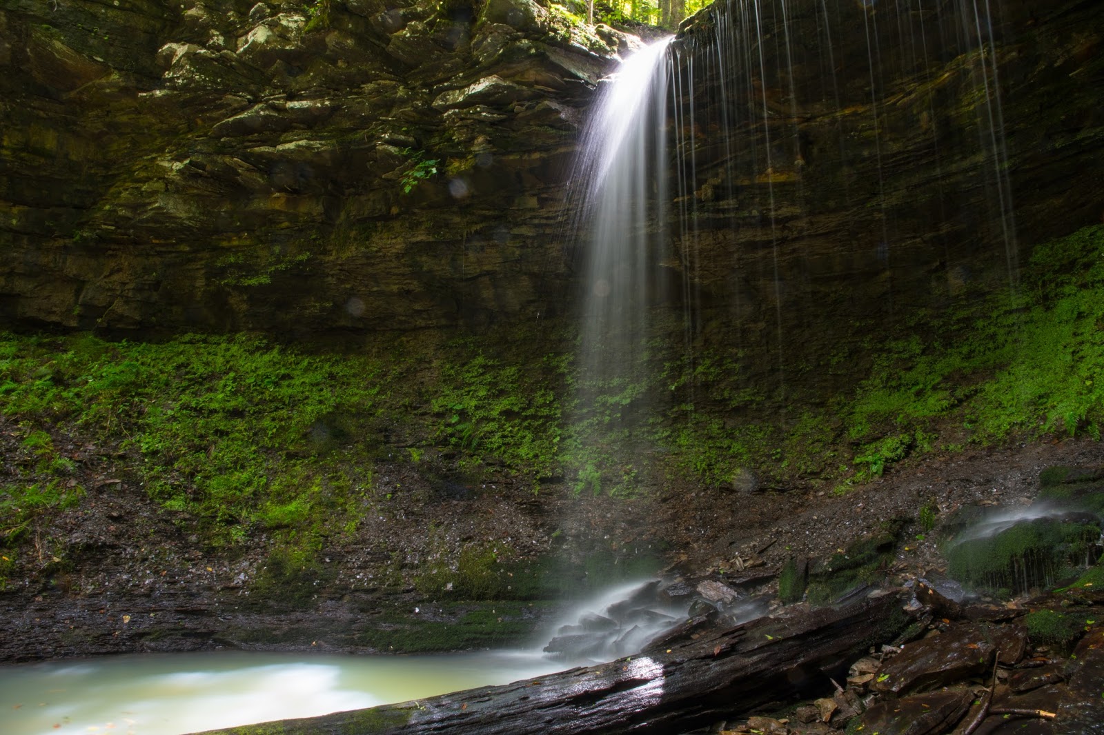
Where you park at the berm is actually at the top of the side drainage I follow to get down to Little Cow Creek.  Head down into the drainage directly below you (west), away from Pine Ridge Road.  This is the large side drainage that flows over the bluffline at Queenie Falls, right between Cincinnati Freedom Falls and Little Cow Falls.  The top of the drainage is literally just a few yards from the parking location.  Unlike most small creeks, bushwhacking along this one is fairly easy.  If you have an aversion to walking along the creek, you can follow it higher along the bluff on the right (north) side.  There is less undergrowth down along the creek, however.  Today, it was particularly easy hiking along the creek, as the gullywasher rains we received in the area the last couple of months have washed away a lot of the debris that had accumulated.  On the ridge above this side drainage, the saplings and other growth get fairly thick, and if you hike down to Little Cow Creek up on the bluff, you will also miss the smaller waterfalls along the way.  Follow this side drainage all the way down to the large bluffline towering over Little Cow Creek.  Along the way, there are numerous smaller waterfalls, and one, Unnamed Falls #8, that is about 10 feet tall.

Little Cow Falls Grotto
Boomer and I quickly made our way down the drainage and down the bluffline break downstream of Queenie Falls.  Descending through the bluffline break, we made our way upstream to Cincinnati Freedom Falls.  When I first found this waterfall last November, my first view was from the top of the waterfall and the water was crystal clear.  It looked to be about eight to ten feet deep, but it is very hard to gauge looking down into the pool.  Today, the water was still a little murky blue-green from the recent rains.  The water in the creek itself was very clear, but in the deep pools it still had not cleared up entirely.  Boomer jumped right in and started having fun.  I set the camera up to do some delayed burst shots and stripped down to blue jean shorts.  

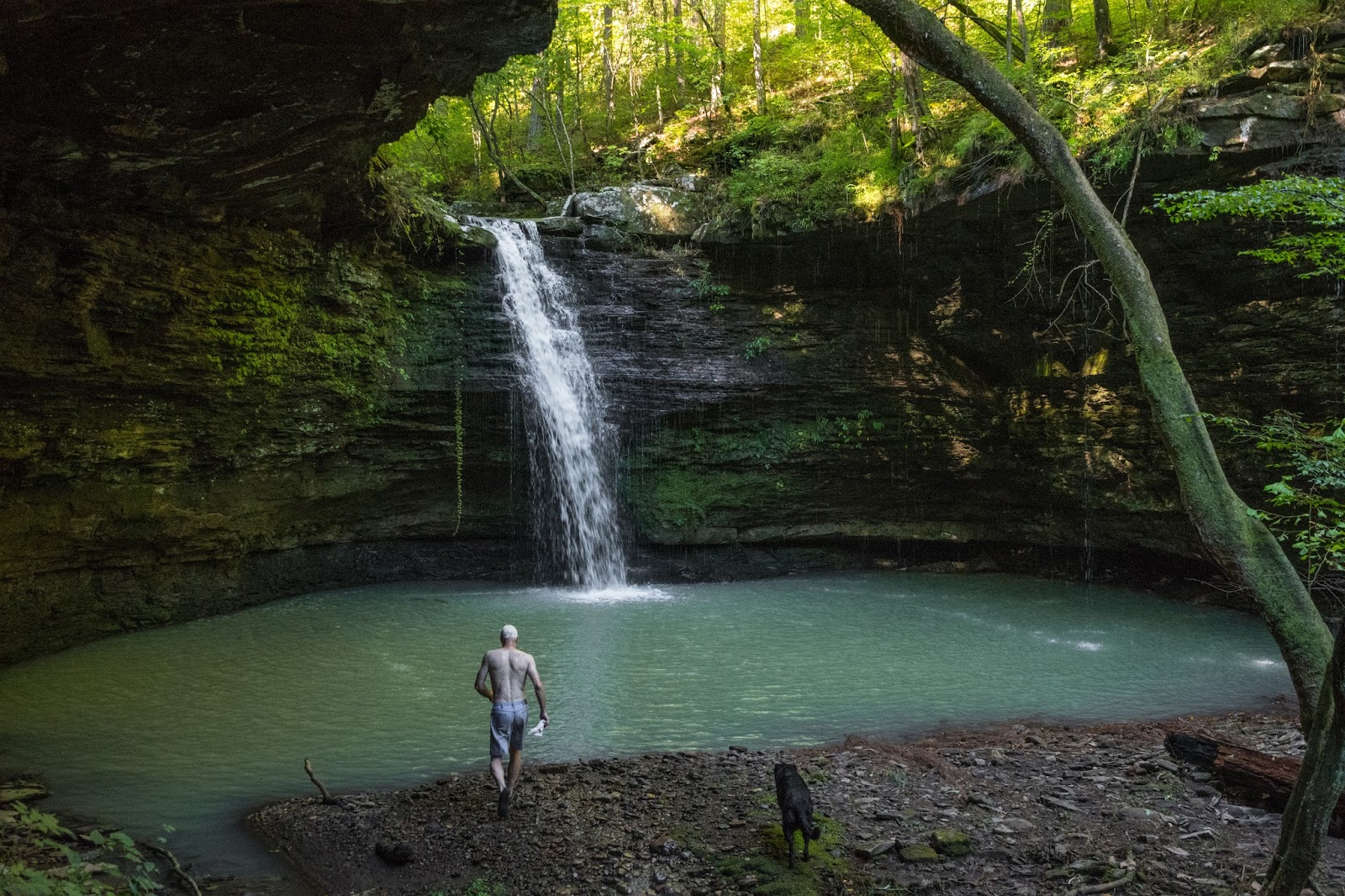
Cincinnati Freedom Falls - time to jump in!
My first impression?  COLD!  I expected temperatures in the 70s by the time we got here, but it was only in the low 60's.  Not bad for late August, and I couldn't believe that at this time of year it could actually be too cool.  The way water flows over and down Cincinnati Freedom Falls, striking rocks on the way down, it causes the water to atomize and spray a little.  This really enhances adiabatic cooling, and the water actually falling into the pool in the 40s.  So there was an initial thermal shock when I charged in, but after I got used to it, it was great.  This is a decently sized pool, especially with just me and Boomer there.  It was indeed as deep as I had originally estimated, maybe a little more.  My reach standing flat footed with my hand straight up is almost exactly eight feet.  I had to dive down a little to stand at the deepest part of the pool, directly in front of the waterfall and had to rise up a couple of feet to reach the surface.  So at it's deepest, it is around 10 feet deep.  Is that deep enough to jump from the top of the waterfall?  Probably, but it's almost 30 feet tall so I won't be doing it. The flow in the creek keeps it cleaned out pretty well, so the bottom is rock, without any mucky mud or anything.  My final impression?  What a fantastic swimming hole!

Slot and water slide at the top of Little Cow Falls
When we got tired of playing around at Cincinnati Freedom Falls, we headed downstream.  While I was down to shorts and t-shirt, I wanted to check out the grotto at Little Cow Creek as well.  That is only about a quarter mile downstream, and the hike actually helped warm me up a little.  At the top of Little Cow Falls, there is a pretty cool slot that forms a nice water slide.  I almost went in that way, but finally decided caution would be a better approach since I had no idea how deep the water was below the waterfall, or if there might be a sharp branch or something I might get impaled on.  So Boomer and I hiked around the grotto to the bluffline break on the east side, and then back up into the grotto.  


Little Cow Falls Grotto - with Rick and Boomer
The grotto at Little Cow Creek Falls actually has four waterfalls flowing into it, and another one just outside the grotto where the bluffline break is on the east side.  The makes a really nice closed-in pool for a swimming hole.  It is also somewhat steep-walled on all sides except the exit so it will stay mostly shaded on those hot summer days.  This was not one of those hot summer days, it was a miraculously cool day for late August.  I got in and swam around some, but didn't linger too long.  This pool is a decently sized one, but not nearly as deep as the one at Cincinnati Freedom Falls.  I am 6'-3", and I could stand in most of the pool with my head out of the water.  Only directly in front of Little Cow Falls was the water a little over my head.  It was plenty deep enough to slide down the slot, and there was no debris or anything below the waterfall.  That being said, you just never know what chunks of trees and branches will wash in during rains, so be careful to check it out before you jump in.


Cincinnati Freedom Falls
Boomer and I headed back up to the Cruiser, and I made a mental note to come back.  This is indeed a nice place to do a little swimming in the hotter months, as secluded and private as you could want, and absolutely beautiful.  Both of these pools are fed from the main creek, so will stay fairly full even in the more normal hot, dry summer months.  There was still a lot of daylight left, so I took a long way home, continuing on down Pine Ridge Road from where we parked to the low water bridge over Big Piney Creek.  It is only about an additional mile from the parking location to the bridge.  At the bridge, we stopped and watched a good-sized water mocassin sunning itself.  Today, he wandered off instead of being aggressive, so today we parted as friends and he got to live to sun himself another day.  


Haw Creek Falls
Across the bridge, we turned right and made our way down along Big Piney on
Johnson County CR-5881, aka Big Piney Road.  We passed under Car Wash Falls, which actually had water flowing!  This is fed by a wet weather creek, so is a very rare thing in August.  You have to ford Hurricane Creek on this road, and it was a little swollen still but no problem for the FJ Cruiser.  Turning right onto Highway-123, we crossed the bridge over Big Piney Creek and soon came to Haw Creek Falls, which I felt obliged to stop at and check out.  Haw Creek Falls had pretty good flow, and for this time of year, it was exceptional flow.  


Pack Rat Falls
Of course, since we were at the Haw Creek campground, and there was actually plenty of water on this late August day, I couldn't help but wonder how nearby Pack Rat Falls was doing.  It was still only about 70 degrees, although it was late afternoon by now, so I decided "why not"?  I had not been able to get out and hike for a while, so I needed to make the most of a spectacularly good hiking day and satisfy my "waterfall jonesing" as best I could.  It was another short but very scenic hike up the side drainage to Pack Rat Falls.  I have seen Pack Rat Falls with a lot more flow, but I have never seen it with more than a trickle in late summer.  After hiking back downstream to the campground, Boomer and I decided it was time to call it a day and head home.  This had been a fantastic day out in the wilderness, and such a special treat to be able to do this at this time of year.


GPS track for Little Cow Creek

Sunday, May 21, 2017

Liles Falls, Ozarks near Jasper, Arkansas

5/21/2017 Jim Liles Falls

GPS Coordinates:  (Latitude,  Longitude,  Elevation)
  Parking Location:  36.05631   -93.19692, 960 ft.
  Liles Falls:  36.05713   -93.19548, 908 ft.
  
Pet Friendly:  They are decidedly unfriendly to dogs here.  This area is part of the Buffalo National River and is under the jurisdiction of the National Park Service.  Pets are not allowed on trails within the Buffalo National River, with the exception of the Mill Creek trail and the Buffalo Point campground trails.   Off trail, pets must be kept under "physical control" You can see the NPS policy here

Motorcycle Friendly: No, not at all friendly to your cruiser or street bike.  The trailhead is several miles down a rough dirt road.  It's do-able, but you won't like it and neither will your bike.

Hiking Statistics:  I hesitate to even call this a hike, it is so short.  One way, from the parking location to the bottom of Liles Falls, is 766 feet, so just under 0.3 miles round trip.  The maximum-to-minimum elevation difference was 112 feet.  The hike down to the bottom of the waterfall took Boomer and I a total of 6 minutes, 43 seconds, and we were not in any big hurry.  So I have to rate this one as a super easy bushwhack.

GPS files (.gpx format) - Maps of the GPS track are at the bottom of this post.
  Middle Buffalo Waypoints

Liles Falls (41 ft) - with Rick and Boomer
Liles Falls is one of those elusive waterfalls that you see dazzling photos of, but when you go to check it out it has barely a dribble of water going over it.  It has been on my 'wet weather go-to' list for quite a while, and it just so happened we got a lot of rain in the Ozarks a couple of days ago.  The Jasper area didn't get quite the rain we did at our home north of Dover but got a fair amount.  I didn't have a lot of time today but figured with as short as the hike was, I could make the drive up there and hike in and out in plenty of time.  This waterfall is in Tim Ernst's great guidebook, Arkansas Waterfalls.  If you are reading this blog, presumably it is because you are interested in waterfall hiking in Arkansas.  If that is you, and you don't have a copy of Tim's book, get one.  You can thank me in the comments below.  Bethany wanted to clean house today, so Boomer (our German Shepherd) and I wanted to get out of the house.  We loaded up in the FJ and away we went.


Parking Location
The route we took today is what is called the Erbie Campground Road.  Going north on Highway 7, from where the highway makes a hard right turn in Jasper (onto Court St), continue north on Highway 7 for 3.3 miles and turn left (west) on NC-2500 (aka CR-79 or "Erbie Campground Road").  There is a sign saying Erbie Campground at the turn.  Go 3.5 miles on Erbie Campground Road and park in the pull-off space on the right.  This is in a bend of the road immediately after it crosses a small creek. 

The top of Liles Falls, not visible from the bottom
The top of Liles Falls is only about a couple hundred yards downstream on this creek.  If there is water flowing in the creek at the road, that's a good sign, and it was going well today.  A friend told me there is a faint trail on the right side of the creek, but I haven't seen it.  So, without a trail, this is technically a bushwhack, albeit a very short and easy one.  I hiked down the left side of the creek, simply because it seemed a little more open.  There is no undergrowth or thick vegetation to contend with, and you hike along the creek with very little slope.  This is the easiest bushwhack you will ever do.  The BRT (Buffalo River Trail) runs right across the top of Liles Falls, and there are a couple of short drops in the waterfall here at the very top that you can't see from the bottom.


Liles Falls
Of course, those two drops at the top are not what you came here to see, so you need to get to the base of the waterfall.  If you get on the BRT to the right (as you face downstream), you will see a volunteer trail branch off to the left immediately.  This trail will take you down the hillside to the creek at the base of Liles Falls.  It is a little steep but should be okay for hikers of all ages.  Liles Falls is a beautiful 41 foot tall stair-step type waterfall, and today Boomer and I had it all to ourselves.  I still find it hard to believe that on a sunny Sunday at mid-day, no one else in the world was out at a place this beautiful and so easy to get to.  But believe me, I'm not complaining. 


Liles Falls from downstream
On the hike out, you can go back up the trail the way you hiked down.  Boomer and I like to mix it up a little bit, so we hiked up the bluff on the right of the waterfall as you face it.  The slope is a little steep, like the trail was, but not too bad.  There is a bluffline break several yards from the waterfall you can ascend through, then simply hike back up the creek to the parking location.  This waterfall is named for Jim Liles, who was instrumental in building a lot of the trails in the Buffalo National River.  Ironically enough, there isn't a trail from the road to the waterfall named for him, but as I mentioned, the Buffalo River Trail goes right across the top of the waterfall.  I would highly recommend this hike for anyone and everyone, but wait to go after a decent rainfall when you can see it in all its glory.
GPS track to Liles Falls

Hudson Shelter Cave and Waterfalls, Ozarks near Cowell, Arkansas

5/21/2017 -  Hudson Shelter Falls

GPS Coordinates:  (Latitude,  Longitude,  Elevation)
  Parking Location:  35.85416,  -93.12623,  2111 feet
  Hudson Shelter:  35.85146, -93.12411,  1912 feet

Pet Friendly: Yes.  Be careful, however, if you go down to the shelter cave itself (base of the lower waterfall).  You have to cross the creek to do so, and right at the top of the fall.  Less sure-footed dogs might slip and go over the ledge.  You might too, for that matter.  Be careful!

Motorcycle Friendly: Marginal at best.  It is over four miles on a gravel road, but I will say it is usually a fairly well-maintained gravel road. 


Hiking Statistics:  Each way, from the parking location to the bottom of Hudson Shelter, is 1535 feet, so 0.6 miles round trip.  The maximum-to-minimum elevation difference was 198 feet.  The hike down to the bottom of the waterfall took Boomer and I a total of 8 minutes, 28 seconds, so a pretty quick hike.  Going back, it is uphill, so a little more strenuous, but still not much of a climb. so I would rate this one as an easy bushwhack.

GPS files (Map of GPS track is at bottom of this post):
  GPS track file for Hudson Shelter Falls hike (.gpx format)

Middle and Lower Hudson Shelter Falls - with Boomer
Hudson Shelter is a large (huge) shelter-type cave tucked away in a drainage right off the side of Hudson Mountain.   On our way back home after visiting Liles Falls north of Jasper, Boomer and I were going through Cowell and I remembered that nearby Hudson Shelter Falls is another of those waterfalls that are hard to catch with water actually flowing.  It wasn't much of a detour, and we were in the area anyway, so we quickly turned the FJ east and went to check it out.


Turn off Highway 7
To get there, drive north 11.0 miles from Pelsor (aka Sand Gap), or if coming from the other direction, drive south 2.8 miles from the junction where Highway 16 splits off from Highway 7 to go west toward the community of Deer.  This will bring you right to the middle of the small community of Cowell.  Turn right on the road going toward the northwest here (or left if coming from the other direction) onto NC-6560 (aka FR-1204).  On some maps, this road is CR-55 (old county road name) and on some, it is Newton 6370.  All I can tell you for sure is there is only one street sign on Highway 7 for this road, and it says NC-6560.  Whatever you want to call this road, go down it for 4.1 miles and turn right onto FR-1204B.  FR-1204B is also known as Hudson Mountain Road locally, but the only marking is a stake on the right that says 1204B.  Go about a hundred yards down FR-1204B and there will be an old logging road on the right.  You can park there and start your hike, but I usually drive a little further on the old logging road.  If you go down this logging road to where it bends to the left, the road ends because of all the trees growing up in it.  But there is room to turn around here, or you can just back down to this point. 


'Inside-out' view of Lower Hudson Shelter Falls
Where the old logging road makes that bend to the left, there is a volunteer trail going down toward the creek in this drainage.  The trail goes straight where the logging road turns and dead ends.  Leave the logging road at that bend and hike down the trail that goes down to the creek  Once the trail reaches the creek, it then follows the creek downstream.  This drainage is a feeder creek that flows into Campbell Creek about a third of a mile below Hudson Shelter.  Today, I could hear the creek below as soon as we started down the trail.  This is another waterfall that you know will be good if there is water in the creek when you get down to it


Top tier of Hudson Shelter Falls
The trail crosses over the creek a couple of times before coming to the top of the falls.  Hudson Shelter Falls is actually a triple-tiered waterfall, with three distinct waterfalls.  There is only 15 to 25 feet from the base of one waterfall to the top of the next, so I only list one GPS waypoint for the group of waterfalls as a whole.  

The top waterfall is fairly short and easy to miss with the spring foliage because the trail veers away from it to go down a short bluff to the middle waterfall.  This one is small, but still a pretty waterfall.   As you go past this waterfall on the left side as you face downstream, there is a path for a relatively easy climb down to the next level.  From there, you stay on the left side of the creek for a similar drop down to the base of the second tier, the middle falls.

Middle Hudson Shelter Falls
The middle falls are nice by themselves, falling off a ledge then down large rocks for a total of at least 20 feet.  Once you get to the other side of the creek, there are several locations where you can see the middle and lower falls together, for a striking view.  To descend to the base of the lower waterfall and to the cave itself, you have to cross over the creek and descend a scramble of large rocks.  Boomer has a difficult time trying to get firm footing from rock to rock, just because they are so large.  

Hudson Shelter
For perspective, Rick in the far corner by the
waterfall is 6'3"
Hudson Shelter itself is a huge cave, easily 75 feet deep and much wider than that.  It has a high ceiling, at least 20 feet in the center.  The lower waterfall falls over the right side of the mouth of the cave (as you look downstream), the side you just climbed down to get there.

This is a quick and easy hike.  Although technically a bushwhack, the volunteer trail is easy to follow and less than a mile round trip, with a total elevation difference of only 200 feet.  My only word of caution would be to take extra precautions if you take children or smaller dogs.  To get to the cave below, you have to cross a slippery creek just a couple feet from the ledge over the cave, and the rock scramble down to the mouth of the cave can be hazardous.
GPS track to Hudson Shelter

Saturday, May 20, 2017

Middle Cow Creek (Center and Southwest Prongs), Ozarks near Limestone, Arkansas

5/20/2017 -  Center and southwest upper prongs of the Middle Cow Creek valley

GPS Coordinates:  (Latitude,  Longitude,  Elevation)
  Parking Location #4 (today's location):  35.70573   -93.30781, 1755 ft.
  Falls #27:  35.70861   -93.30734, 
  Sozo Falls:  35.70942   -93.30806
  Falls #29:  35.70998   -93.30863
  Falls #30:  35.71016   -93.30879
  Bluffline Break (Falls #31):  35.71121   -93.30860
  Falls #31:  35.71111   -93.30887
  Bluffline Break (Falls #32):  35.71233  -93.30925
  Falls #32:  35.71179   -93.30919
  Falls #20:  35.71030   -93.31327, 1393 ft.
  Falls #19:  35.70933   -93.31329, 1440 ft.
  Jackson Drew Falls:  35.70888   -93.31323, 1472 ft.
  Bluffline Break (Jackson Drew Falls):  35.70956   -93.31347, 1442 ft.
  Harper's Hidden Cascade:  35.70866   -93.31325, 1491 ft.
  Derek Jr Falls:  35.70853   -93.31324, 1522 ft. 
  Falls #15:  35.70749   -93.31440, 1581 ft.
  Falls #33:  35.70639   -93.31501

Pet Friendly: Dogs off leash should be OK.  If your dog needs to be on a leash, it is doable but difficult because this is all bushwhacking.  Boomer had no problems scrambling up and down through the bluffline breaks, although some of them are fairly steep.

Motorcycle Friendly: No, not at all friendly to your big bike.  The parking locations are several miles down dirt roads.

Hiking Statistics:  The Middle Cow Creek valley is only about 800 feet from top to bottom.  On today's hike, we had a highest-to-lowest elevation change of 510 feet.  Boomer and I hiked a total of only 4.64 miles on this loop, in 4:16 hr:min.  The terrain varied from relatively open, with a low slope along Middle Cow Creek itself, to very rugged and very steep in the prongs.  I would rate this a moderately difficult bushwhack.

GPS files (.gpx format) - See maps at the bottom of this blog post
  Cow Creek Basin Waypoints
  Middle Cow Creek center and southwest upper prongs - today's hike track
  Jeep road track from Pine Ridge Road to Parking Location #4

Links to blog posts for other sections of Middle Cow Creek:
Jackson Drew Falls (22 ft)
I had just hiked the center and southwest upper prongs of Middle Cow Creek on Tuesday, just 4 days ago.  Why was I back to hike it again so soon?  Because I had found some great waterfalls on Tuesday that unfortunately did not have much flow at all.  In other words, a fantastic instant polyfoss area, just add water.  Well, as it turns out, we got water yesterday and last night.  At our home north of Dover, we got about three inches of rain.  According to the closest networked weather station, I could find, in the Baskerville area near Jasper, they had received about the same amount.  My bet was that it wasn't just localized rainfall and the Cow Creek basin area, roughly in between, had at least got a good soaking even if it didn't get a full three inches.  So Boomer (our German Shepherd) and I loaded up in the FJ and headed north.


Falls #32 - with Boomer (20 feet)
Middle Cow Creek is a large valley, the entirety of which is all public land.  To date, I have found 33 "photo worthy" waterfalls there, many smaller water features, and some of the nicest country for hiking you will find anywhere.  That being said, the key word is "large".  If you want to try to hike everything in one day, good luck.  If you are into backpack camping, this would be a great place to spend two or three days.  If you are like me, however, and prefer day trips, where you park will have everything to do with what areas in this valley you want to see.  See my post on March 9 for a description of how to get to the first three parking locations and details of the hikes for those areas.  To avoid redundancy, I'll limit this blog post to just the hike Boomer and I did today.


Falls #29
To get there, From the community of Pelsor (Sand Gap), go 16.2 miles south on Highway 123, then turn right onto FR-1003 (aka Johnson County CR-5741).  This is 3.3 miles past the Haw Creek Campground.  If you are coming from the other direction on Highway 123, this junction is 10.5 miles north of Hagerville  
- Go north on CR-5741 for 5.7 miles, then 
- Turn right on CR-5680, also known as Pine Ridge Road.   
- Go only about a quarter mile on Pine Ridge Road, and turn left (north) onto an old logging road, what I refer to as a Jeep road.  If you don't have a good 4WD vehicle with good ground clearance, park here off Pine Ridge Road and hike the rest of the way.  This Jeep road has not been used as a logging road for many, many, years, and even if you don't get stuck you will pick up what we refer to locally as "Arkansas pin-striping" from the brush and trees you have to plow through.
Harper's Hidden Cascade - view from the top
The top of Jackson Drew Falls is at top center-left
  This is the kind of old track that I got the FJ Cruiser for, and the winch and tires I have on it give me a little more confidence on this kind of trail.  There were a couple of logs and holes we were able to roll over, but still only got about a quarter mile down the Jeep road before coming to a log across the old road that I didn't want to take on.   We turned around and parked here, and this is the location I have marked above as parking location #4.  


Falls #31 (28 feet)
Am I ever going to bring a chainsaw with me to take care of this log?  Probably not.  This happens to be pretty close to the top of the center prong anyway, and on future hikes if I do a loop, it will probably start with going down the center prong and probably come back on the southeast prong, which we didn't hike today but may be my favorite of the upper prongs here.  The southeast prong has a couple of really nice waterfalls I have actually taken the time to name.  Except for Middle Cow Falls, a couple of miles downstream, all the waterfalls in the Middle Cow Creek Valley are new finds and so far I have only had time to name a handful, the rest I have just given a number as an 'Unnamed Falls'.  Boomer and I set off down the Jeep road and after a short distance veered off into the center prong and down to the creek there.  My initial impression of this trip?  Wow!  What a lot of water, everywhere.  This is a kind of remote area, and there probably isn't a rain gauge within many miles, but I'm betting the Cow Creek basin area got at least an inch or two, maybe more.  


Sozo Falls with unique whirlpool feature in foreground
We quickly got to Falls #27 and Sozo Falls, and they were much different than they had been four days ago.  The lower part of Sozo Falls, a short distance from the actual drop of the waterfall is a water feature that didn't exist before, with the much lower flow conditions.  Water swirls around rocks like a funnel, dropping down and fanning out in a big cone.  This did not exist on my initial visit to this hollow and appears as if it will be highly dependent on having just the right flow conditions.  But it was pretty cool today.  I have seen hundreds of waterfalls, but this one is unique.  I have seen several hundred waterfalls in the Ozarks, but nothing like this one.


Falls #29 (left) and
Falls #30 (upper right)
We hiked down to Falls #29 and Falls #30, both in the same grotto.  Falls #30 is a little shorter, and a little less flow, being fed from a separate feeder creek.  Both are pretty good sized waterfalls, in the 26-foot range, and both are just beautiful.  if you go from the top of Falls #29 along the top of the bluff to the right (east), there is a bluffline break in just a few yards that you can descend through down to creek level.  From the top of the bluff, there is a point where you can see both Falls #29 and Falls #30, even with all the spring greenery.  Of course, once you are at creek level, you can easily see both from the confluence of the tributary stream coming from Falls #30.  Each of these waterfalls was impressive today, and the combination of the two was just spectacular.  

Falls #20
Continuing downstream, one of the things I started noticing is that with the increasing flow in the center prong creek, it became increasingly difficult to hike downstream.  As far as bushwhacking conditions, there still is not much undergrowth, one of the things I really like about the upper prongs of Middle Cow Creek.  But with the much higher water level, there was much less room to hike along the creek without getting a boot full of water.  On my hike here Tuesday, I could just splash down the creek itself, and just aim my feet at places where I could see that the water was only a couple inches deep, not enough to get over the top of my waterproof Vasquez boots.  Today, that was no easy feat for my feet, and by the time I made it down the center prong, my boots and socks were soaked.  I finally just said "heck with it" (or some words to that effect), and hiked on with wet feet.  At least it wasn't freezing temperature-wise.


Falls #31 (28 feet)
Boomer and I soon came to Falls #31, another fairly good-sized waterfall.  On the way down the base of the bluff after descending through the bluffline break, we passed an extended area of the bluff that had water pouring over it like a curtain.  My last visit, I had taken a photo on the camera's timer of myself perpendicular to the waterfall base so I could scale it at home.  Falls #31 is just over 28-feet tall.  We had to go quite a way down the bluff on the right to find a bluffline break, which I marked and recorded coordinates for.  What a difference a creek full of water makes for a large waterfall like this one. 

Falls #32 (20 feet)
Like Falls #31, Falls #32 downstream had the same extended bluffline and we had to hike a good distance along the top of it before finding an access break.  That seems to be a characteristic of most of the larger waterfalls I have found in the Middle Cow Creek upper prongs.  It makes for a lot of doubling back and hiking the same length of creek three times, but those tall, unbroken blufflines are exactly the topology that gives us these nice, tall waterfalls.  When you go below the bluffline, you want to make sure you get entirely below the bluff, but stick to the base of the bluff as well as you can.  If you end up down at the creek level this far downstream, it is a rugged and wet hike up the creek.  


Some of the cascades downstream from Falls #32
After leaving Falls #32, it was less than a couple hundred yards to the junction of the upper prongs.  Remember what I said about it being rough, rugged, and wet?  The creek is basically one cascade and small waterfall after another,  all the way from the Falls #32 grotto to the confluence of the upper prongs.  That makes it a little rough hiking next to the creek, because of the narrowing embankments next to the creek in this area.  You could hike closer up to the bluff and around the spur into the next prong, but you would miss quite a show.  The cascading creek here is spectacular.  This hike took us a lot longer than the exact same route we took on Tuesday, not only because it was a little harder getting around with the higher water, but because there was so much more in the way of water features like this that I wanted to stop and photograph.


Falls #19
Boomer and I turned up the southwest prong, which I had hiked about six weeks ago while we were still in 'leaves off' season, and again four days ago in greener but much dryer conditions.  Hiking down the center prong along the creek had been pleasant, without a lot of briars and other vegetation that can make hiking this time of year very aggravating.  You get the same experience in the southeast prong, where it is also not noticeably worse hiking than a 'leaves off' season hike.  This southwest prong is similar in that respect to the other two prongs, but higher water and a narrower creek channel make it a little more challenging.  My boots were already soaked, so that part didn't bother me so much at this point.  The other nice thing about hiking all three of the upper prongs of Middle Cow Creek is that you don't go very far between waterfalls.  Instead of just a long slog of a bushwhack, there will be a waterfall every hundred yards or so to break up the hike and give you an excuse to stop and shoot some photos.  The longest stretch between waterfalls is the section we were now on, between the confluence of the upper prongs and where the southwest prong forks.  That extra time spent at every waterfall slows the overall pace enough that I'm not really even tired when I get back to where we parked.  I need to learn to pace myself better on every hike.


Falls #7 (center prong creek in upper right)
I see Falls #7 on a lot of my hikes in the Middle Cow Creek valley because it is just below the confluence of the center and southwest prongs, and just upstream of the confluence with the southeast prong.  So I see it on every trip here except when I only go see Middle Cow Falls far downstream.  Today, it had more flow than I have ever seen.  The southwest prong had even more flow than the center prong did.  Even though I didn't care about getting my boots any wetter, it was difficult at times moving upstream.  Not far upstream, the southwest prong splits into two forks, and we took the left fork again.   First, we went over and grabbed some shots of Falls #21.    


Falls #21
From where the southwest prong forks, you can easily see Falls #21, just a few yards upstream on the right (west) fork.  It is a smaller waterfall in the 10-foot range, with a big tree trunk exactly in the wrong place to get a good shot of it.  From there, we came around the bluff back into the left fork and continued our hike upstream.  Falls #20 is a short distance upstream from where this prong forks, and looked fantastic.  Upstream from Falls #20 was a long cascade that I didn't even notice on my previous trips here with a lower flow in the creek.  Further upstream, Falls #19 spills over the large bluff on the left.  


Jackson Drew Falls (22 ft)
From Falls #19, you can see Jackson Drew Falls just ahead, around the bluff on the left.  Hiking along the base of the bluff behind Falls #19 I noted there was an abnormally large number of deer tracks.  Either they like going behind the waterfall for some reason, or there is salt in the rocks here that they come to get.  Hiking along the base of the bluff will take you right to Jackson Drew Falls, at a location where you can see it plunge over the high bluffline and also see Harper's Hidden Cascade above it.  Jackson Drew Falls is the gem of this prong, in my opinion, and Boomer and I spent some time here.  We have a tradition for naming waterfall finds that are previously unnamed after newborn babies in the Henry clan, as a way to welcome them to the family.  This one is named for Jackson Drew Henry, son of Madison and Andrew Henry, and Harper's new baby brother.  The only rough spot hiking-wise is climbing above the bluff after visiting Jackson Drew Falls.  I had marked a bluffline break on our previous hike, and I knew it was a steep one, but today, the steepness and wetness combined to make it even more iffy than normal.  This bluffline break is already a good deal downstream from Jackson Drew Falls, but I may look even further downstream for a better one on my next hike here.


Harper's Hidden Cascade
Getting above the bluffline for Jackson Drew Falls finally, Boomer and I headed up to see Harper's Hidden Cascade in its hidden box canyon above Jackson Drew Falls.  This one reminds me of Vic's Hidden Falls in the Rock Creek area in that it is pretty hard to get down into the canyon.  The best slope going down into it is also the most dangerous, right next to where the bluffline cliff runs at the top of Jackson Drew Falls.  This is very much like the scenario with Vic's Hidden Falls, which has a short hidden canyon that exits where it flows out over Rock Creek Bluff Falls.  There are some small maple trees on the slope that I used to help me NOT slide right down into the canyon.  Harper's Hidden Cascade was also spectacular today, with such an amazing difference from the small trickle it was earlier this week.  


Derek Jr Falls (left) and Southwest Prong Creek - the pool
 they flow into is at the top of Harper's Hidden Cascade
Climbing back out of the box canyon again, we spent some time at the top of Harper's Hidden Cascade as well.  The creek is itself a long cascade as it goes into a small pool at the top of Harper's Hidden Cascade which looks stunning when viewed from the top as well.  Adding to the beauty of the location, Derek Jr Falls flows from the large bluffline on the left (east), right at the top of Harper's Hidden Cascade.  This gem of a waterfall is named for my niece Gabrielle's second son, Derek Dwayne Davis Jr.  This is one awesome and very photogenic spot.  If I was more into backpack camping, this is where I would hang my hammock.  I spent some time taking photos while Boomer played in the cascades, then we continued our hike out.


Derek Jr Falls
Boomer and I walked right up along the creek bed and out the top of this prong to the old trace road that wraps around the top of the upper prongs.  Falls #15 is about a hundred yards upstream, and Falls #33 is about another hundred yards beyond that.  Directly above Falls #33 is the old trace road leading back to the parking location.  The top of the creek is very overgrown, including where the old road crosses it at the top of Falls #33.  From this little waterfall, it is best to leave the creek to the left and bushwhack back up to the old trace road on that side.  Once you hit the old trace road, it is just a simple hike back along the old road to our parking location.  It has a little up-and-down to it, but is mostly on the level and makes a great hiking trail.  There are a few downed trees, but they can easily be bypassed.  


Falls #15
I finally got the concept of human height across to Boomer.  When I give him the 'lead' command, he knows he is to lead ahead of me a short distance and find the best hiking path.  He has always done a good job at this but tended to forget that he is quite a bit shorter than I am and he would simply go under and through a downed tree that I could neither go under nor through.  After constant feedback and reinforcement, I think he has it now.  I have noticed that he will now find the best path around these trees now instead of simply going through them, which he easily could.  Boomer is an incredibly bright dog.  He can also be a little full of himself, which is why he insists I call him 'TMMD' (The Magnificent Mountain Dog).  He's a great hiking companion, so the least I can do is humor him on that.


More cascades downstream from Falls #32
All in all, it was another great day to be out in the woods.  I can take this one off my 'wet weather go-to' list, but it's a fantastic area with waterfalls that no one else sees.  I'll be back, definitely.  I would rate this a moderate bushwhack and highly recommended for anyone.  I wouldn't take small children, because it is a rugged area with a lot of high drop offs, and if you take older children, keep an eye on them around the high points and especially coming out of the canyons for Harper's Hidden Cascade and Jackson Drew Falls.  The center prong is clearly a wet weather creek, so it is best to visit after rain.
Upper Prongs of Middle Cow Creek
Green - old trace road
Yellow - today's hike
Blue - 4/1/2017 hike of Southwest Prongs
Red - 3/9/2017 hike of East Prongs and Middle Cow Creek
The Greater Cow Creek Basin
Cow Creek(left and top), Middle Cow Creek (middle, of course) and Little Cow Creek (right)
Orange - Forest Service Roads
Green - old trace roads ("Jeep roads")
Red/Blue/Yellow - Hiking tracks