Sunday, September 25, 2016

Tuckaleechee Caverns, near Townsend, Tennessee

9/19/2016 -  Tuckaleeche Caverns 

GPS Coordinates:  (Latitude,  Longitude)
  Parking:  35.65835   -83.77439
  825 Cavern Road, Townsend, Tn
  
Miniature bat 'hanging out'
in the visitor center
Pet Friendly: No, sorry.  Like most caves, they won't allow pets in the cave.  There are a few very small bats, however.  A surprise for me was that the bats in this region are very, very small, only about the size of a silver dollar full grown, with a wingspan of a few inches.  Don't worry too much if you are batphobic; the only one we saw was in the visitor center.

Motorcycle Friendly: Yes; there are good paved roads right to the visitor center.

Hiking Statistics:  It's really hard to say how far we hiked since obviously GPS won't work several hundred feet underground.  Our guide said it was about a mile and a quarter from end to end, and we covered all that twice, plus some.  Elevation changes are also hard to estimate.  At the deepest point we went, we were 500 feet below the surface.  But since the caves go up into a mountain, that doesn't really tell you much.  I would rate it as an easy hike, and children should be able to make the trip just fine.

The 'Big Room' - with Bethany and Rick
On our vacation in the Smoky Mountains, we wanted to get out and see as much as we could but weren't too keen on the heat and humidity.  It had been a hot, dry, summer and temperatures were still in the 90's.  In the Smokies, it is apparently humid year round.  My wife Bethany and I gravitate toward caves and waterfalls, and our waterfall hiking in the park wasn't working out so well.  So we thought we would check out the caves in the area that were open to the public.  Forbidden Cave is north of Sevierville, and is worth the trip, but Tuckaleechee Cavern really stands out.  I hesitate to call trips through caves "hikes", but you will definitely get some hiking exercise going through it.  With a year-round temperature of 58 degrees, you get the benefits of natural air conditioning and no chance of sunburn.  Score!

For a cave that has been in the making the last 20 to 30 million years, it has managed to stay relatively pristine and undamaged by humans.  The Cherokees that lived in the area long ago knew of it, but never went inside.  They believed evil spirits existed inside where the sun could not reach, so they held ceremonies at the entrance but never ventured inside.  The loggers that came in the mid-1800's noticed the sinkhole that never filled with water and found the natural cave entrance, only a couple of feet in diameter.  This led to an interior opening with a 60-foot drop off;  these guys couldn't even see the bottom with a tar torch, so they went back to logging and the cave was forgotten again.  Forgotten, that is, until a couple of local 6-year olds stumbled across it in the 1930's.

Best friends Bill Vananda and Harry Myers did what most 6-year old boys would do - kept it a secret from their parents and used it as their private clubhouse and playground.  They tied a cedar tree off to climb down the initial drop and used pop bottles of kerosene with a rag in them to light the way.  For years, they kept the cave a secret and explored it's depths.  After graduating from college and fighting in World War II, they found jobs and saved until they could buy up 200 acres around the cave entrance.  In 1953 they finally opened the caverns to the public and charged 50 cents a head for guided tours.  Bill and Harry are now deceased, but to this day, Tuckaleeche Caverns is owned and operated by their two families.

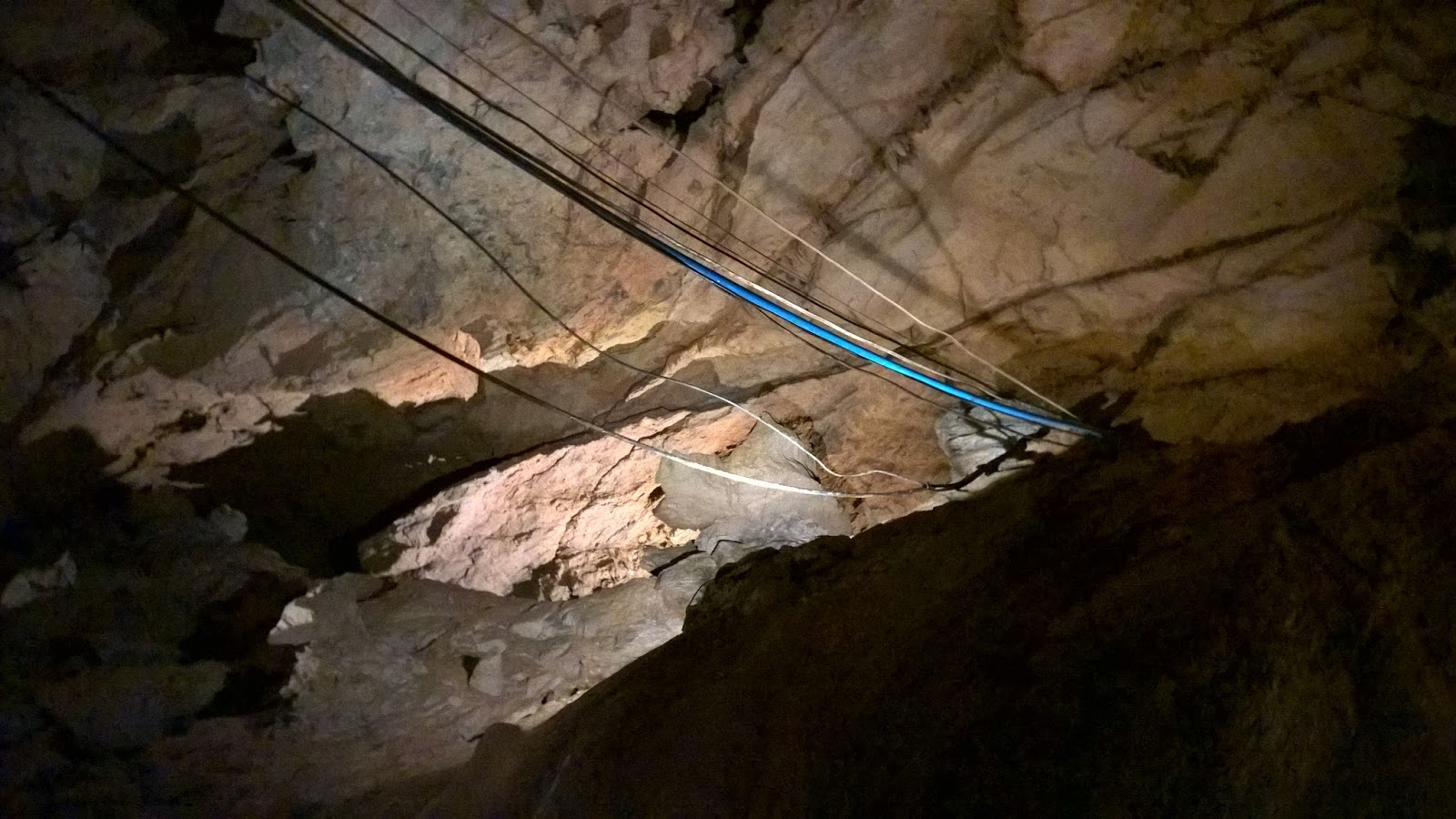
Early tourists had to carry kerosene lanterns down a 50-foot rope ladder to reach the bottom of the cave.  Fortunately, you won't have to lug a lantern around nor climb down a rope ladder.  A much larger opening has been dug into the cavern, and a set of stairs take you down the last few feet to the cave floor in the initial room.  From there, you go through a series of rooms and passageways until you reach what they call the "Big Room".  It is a big one.  The Big Room is over 300 feet in one direction, and over 400 feet in the other.  It is 150 feet from the 'floor' to the ceiling, and at the far end from where the trail goes is a canyon that drops off another 150 feet deep.  


The Big Room was actually not found for a year after the caverns were first opened to the public.  They opened it to tours at the same time they introduced electric lighting throughout the cavern.  The Big Room is at one end of the cavern's extent and is as far into the cave as tours go.  The underground river that initially created the caverns runs through the canyon on one end of it.  Our guide informed us that divers had found huge rooms, including one with an underground lake further upstream.  There are no plans to develop it further as that would require blasting, which might damage the cave formations.

The 'Big Room'
Heading back toward the entrance from the Big Room, you get to see again all the cave formations you passed on the way into the cave.  Your tour is not over, however.  The cave's entrance is actually midway in the maze of passageways, so we went right by the stairs leading out and continued our tour in the other direction.  One of the stops along the way is an area they call "the beach", where the underground river runs right next to the trail and actually has washed sand up along the shore for a beach of sorts.  The water is far more pure than any bottled or tap water you will find, and they allow you to fill a water bottle and/or drink from the river if you like.

Silver Falls
The trail going into the caverns in this direction culminates in one of the most fantastic sights I have seen in a cave.  Silver Falls is an underground waterfall 210 feet high.  It has two drops and while the base of the waterfall is next to the trail, parts of it can only be seen in the large 'holes' between cavern rooms.  The water filters down through hundreds of feet of rock from a sink in Cades Cove, in the Great Smoky Mountains National Park above.  I'm told that there are other waterfalls in Tuckaleechee Caverns during wetter periods, but this feature alone makes this well worth the trip.  We plan on going back for another visit the next road trip we make to the Smokies.  

This is highly recommended for everyone.  Admission is relatively inexpensive, I think it was around $15 each.  I'll leave you with one more little tidbit of coolness.  When you go through the front door of the visitor center, look to your right.  You will see an odd computer cabinet with a strange looking display.  In the ceiling in front of it is a video camera.  You might assume the camera is covering the door for a security system, but that's not it.  The computer system is actually the world's most sensitive seismograph equipment.  The cables for the sensors deep within the cave are visible in the
The blue cable has seismograph sensor wires.
entrance as you go into the cave.  It is used by the U.S. government and the United Nations to watch for nuclear testing.  Yeah, it's that sensitive.  On the front of the cabinet is a printout of the traces from a North Korean nuclear test.  I don't know why they don't have more sophisticated telemetry, but the staff there told me the camera in the ceiling watches the display, and U.N. personnel in Vienna, Austria monitor the feed from it 24/7.  Honest - I can make this stuff up, but I didn't.


Tuesday, September 20, 2016

Mingo Falls, Cherokee Reservation near Cherokee, North Carolina

9/13/2016 -  Mingo Falls

GPS Coordinates:  (Latitude,  Longitude,  Elevation)
  Parking Location:  35.53406   -83.27617,  2230 ft.
  Mingo Falls:  35.53177   -83.27543,  2407 ft.
  
Pet Friendly: I think so.  I saw no signs prohibiting dogs on the trail, and this is on the Cherokee reservation, not the National Park.

Motorcycle Friendly: Yes, it is. This is on a paved road with a nice parking location.

Hiking Statistics:   This hike is just under one mile round trip, with a minimum to maximum elevation change of 180 feet.  Most of that 180 feet is in the first hundred yards from the parking location. The National Park Service calls this a moderately strenuous hike, but I am going to disagree.  This is an easy hike.  A lot of folks complain about the vertical ascent over a short distance, but it is all stairsteps.  If you find 162 steps tiring, just take your time.  This should be easily doable for hikers of all ages and hiking ability.

GPS files (.gpx format) 
  Great Smokey Mountains National Park waypoints - contains waypoints for 89 waterfalls in and around the GSMNP.


Mingo Falls (180 ft)
While roaming around Great Smoky Mountains National Park (GSMNP), my wife Bethany and I ran across another hiker that assured us Mingo Falls was by far the most spectacular waterfall in the park.  "It isn't a very long hike," he said, "but there are a thousand stair steps going up to the falls, and it will flat out wear you out."  Intrigued, I checked out the information the GSMNP had.  It is listed as one of ten waterfalls with hiking trails, but it is not actually in the park.  We had intended to drive across the park to the southern border anyway, just to take in the sights and see what was there.  We checked with the rangers at the Sugarlands Visitor Center who assured us it was indeed one of the prettiest waterfalls around, and told us "there are a lot of stairs at the start, maybe 60 or so."  Now we had to check it out, just to see how many stair steps were on the trail.

So off we went across the mountains.  Highway 441 goes from Gatlinburg, Tennessee, across the Smoky Mountains at Newfound Gap, then out the southern entrance at the Oconoluftee Visitor Center in North Carolina.  This highway, in addition to being one of the most scenic in America, is the reason why the Great Smoky Mountain National Park is the only one the National Park Service can't charge an entrance fee for.  Back in the 1930's, when the federal government was trying to complete all the acquisitions for the park, they had to get the rights for Highway 441 transferred from both states.  The North Carolina state legislature was happy to sign the highway over and let the federal government maintain it.  The state of Tennessee was also happy to do that but was worried that this highway, which was the only one into that part of the state, might someday have a toll collected by the federal government that would restrict commerce.  So as part of the deal, they stipulated that the federal government could never impose a toll on the road.  That was acceptable to the feds, and everyone signed on the dotted line and had a photo op.  But to this day, The federal government can't charge to use this highway, the only one running through the park.  

To get there, from the Oconaluftee Visitor center, go south on Highway 441 out of the park.  You are now on the Cherokee reservation, but no special permission is needed to go to the waterfall.  Go past the Blue Ridge Parkway turnoff, and take the next left onto Big Cove Road.  Go five miles on Big Cove Road to the Mingo Falls campground.  There will be a sign for Mingo Falls and a small parking lot at the trailhead.  The Cherokees even keep a couple of porta-potties at the trailhead.  

Sure enough, right at the start of the trail is a very long set of concrete stairs to take you up almost all of the vertical ascent.  We determined almost immediately that to the guy we first talked to, it probably just seemed like "a thousand stairs".  It isn't, but it is more than sixty, so the Ranger's perception was somewhat off as well.  On the way down, we counted and there were 162 stair steps.  So, not all that bad at all.  Anyone can make it, and I would recommend it for small children.  The entire trail is only a half mile long, and from the top of the stairs, it is mostly hiking on the level to the footbridge going over the creek at the base of the waterfall.

Mingo Falls is as spectacular as we had been led to believe.  At 180 feet, it was second only to the 210 foot Silver Falls we had seen (inside a cavern!) on this road trip.  Today, it did not have a lot of flow, but still was well worth the trip.   This is another one I'll have to take another look at the next time we come here.

Laurel Falls, and others along Little River Road, Great Smokey Mountains National Park, near Gatlinburg, Tennessee

9/13/2016 -  Laurel Falls

GPS Coordinates:  (Latitude,  Longitude,  Elevation)
  Parking Location:  35.67817   -83.58030,  2317 ft.
  Laurel Falls:  35.67770   -83.59320,  2648 ft.
  Mannis Branch Falls:  35.66220   -83.66030
  The Sinks:  35.66922   -83.66239
  Meigs Falls:  35.66890   -83.67501
  Upper Meigs Falls:  35.66001   -83.65964
  Cane Creek Twin Falls:  35.67450   -83.69261
  Meadow Branch Falls:  35.65216   -83.71312
  West Prong Falls:  35.65379   -83.70955
  
Pet Friendly: No, unfortunately, the NPS is anti-dog.  This area is within the Great Smokey Mountains National Park and is under the jurisdiction of the National Park Service.  Pets are allowed on only two trails within GSMNP, and this is not one of them. 

Motorcycle Friendly: Yes; the parking locations are right on the paved Little River Road, a very windy, very cool motorcycle road in its own right.  In fact, as popular as Laurel Falls is, the parking spaces are generally in use and it is much easier to find a slot for a motorcycle closer to the trailhead.

Hiking Statistics:  Laurel Falls is an easy hike, at least to the top of the falls.  It is 1.3 miles each way and the highest-to-lowest elevation change is only 360 feet.  Our actual hiking time was only about a half hour each way.  I would rate this an easy hike.  The climb to the base of the lower waterfall is a little iffy.  The other waterfalls are very short bushwhacks directly from the Little River Road.

GPS files (.gpx format) 
  
  Great Smokey Mountains National Park waypoints - contains waypoints for 89 waterfalls in and around the GSMNP.

Laurel Falls (80 ft)
The Great Smokey Mountains National Park (GSMNP) has over 150 maintained trails, with over 800 miles of trail.  All of it is beautiful scenery, but Bethany and I had a limited amount of time to spend in the park, so I naturally gravitated toward the waterfalls and caves.  When we went around the Roaring Fork Nature Loop it was raining, so we noted the trailheads for waterfall hikes and vowed to come back to them.  We did have good hiking weather when we explored the Little River Road and Cades Cove, so we stopped along the way to stretch our legs a little.  The Smokies have had a very dry summer, so we didn't know what to expect.  I had done my homework and mapped out oodles of waterfalls within the park.  The NPS only has ten waterfalls along hiking trails listed in the literature you can pick up at the visitor centers, but a little research turned up several dozen more.  Some of these require a little bushwhacking, but nothing a country boy from the Ozarks can't handle.  This has been a National Park since 1934, so the forest is very mature.  I just wasn't sure what kind of flow there would be on some of the minor tributaries, and whether it would be worth the hike this time of year.

Laurel Falls was the first stop for us.  We had driven by the trailhead yesterday on our way to Cades Cove and had noticed the very crowded parking on the side of the road.  Today, we arrived fairly early in the morning on a Tuesday during the 'slack' season and there were already a half-dozen vehicles parked at the trailhead.  To get there from the Sugarlands Visitor Center, go 3.8 miles down Little River Road toward Cades Cove.  There are a few parking spots on both sides of the road, but this is one of the most popular hikes in the park.  There was still plenty of parking when we got there, but by the time we returned people were having to park quite a ways down the road.

Really rough hiking here...
The hike to Laurel Falls is very easy and very pleasant.  This is such a popular hike, the NPS has paved the trail all the way to Laurel Falls.  We saw a couple of strollers being pushed on the hike back.  I know, I know - it's hard to maintain any 'trail cred' as an avid hiker when babies are being pushed down the trail you are on.  I was somewhat surprised at the number of people we passed on the way down that were huffing and puffing and asking "are we there yet?"  I'll still maintain that anyone can do this hike.  Little kids have no problem with it, and I saw one girl with a foot brace that was doing just fine.  The hike is only 2.5 miles round trip, and the 360-foot elevation gain is spaced out over most of the hike with few ups-and-downs in between.  It is uphill going to the waterfall, so you get to coast going back down.  Laurel Falls is beautiful, even with the lower than normal flow.  The trail goes to the upper half of the fall, and all of the folks that we saw there today only went that far.  Except me, of course.  I have to explore a little, so I worked my way down to the lower half of the waterfall as well.

The Laurel Falls Trail actually goes for four miles altogether.  After you cross the footbridge at the bottom of the upper waterfall, it continues for another 2.7 miles.  It is only paved to Laurel Falls, but the trail beyond that is maintained and is a heck of a lot better than my normal bushwhacks.  If you go .75 miles beyond the falls, you will be in one of only three areas of old growth forest within the park.  Mind you, the rest of the park has not been logged since well before 1934, so "old growth" means really old, really big trees.  Just a few yards beyond Laurel Falls on the trail, there is a spot where you can pick your way down to the base of the lower part of the falls.   Today, it was very nice, but I could envision how it would look with a full head of flow.  I'll definitely need to come back in wetter times.

The Sinks
Continuing down the Little River Road, we decided to skip Mannis Branch Falls since it was in a smaller tributary creek, and we headed directly to The Sinks.  I have no idea where the name came from, as a 'sink' is typically a depression that water flows into and drains down below.  The Sinks is right along Little River Road, 12 miles from the Sugarlands Visitor Center (8.2 miles from the Laurel Falls trailhead).  It is not very tall, only about a 12-foot drop, but it is right on Little River and will have the full flow of the river going over it.  It is a popular swimming hole, and a few yards downstream there is a deep hole that you can jump off the cliff into.  From the small parking lot, you can hike down to the base of the falls.  Watch your step as it is a somewhat steep and rugged climb.

Meigs Falls
Another mile west down Little River Road from The Sinks (13 miles from Sugarland), you will find another long parking pull-off on the left (south).  Park here for Meigs Falls.  This waterfall can be seen from Little River Road, but since the road takes all your attention with its winds and curves, it is easy to miss if you don't know it is there.  It is about 130 yards from the parking pull-off, on Meigs Creek.  Although Meigs Creek is another tributary to Little River, it is a fairly large one and had a decent amount of flow today.  It was not nearly as nice as photos I have seen of it, but still very nice.  Little River flows next to the road and you have to cross it to get to Meigs Falls.  Either wear water shoes or take your boots off when you cross.  I misjudged the depth of Little River and ended up in water knee deep with flooded boots.  

Small waterfall above Meigs Falls
To the right of Meigs Falls, there is a route to the top of the falls.  It is very steep and very treacherous, so be careful if you make the climb.  At the top of Meigs Falls are two smaller waterfalls.  There is another waterfall, Upper Meigs Falls, over a mile upstream from Meigs Falls.  I noticed it on the GPS while at Meigs Falls and remembered that this was one I wanted to check out - but not by bushwhacking upstream.  While you are at The Sinks, look for a trail leaving  the parking area called Meigs Creek Trail.  This will take you right past Upper Meigs Creek Falls.  Today, given that we had already been to The Sinks and flow wasn't all that good in the creek, we decided to forgo that hike this time and head on down the river.

West Prong Falls
Continuing downstream along the Little River Road, we stopped to check out Caney Creek Twin Falls and found its little tributary creek dry.  Further downstream, at the intersection of Highway 73, Little River Road turns into Cades Cove Road.  The Little River flows north along Highway 73, and Laurel Creek flows into Little River at this junction.  Cades Cove Road follows Laurel Creek upstream toward Cades Cove.  Don't be confused by the name;  Laurel Creek is several miles from Laurel Falls, which is on a creek called Laurel Branch.  Its seems like the pioneers that named creeks and hollows in the Ozarks learned from their cousins in the Smokies.  

Laurel Falls - with Rick and Bethany
About a half mile from the Highway 73 junction is a small waterfall right on Laurel Creek called West Prong Falls.  Laurel Creek is a fairly good sized creek, so it had some flow, but not a whole lot.  Further upstream another half mile, the Meadow Branch Cascade was basically dry.  At this point, we decided to call it quits on our waterfall chasing for the day.  While wetter conditions would have been nice, it is always great to get out in the woods and do a little hiking.  Great Smokey National Park is one of the prettiest parks in America.  It is by far the most visited of all our National Parks, with about 10 million plus visitors every year.  I can see why.  Bethany and I are already planning a return trip to take in fall colors next year, and hopefully some better-flowing waterfalls.


Friday, September 2, 2016

Blanchard Springs Cavern Discovery Trail, Mirror Lake, and Gunner Pool, Arkansas Ozarks near Fifty-Six

8/30/2016 -  Blanchard Springs Cavern, Waterfall, and Mirror Lake 

GPS Coordinates:  (Latitude,  Longitude,  Elevation)
  Park for Blanchard Springs:  35.95889,  -92.17539,  439 ft.
  Blanchard Springs:  35.95860,  -92.17740,  483 ft.
  Mirror Lake:  35.96349,  -92.17094,  416 ft.
  Gunner Pool:  35.99507   -92.21349,  461 ft.
  
Pet Friendly: Yes; dogs on or off leash should be fine.  Just not in the cave.

Motorcycle Friendly: Yes; there are good paved roads right to the visitor center, as well as parking locations for Mirror Lake and Blanchard Springs.  Gunner Pool is another matter; it is three miles down a dirt road off Highway 14.  While it is a pretty good road, it has loose gravel.  If you do take a bike, be careful on the turns.  It is easy to skid and is a steep drop off the side.

Hiking Statistics:  We did a number of short hikes today, all of them easy, and on some of the best trails you will find anywhere.  The lower cavern hike, the Discovery Trail, is 1.2 miles long, and hikes to either Blanchard Spings or the base of Mirror Lake  are only about a quarter mile each.  There are some ups and downs in the cave but easily managed.  The upper cave hike, the Dripstone Trail, is only about a half mile long.  Gunner Pool is right next to the campground road.

Even though we have had a much wetter August than normal, the creeks were still barely moving.  Mind you, many of these creeks would be dry in a normal August, so I'm not complaining.  But the low creek flow, hot weather, humidity, ticks, spiders, (need I go on?) etc. makes the dog days of summer a particularly unattractive time of year to hike the Ozarks.  This time of year we typically do a lot of back road trips in the FJ Cruiser, or we go to a handful of places that are more "climate controlled".  Blanchard Springs fits that bill nicely.  Not only does the spring have good flow all year, the caverns themselves stay at a perfect hiking temperature of 58 degrees all year round.  I take a light jacket for hiking through the cave.

Mirror Lake
Getting there is easy, but for most of us in Arkansas, it's a long drive.  We live just north of Dover, and it is a 2.5-hour drive for us.  The turnoff to Blanchard Springs is right off Highway 14, so this is one of those rare hiking trips in which you can stay on the pavement for the entire drive.  The turnoff is well marked with a sign, 1.1 miles east of the small town of Fifty-six, Arkansas.  After you make the turn, there are signs on the paved access road to the visitor center, Mirror Lake, and Blanchard Springs.  There is a fee for the various tours, currently $10 each with a 50% discount if you have a "Parks Pass" - the interagency pass also called a Senior Pass or Golden Passport.  If you don't have one and are over 62 years old, get one.  It is a one-time fee of $10 for a lifetime pass that will get you into all the national parks and other areas run by the federal government agencies.  Blanchard Springs is operated by the Forest Service.  There is no fee for entrance to Blanchard Springs Recreation Area, but there is that small fee for the guided tours.

Gunner Pool - with Rick
Our first stop was the visitor center.  We left the house early enough so we could make the 11:00am 'Discovery Tour' of the lower cavern.  This 1.2-mile trail is only available from Memorial Day to Labor Day each year.  The other nine months of the year, this huge section of the cave is left to the bats.  Literally.  The over 400,000 bats that call Blanchard Springs Cavern home were already showing roosting activity.  That is very early in the year; I'm sure that means something about the upcoming winter, but I'm not sure what.  There were quite a few bats flitting about the cave passages today, one even brushing our guide's head as he flew by.  Labor Day is this coming weekend, so our window for going on the lower cavern tour was rapidly closing  The tours are at set times during the day, so we make sure we get that done first, then go see all the other attractions in the area.

The caverns are very restricted, and you are only permitted in on a scheduled tour.  I would rather roam around on my own, but our tour guide was very knowledgeable, very patient as we went through the cave, and willing to let us do anything short of touching the cave.  My wife, Bethany, and I were the only ones that showed up for the 11:00am Discovery tour, so we got our very own private tour.  The maximum group size is 35, which to me seems an almost unmanageable number.  Fortunately, groups are rarely that big, probably averaging in the eight to ten range.  Having the ranger all to ourselves was great; we got a highly personalized guided hike, and got a lot of inside information that I doubt he would share with a larger group.  He also spent more time discussing features and history, so our tour extended to about two hours long for the 1.2-mile hike.

The extent of the cave itself was not even known to exist until 1960.  The entrance to the lower cave was known, about a half mile from Blanchard Springs, but was so hard to descend into that it wasn't done until 1960.  It was 
The 'natural' cave opening
with 70 ft drop into the cavern
known as "half mile cave" for quite a while.  Once a couple of locals managed to descend into the cavern, they found a massive cave system with huge rooms, columns, curtains, stalagmites and stalactites, and all that other cave stuff.  Over 10 miles of passages have been mapped out in this cave system.  They also eventually found a vertical wall of rock 60 feet high that had gravel washed down from above.  In 1963, two local teenagers made it to the top of the wall, squeezed through a tight passage, and discovered the upper cavern.  This upper cavern is smaller, but it is still huge.  It is a geologically much older section of the caverns, so is literally packed with features caused by the slow drip of water and minerals over the millennia. 

Blanchard Springs had been under the jurisdiction of the Forest Service for decades before people had ever entered the cave, so they have been able to control it fairly well and prevent it from being ruined.  The early expeditions to try to map it our were generally very respectful of maintaining the sanctity of the cave, but in one location used as a camp for multi-day expeditions, they did graffiti names onto the walls.  Other than that
one spot and the walkways made for the tours, the caves are pretty much just as nature created them.  There is much more that is still unseen, to be sure.  As holes have opened up after major rains and flooding, some initial looks with borescopes show more large rooms yet to be explored. 

In the first section of the lower cavern, we passed a passage where a much
 earlier explorer, a Native American, had perished over a thousand years ago.  For a while in the 1970's, his bones were recovered and on display at the visitor center.  Some members of Indian tribes found that understandably disrespectful.  Since no one could determine which current tribes may have been descended from his, a big meeting was convened with Tribal leaders from all over the country to perform a ceremony to re-inter his bones where they had been originally discovered.  That area has since been cordoned off and restricted to all, even the Forest Service rangers.  There is an unexplored section of caverns past that passage, but it looks like that will stay unexplored.


Continuing on into the lower cavern, we went through giant rooms, along the underground river that eventually flows out of Blanchard Springs, and eventually past the natural opening that the early explorers used to initially enter the cave system.  The lower cavern system is geologically younger than the upper cavern since it remained flooded with water for millennia while the surrounding countryside slowly eroded to form the valley and Blanchard Springs opened up to drain the lower caves.  So it doesn't have the density of columns, stalactites, stalagmites, etc. that the upper cavern does, but it still has plenty.  There is also much more cave to get through than the upper cavern has.

The "Wild Cave" tour goes even further back into the lower cavern system, where absolutely no walkways or other development has been done.  The rangers will do one of these tours on demand, but you have to schedule it with a group of at least three and no more than eight.  They supply headlamps, coveralls, kneepads, hardhats, etc. and take you on a rigorous five-hour tour in this undeveloped area of the lower cavern.  Since the entry is in the air lock used to exit the Discovery Trail and bypasses the area of the cave where bats are roosting, this tour is also available all year long.  The fee for this one is currently $75, much steeper than the other guided tours.  I have not been on the Wild Cave tour yet, but it's on my list.


Largest Flow Stone in the U.S.
We eventually made our way down into the lower cavern to a huge room with the largest flow stone in the country.  From there, you go up a flight of stairs in a tunnel bored through the solid rock into the "Ghost Room", so named because the ranger that discovered it saw a large white alabaster column in his headlamp that he thought was a ghost.  From the Ghost Room, a passage has been carved through the rock to an airlock going to the valley outside.  A bus was waiting on us there to take us back to the visitor center.  Air locks protect the cave environment itself, and disinfectant pads at the exits keep visitors from spreading White Nose Syndrome out of the cave on their shoes.  So far, the efforts at this cave in that regard have kept it exempt from the five-year ban on cave entry in effect in the rest of the Ozarks.

Blanchard Springs
After our cave tour, we got back in the Explorer and drove down to the trailhead 
for Blanchard Springs.  It doesn't seem right even calling it a "trailhead"  This is the nicest hiking trail in existence, a wide, pebblestone paved trail that you can literally take a wheelchair down, all the way to where the spring can be viewed.  The paved part ends there, but you can descend some short steps and explore the rock-strewn valley here.  Access to the cave that Blanchard Springs spills out of is prohibited, but you can roam around the rest of the area.  There are numerous maintain trails in the area.  Blanchard Springs itself flows out of the cave in a waterfall about ten feet high.  Like many cave waterfalls, it seems to keep a pretty good flow through dry times.

Mirror Lake
Leaving Blanchard Springs, we went down to Mirror Lake, which we had just passed on the way to the spring.  There is parking next to the road at the spillway for Mirror Lake, and from there you can walk down a long boardwalk to the handicap parking.  It would be nice if you could park here, but it's for handicapped folks.  There is an area next to it for dumpsters, but it has a "no parking" sign.  So we park at the spillway, go all the way down the boardwalk to the handicap parking, and from there you can hike at creek level. 

Ruins of old mill and Mirror Lake spillway
Going back upstream toward the spillway, you pass the ruins of an old grist mill, operated up until 1928 when the original owner sold the property to the Forest Service.  This mill was used to grind corn and gin cotton for decades.  The CCC undertook an effort to build the stone walls for the mill that you see today.  Mirror Lake itself is formed by a masonry dam created to supply the water head to power this mill.  Since Blanchard Springs feeds the creek that flows into the impoundment, this one also has good flow even in dry times.  The upper part may be a man-made waterfall, but the Mirror Lake spillway forms one of the prettiest two-tiered waterfalls anywhere.  Having the remains of the old mill there as well makes for a photographer's dream setting.  I'm really surprised I don't see professional layouts done here.
  
Gunner Pool
Gunner Pool is also close and is one of those cool areas you should see if for no other reason than rule #1 ("... but honey, we were in the area anyway ...").  From Mirror lake, if you take the road along the creek coming out of Mirror Lake past where you turned coming from the visitor center, to where this creek flows into North Sylamore Creek.  At this junction of creeks, you will find one of the nicest campgrounds that I never see used.  It has nice facilities, access to the creek, and is in a beautiful setting.  It's curious that we rarely see it being used.  From this campground, there is a hiking trail going upstream along North Sylamore Creek.  Roughly three miles upstream, you go under a bridge across the creek and Gunner Pool is a few yards up a tributary creek on the left.


"Trail" to Blanchard Springs - with Bethany
You can also drive directly to Gunner Pool as well.  From the west end of the town of Fifty-Six, turn north on CR-93 (aka Gunner Pool Road) and go three miles to the Hedges Campground.  This campground was also empty today.  If you go over the bridge across North Sylamore Creek, you have gone too far.  As you go through the campground, turn onto the last road to the left.  Gunner Pool will be on your right; you can park and follow the volunteer trail down to the base of the dam.  This is a small masonry dam built by the CCC, known for their rockwork projects all over the country.  Today, it didn't have a whole lot of flow, as we suspected, but was still worthwhile stopping to see it.

This area is about a 2.5-hour drive for us.  I wish it were closer, but it is well worth the drive.  I have been to a lot of caverns in my life, including the likes of Carlsbad Caverns.  This one is my favorite, and having additional water features in the area makes it all the more enjoyable.  I highly recommend this to everyone.  In fact, I would recommend you visit as many times as you can.  It never fails to amaze me and fill me with that feeling of awe you get when confronted with God's best works.