Thursday, February 22, 2018

North Highway 27 - Middle Fork Hollow, Ozarks north of Hector, Arkansas

2/22/2018 - Waterfalls in an unnamed hollow south of Meyer Branch

GPS Coordinates:  (Latitude,  Longitude,  Elevation)
  Parking Location (Hwy 27):  35.59480   -92.90864,  1519 feet 
  Parking Location #2 (today's parking spot):  35.60487   -92.90839,  1501 ft.
  Parking Loc
ation #3:  35.60335   -92.91331, 1347 ft.
  Falls #1:  35.60569   -92.91302
  Falls #2:  35.60566   -92.91316
  Falls #3:  35.60618   -92.91440, 1114 ft.
  Falls #4:  35.60617   -92.91508
  Falls #5:  35.60642   -92.91529, 1045 ft.
  
Pet Friendly: No, it is not all that suitable for pets, but it depends on your dog.  This is a very steep hollow, with limited access to where the waterfalls are.  If your dog needs to be on a leash, forget it.  If not, it will still be difficult for most dogs because of the need to climb through access points or maneuver small ledges.  I won't bring Boomer to this one, and he prides himself on being quite the mountain dog.

Motorcycle Friendly: Yes, but only if you park on Highway 27 and hike in on the access road to the parking location.

Hiking Statistics:  We hiked approximately two miles, with a highest-to-lowest elevation difference of 638 feet.  This could be cut even shorter by parking at the new parking location we found.  On the other hand, if this road has a berm across it as it did last year, you will add another two miles due to the extra hike back and forth on the access road.  This is a very difficult bushwhack.  It is a relatively short hike, but it is very steep and somewhat treacherous in places.  

GPS files (.gpx format) - Maps of the GPS track are at the bottom of this post.
  North Highway 27 area waypoints
  North Highway 27 - Middle Fork River Hollow GPS track


Falls #3
There is a long stretch of unnamed hollows along Highway 27 between the bridge where you cross the Middle Fork of the Illinois Bayou and Meyer Branch about seven miles north of that.   That bridge is where the Middle Fork and the East Fork flow together to form the Illinois Bayou.  The highway runs along the ridge in between these two rivers and has a number of hollows that flow from the highway down to the Middle Fork on the west or the East Fork on the Right.  Other than Bear Hollow and Meyer Branch, these hollows have no name that I am aware of.  One of those hollows, the one just south of Meyer Branch between Highway 27 and the Middle Fork River, was our target today.  We had just had a few days of rain that dropped over four inches of precipitation, so I was looking hard at my "go to in wet weather" list.  My hiking partner today, Dan Frew, had just worked a night shift last night, but he was game for getting out today and has an even more extensive "wet weather" list than I do.

Falls #4
To get there, from "The Store" (actually a gas station, not a store, although it does have food) at the corner of Highway 27 and Pine Street in Hector, go 12.3 miles north on Highway 27.  Turn left onto the Jeep road.  Note - if you don't have a vehicle with good ground clearance, you may want to park on the Highway and walk.  When I was here last March, I didn't have any choice.  The Forest Service had erected a berm across the Jeep road, so I hoofed it to the top of the hollow and went down the creek from there.  Today, there was no berm, so we drove all the way to the top of the hollow, crossing over the top of another unnamed hollow that also has a number of nice waterfalls.  The old logging road we took on part of our climb out of the hollow is passable for a good 4WD, so I marked a parking location #3 for any future trips I might make here.

The creek; virtually one long, continuing cascade.
We started our hike just hiking down the creek, as I did last year.  This is another very steep hollow, as many are along this side of the Middle Fork. The creek is a beautiful continuous cascade of small waterfalls but does not have any sizable waterfalls until you get down to Falls #1 and Falls #2, which are both in hidden box canyons directly above the big one in this hollow, Falls #3.  Last year, in dryer conditions with better footing, I was not able to find a way into the small box canyon containing Falls #1, and today we just bypassed it and went for the big Falls #3 first.  The bluff along the creek on both sides is very high and very sheer, but on the left (south) side at least we knew there was a way to get below the big lower waterfalls and get back out.

Falls #3
To get below the bluffline to the first bench, which will be the base of Falls #3, you have to go quite a way downstream past the waterfall and make your way along the base of the bluff at that first bench up to the base of Falls #3.  There are a couple of points that involve traversing very small ledges, with a steep slope below that before it gets to the edge of the bluff cliff.  For a guy like me with an insane fear of heights, that can be a little nerve-wracking.  All I can tell you is that you have to pick your way along carefully, but it can be done safely.  We didn't take any undue risks on today's hike, but you need to be very careful of foot placement and the potential for slipping.  I would consider actually going all the way down the spur on the south side of the creek and come in below the last waterfall, then making your way upstream to Falls #3.

Falls #4
Falls #3 is visible in the background
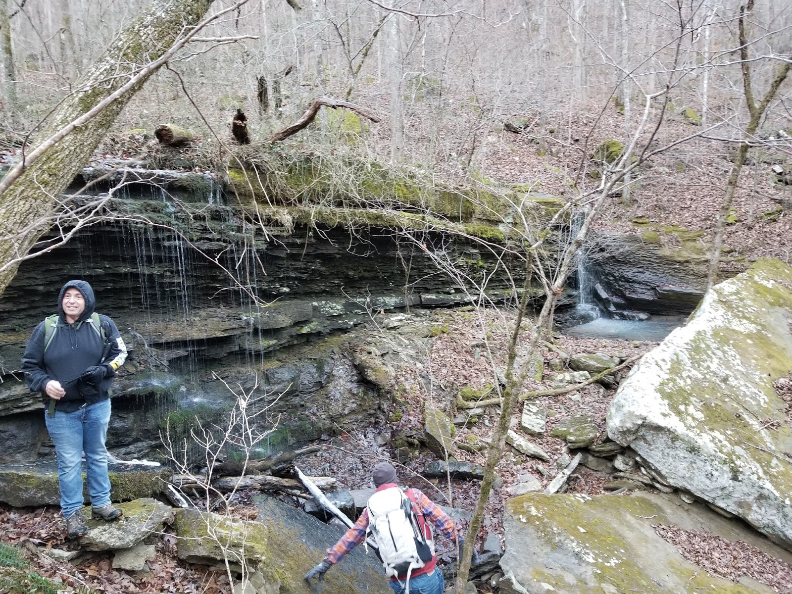
Once we made our way to Falls #3, it was all worth it.  The recent rains had really made this a spectacular looking waterfall, one that photography doesn't really do justice to.  I took some photos for scaling, and by that rough calculation, it is 37 feet tall.  From Falls #3, we picked our way carefully downstream to Falls #4, right below it, on the right (north) side this time.  Again, this is steep and treacherous, so extreme care is needed here.  Falls #4 is not quite as tall as Falls #3 but is even more picturesque.  You can easily see Falls #3 above it.  Below Falls #4 is yet another waterfall, much shorter but still quite beautiful, Falls #5.   

Falls #5 (foreground)
and Falls #4 (background)
We did not hike the remainder of the creek to where it flows into Middle Fork.  That is only another couple of hundred yards downstream, and we could not see anything further downstream.  From Falls #5 we followed the base of the bluff downstream as it rose and climbed up to the top of the ridge above the creek here, a very steep climb.  From there we angled up and a little south to intersect an old logging road the FS maps showed.  I marked a location where we found the old road, and on the trek up the road did not see anything that would prevent a good 4WD with good ground clearance from driving down to that location.  It was still a climb up on the old logging road, but that is much easier than bushwhacking back up the mountain.  

View from the bluff on the hike out; all three
waterfalls are visible upstream
Overall, even though it was a relatively short hike of fewer than two miles (4 miles if you park on the highway), I would have to rate this as a very difficult bushwhack.  The steepness of the hollow where the big waterfalls are, and the ruggedness of the terrain, combined with a climb out of well over 600 feet, make this a good one to do at least once when the waterfalls are flowing.  But now that I have that out of my system, I doubt I will go back to this one.  There are just too many places I have yet to explore, and others that I know to be easier hikes with payloads just as good or better.  I would recommend this only to experienced hikers, and ones that like a challenge, and like going places and seeing things that other human beings will never see.
North Hwy 27 - Middle Fork Hollow
Red - Hiking Track today
Blue - Access Jeep Road


Saturday, February 17, 2018

Why Hollow, Ozarks west of Freeman Springs, Arkansas

2/17/2018 - Why Hollow waterfalls

GPS Coordinates:  (Latitude,  Longitude,  Elevation)
  Parking Location:  35.62360   -93.10041,  1591 ft.
  Falls #1:  35.62517   -93.10139,  1499 ft.
  Falls #2:  35.62479   -93.10371
  Falls #3:  35.62462   -93.10386
  Falls #4:  35.62405   -93.10402
  Falls #5:  35.62476   -93.10672
  Falls #6:  35.62479   -93.10691
  Falls #7:  35.62489   -93.10722
  Falls #8:  35.62496   -93.10764
  Falls #9:  35.62496   -93.10764
  Falls #10:  35.62495   -93.10836
  Falls #11:  35.62510   -93.10861
  Falls #12:  35.62498   -93.10911
  Falls #13:  35.62506   -93.10950,  1043 ft.
  Bluffline Break:  35.62914   -93.10928,  999 ft.
  Falls #14:  35.62939   -93.10924,  1005 ft.
  Falls #15:  35.62924   -93.10947,  929 ft.
  Falls #16:  35.62951   -93.10802,  1111 ft.
  Falls #17:  35.64942   -93.10747

Pet-Friendly:  Dogs off leash may be okay, but there are some areas they may have difficulty getting into and out of.  This is a very steep hollow, and a couple of bluffline breaks we went through required climbing up two or three feet.  If your dog is too heavy to lift that far or if you think your dog needs to be on a leash, I would leave it at home.  

Motorcycle Friendly:  Not 'friendly', but do-able.  You will be going about 3.1 miles down Dare Mine Road from where you turn off Highway 7.  This is a dirt road, and not too bad at this point.  Your big bike, your decision.  I have driven a Harley Electraglide on worse roads for much longer distances.  After that, it is advisable to hike down the old Jeep road.


Hiking Statistics:  From the top (Dare Mine Knob) to the bottom of Why Hollow, it is over 1200 feet of elevation change before it runs into Indian Creek.  Today, we only hiked a total of 2.81 miles, with a minimum-to-maximum elevation change of 719 feet.  As with most areas in the Ozarks, getting to waterfalls means repeated climbs and descents, to get from the top of waterfalls to the base, or vice versa.  We hiked in two different forks of Why Hollow, so we had ascents and descents for each.  This is a difficult bushwhack, because of the ruggedness of the terrain and the very steep slopes within the drainages.  

GPS files (.gpx format) - GPS track maps are at the bottom of this post.
  Waypoints for Why, Gulf, Still, and Elmer Page Hollows
  Why Hollow GPS Track

Links to blog posts for nearby areas:
    Elmer Page Hollow
    Still Hollow North Prongs
    Still Hollow South Prong
    Still Hollow Lower Section
    Gulf Hollow 

Falls #8

I hadn't planned on going hiking when I woke up this morning.  We had actually got a nice rain last night, but it was still raining and I am not a big fan of hiking in the rain.  But about the time it stopped raining, I got a text from my friend and frequent hiking partner, Dan Frew, wanting to know if I was up to a hike into Why Hollow.  This little hollow had been on my "wet weather" hiking list for quite a while.  Dan had been there before and knew it should have a number of nice waterfalls, but we had put it on the back-burner until we got some rain.  Well, Shazam!  Here we were, with some rain.  So I met up with Dan and David Dedman, another friend I have often hiked with, and we headed north to Why Hollow.  Why "Why" Hollow, you might ask?  It was an unnamed hollow but had enough really nice waterfalls that it needed something we could call it because folks would be asking.  On the topo maps, this hollow has the main creek and two forks looking exactly like a "Y".  Y Hollow seemed a little odd, and we already had one named Wye Hollow.  Additionally, the climb in and out was so steep and we kept asking ourselves "WHY did we think this was a good idea?"  So, Why Hollow it is.

Falls #15 (top)
Driving directions to Why Hollow are fairly easy.  From the Dover
 town square (intersection of Highways 7 and 27), go north on Highway 7 for 21.2 miles.  This will take you to the small community of Freeman Springs.  Like many of the older communities in northwest Arkansas, don't expect a bunch of houses or a sign or anything.  It's more like an area that used to have a group families living there and now has one or two.  Turn left (southwest) on Dare Mine Road (aka CR-1806).  Go 3.1 miles on Dare Mine Road and turn right onto a Jeep road.  If you don't have a good 4WD vehicle, park here.  Either drive down it or hike down it, but go an additional 0.7 miles down this Jeep road to where a large berm blocks access to the logging road heading north across the top of Why Hollow.  This is the parking location I marked with the GPS coordinates above.  The parking location is down off Dare Mine Knob along the spur between Elmer Page Hollow and Why Hollow.  This Jeep road is actually called Dare Mine Knob Road, not to be confused with Dare Mine Road, which goes all the way down to the junction of Indian Creek with Moccasin Creek.  See the map at the bottom of this post.

How culverts were done back in the day!

From the parking location, we headed over the berm and down the old logging road there, to the top of the first fork, and headed down into the hollow there.  Where the logging road crosses the top of the drainage, the culverts are a little old school.  They had taken a couple of big old black gum trees, which are often hollow, and laid them in a trench under the road.  I don't know how long they had been in the ground, but they did not seem to be rotted at all, other than the hollow middle.  Pretty cool, the stuff you find in the woods.  We found the first waterfall only a hundred feet or so off the old road.  All the waterfalls in this hollow are unnamed, so I'll stick to my standard convention of just numbering them as we found them.  


Falls #2
Getting down to the base of Falls #1 was a bit of a feat in itself.  The slope on both sides of this hollow is very steep, making it a little difficult just getting down to the creek level without slipping.  The real challenge for us in Why Hollow was hiking downstream from waterfall to waterfall on our feet.  We only hiked a little less than three miles total today, but this kind of hiking takes it out of you very quickly.  Falls #2 is over a tenth of a mile further downstream, a beautifully long stairstep waterfall extending and curving downhill.  Falls #3 was right below that, a more classic Ozark waterfall spilling out over a ledge.  Wherever we encountered this type of waterfall, we had to climb up on the steep bluff, then trek downstream to make sure we didn't slip and end up going over the edge of the bluff and down into the grotto.

Falls #9
Falls #4 was in a side drainage a short distance further downstream, but after that, we didn't come to Falls #5 until about 0.2 miles downstream.  This is actually somewhat normal spacing between waterfalls in an Ozarks hollow, as waterfalls form where the creek goes over blufflines and those big layers of harder rock are layered out such that there will be a run of the creek between where major blufflines create a drop for a waterfall.  Why Hollow is no ordinary hollow, however, and it falls off steeply as it runs downhill.  Once we found Falls #5, we encountered waterfalls one after another, less than a hundred feet apart.  Even with the curvature of the creek, we could sometimes see four or five of them at a time from up on the slope along the creek.

Falls #10 (background)
Falls #11 (foreground)
The next eight waterfalls, Falls #5 through Falls #13, were spaced out within the next 300 yards of the creek in this fork, a veritable waterfallapalooza!  Some were smaller, some a pretty good size, waterfalls of all shapes and styles.  It is awesome to see a polyfoss area this prolific.  It seems to be a feature of this localized area in the Ozarks, with Still Hollow to the north and east of Why Hollow being much the same way.  I have documented 67 "photo worthy" waterfalls to date in Still Hollow, and I have no doubt there are more waiting to be discovered. 

Falls #14
After Falls #13, the creek in this fork still dropped off fairly steeply, but for the most part, the heavy rock layers downstream had broken down.  There were a few smaller waterfalls, including some in side drainages that did not have much flow today, but no more that I considered photo-worthy.  We continued down and around the bluff to the right and started hiking upstream on the other fork in Why Hollow.  On this fork, the bluffline was higher and unbroken until we had gone upstream to about the same elevation as Falls #13 had been in the other fork.  This is where we found Falls #14, and we found one bluffline break that we were able to carefully make our way down to get to the base of Falls #14.  It isn't much of a bluffline break, but it was all we could find.  The other side of the creek appeared to be just as sheer downstream, with no breaks in the bluff cliff anywhere that we could see.  

Falls #15
Once at the base of Falls #14, the creek flows just a few yards downstream before plunging into the long, beautiful cascade that is Falls #15.  Falls #15 falls steeply down, curving into the side of the solid rock cliff that it has slowly eroded a slot channel into over the eons.  Photographing the lower part of Falls #15 is a little tricky in that it necessitates climbing down some rock ledges to a point where you can see the cascade.  You can't see this from on top of the bluff cliff because it has channeled into the rock on the south side of the creek.  On the other side, where the creek leaves the base of Falls #14, there is a huge shelter where the creek has eroded the solid sandstone several yards back from the present day creek bed.  This shelter extends all the way from the base of Falls #14 to the top of Falls #15.

Falls #16
We climbed back up through the treacherous bluffline break on the right (south) side and continued upstream.  Once adjacent to the top of Falls #14, we were able to slope back down to the creek bed and continue upstream at the creek level.  Falls #16, a little over a hundred yards upstream from Falls #14, is perhaps the crown jewel of this steep little hollow.  It is actually four falls, a stunning 4-tiered waterfall system that really put an exclamation point on an already awesome hike.  As you might suspect, you can hear this one quite a distance away.  Upstream from Falls #16, Falls #17 is a continuous cascade of smaller waterfalls stretching for a good 50 yards upstream.  On the climb up the slope, you can see it stretch out far up into the drainage, nature at its finest.  

Falls #14
This is where we chose to make our climb up out of the drainage, heading straight up the slope to the spur between the two forks of Why Hollow.  When I say straight up, that's what I mean.  It is very steep, and the clay soil covered with loose rock and a thick layer of loose leaves makes for a very strenuous hike up to the spur.  There we found the old logging road that we had started hiking down before we peeled off and went down into the southern-most fork.  The entire hike was not that long, and just packed with waterfall after waterfall, but the hike out is a little rough.  After hitting the old logging road, it is still uphill but at a much lower grade and much easier hiking conditions.  

Falls #1
Why Hollow is another of those great areas in the Arkansas Ozarks that no one

really knows about and no one ever goes to but is just spectacular, unbridled 

natural beauty.  Note that it is strenuous hiking at times, as I have mentioned, and sometimes a little treacherous.  That being said, if you are up to it, this hike is a difficult bushwhack but definitely worthwhile.  I plan on going back in the spring to get some photos with a little greenery and hopefully even better water flow.  The well-known waterfalls that people know of and go to frequently, like Hemmed-In Hollow Falls, Compton's Double Falls, etc., are great, but there is something about exploring and photographing areas like this that few people will ever set eyes on that really enthralls me.  If you go, make sure it is in the relatively wet weather for best effect, and be very careful out there.
Why Hollow GPS track
Area around Why Hollow (purple track in center)
Still Hollow - north and east
Elmer Page Hollow - south
Gulf Hollow - east
Cowan Hollow - far east
Buzzard's Roost - west


Wednesday, February 7, 2018

Upper Graves Creek, Ozarks north of Pilot Rock Mountain, near Hagerville, Arkansas

2/7/2018 -  Upper Graves Creek

GPS Coordinates:  (Latitude,  Longitude,  Elevation)

  Parking Location #3:  35.56565   -93.21119, 1456 ft.
  Parking Location #4:  35.56740   -93.21037, 1395 ft.
  Falls #5:  35.56949   -93.21045,  1206 ft.
  Falls #6:  35.57357   -93.20859,  1053 ft.
  Falls #7:  35.57376   -93.20811,  1036 ft.
  Falls #8:  35.57778   -93.20547,  934 ft.
  Falls #9:  35.57877   -93.20561,  915 ft.
  Falls #10:  35.57917   -93.20304,  892 ft.
  Falls #11:  35.57962   -93.19826,  889 ft.
  Graves Creek Slot Falls:  35.59225   -93.19073,  722 ft.
  Dead Pool Falls:  35.59198   -93.19006,  709 ft.
  Falls #12:  35.58023   -93.20473,  980 ft.
  Falls #13:  35.58014   -93.21593,  1158 ft.

Pet-Friendly: Dogs off leash should be OK.  If your dog needs to be on a leash, it is doable but difficult because this is mostly bushwhacking.  

Motorcycle Friendly: No, not at all friendly to your big bike.  The parking locations are several miles down dirt roads.

Hiking Statistics: Today we hiked a total of 10.68 miles, about 2.2 miles of which was hiking along the road from where we climbed back to the Jeep.  The rest was bushwhacking, although on the climb out we followed an old trace road as much as possible.  The highest-to-lowest elevation difference was 1186 feet.  The total hiking time was 5:22 (hours:minutes).  I would rate this as a difficult bushwhack.  There was not a lot of undergrowth along the creek, but the terrain is rugged, with some downed trees and a lot of rock hopping.  Some areas were very steep, particularly on the climb out, but most of our hike today was on fairly moderate slopes.

GPS files (.gpx format) - See maps at the bottom of this blog post
    Graves Creek waypoints
    Upper Graves Creek GPS track
    Lower Graves Creek GPS track
Links to blog posts for other nearby areas:
    Graves Creek (lower section)
    Trace Creek
    Hole Creek 
    Arkansas Sphinx


Graves Creek is an area fairly well known to Arkansas Hikers.  It is featured in Tim Ernst's guidebook Arkansas Waterfalls, and in Danny Hale's Takahik trail book.  I have seen quite a few photos of the waterfalls highlighted in these books that flow over the tall bluffs on the sides of Graves Creek Canyon, but not much on the bulk of the drainage upstream.  I saw a photo by John Moore of a beautiful area on Graves Creek with huge overhangs on both sides of the creek, and that was the only thing I have seen.  That one photo is intriguing enough to get it on my "go-explore" list.  Today, we set out to do exactly that.  Besides the waterfalls, Graves Creek itself is known as one of the most beautiful and picturesque creeks in the Ozarks.  My hiking companions today were Dan Frew, Dan Breedlove, and Roy Hocker.  We met up bright and early and set out for Graves Creek.

To get there, from the Dover town square (junction of Hwy 7 and Hwy 27), go north on Highway 7 for 5.5 miles and turn left on Highway 164.  Go 7.6 miles on Highway 164 and turn right on FR-1800 (Pilot Rock Mountain Road or CR-3891).  This is just past the twin bridges over Big Piney Creek.  Stay on Pilot Rock Mtn Road for 6.0 miles as it changes to CR-3890, to CR-3861, to CR-4840, then park on the left side of the road where a logging road has been cut.  It looks like the Forest Service has been working on a new road here, and were about to put a gate up.  Today, we went an additional 250 yards down the road and parked.

We started our hike heading straight down the bluff to the creek below.  This was still high enough in the drainage that there was little water, but the creek started flowing a short distance downstream.  We are still in the grips of an extended drought, with little rain since last August, going on a half year with only sporadic light rain.  I didn't even bring my tripod and camera today because I didn't think there would be enough flow in any waterfalls to make it worthwhile.  For photography where I don't need manual control of the camera, I find the camera in my phone (Samsung S7 Active) to be more than adequate.


Falls #6
The drainage we were hiking down was one of 2 major forks in the upper part (west end) of Graves Creek.  We found the first waterfall, Falls #5, about 200 yards downstream.  Unnamed Falls #1 through Falls #4 were identified in hikes on the lower section.  Another quarter mile downstream we found Falls #6, which will be a nice twin waterfall when we do get some rain.  With some good flow in the creek, this one will be really beautiful.  A short distance downstream from that is Falls #7, a double waterfall in a side drainage on the right.  The bluff on the right side of the creek was already starting to form up with the tall, solid sandstone sides that are characteristic of the lower part of Graves Creek.


Falls #9
Continuing downstream, we came to Falls #8, and Falls #9 shortly afterward at the junction with the other major fork in the upper end of Graves Creek.  Falls #9 is a small but picturesque waterfall flowing into a large pool.  Having hiked the lower section of Graves Creek a few times, large pools of water was not one of the things I would have expected, but we did encounter a few of them.  Downstream, Falls #10 was another waterfall with a large pool, large enough to make a nice swimming hole.  We had just passed a huge bluff on the left that made a nice natural campsite.  


Falls #10
We were in a section of Graves Creek now with tall, sheer rock bluffs.  Falls #11 is another double waterfall, in a fairly large side drainage, spilling over the tall bluff on the right as we headed downstream.  Hiking along the creek today was not that bad, but this was drier than normal for this time of year.  When the creek water level gets up, one thing you will have to watch for is sections of the creek that are filled with water from side to side in some of the more narrow canyons.  This will make for prettier waterfalls, but harder creek crossings and fewer options on your hiking routes.  Today, things were really nice; enough water in the creek to make for some beautiful scenery, but low enough to allow us to walk right along the creek.

After Falls #11 there is a long stretch, well over a mile, before you hit another waterfall.  That doesn't mean it is lacking in natural beauty.  This part of the creek has huge rocks that have been shed from the tall solid rock bluffs eons ago, and some of the prettiest creek that you will find anywhere.  The section includes the area with that great photo John Moore had posted on Google Earth many years ago.  When the creek level is up higher, you may have to climb up on the bluffs on either side to walk down, but today we could go right down the creek and take it all in.  


Graves Creek Slot Falls
Eventually, we came to familiar territory for me, a slot waterfall flowing into a deep pool that I had called Unnamed Falls #3.  I notice in Danny Hales Takahik book, he has named it Graves Creek Slot Falls so I will start using that name.  This is where I started regretting not bringing my "big" camera, as it had plenty of flow today to look really nice.  The same can be said for Dead Pool Falls, right below it.  I apologize for the quality of my photos today and promise to start packing my Nikon D500.  Forever Falls can be seen spilling over the canyon wall from here, just downstream of Dead Pool Falls, but it is on a side drainage and had little more than a dribble of water today.  


Dead Pool Falls
Now we were through the part of Graves Creek none of us had been to, so our exploring goals for today were accomplished.  But we were a long way from where we parked, both in terms of distance and elevation.  It is such a remarkably beautiful creek, we debated hiking the rest of the way down the creek, then hiking back along Graves Creek Road to Pilot Rock Mountain Road, but decided that would be a bit too much.  Maybe in the spring, that would be a good hike.  Today, we were ready to get on out of there.  We knew of an old logging road on the north side of the valley and thought that might be our best route out for the big climb, and headed up the mountain on that side.  

We did find an old trace road and started hiking that back up the valley.  We did come to a logging road at one point that probably would have taken us up to Meadows Knob Road, but we chose to keep hiking upstream, following the old trace road as well as we could.  As we hiked up into the upper part of the drainage, we eventually had to just climb straight up and out, getting up to the ridge on the north side, where Meadows Knob Road runs.  We hiked back along that road to Pilot Rock Mountain Road for over 2 miles before getting back to where we had parked the Jeep.  This is a really nice area that I want to get back to, but I'll have to do some thinking on a better way to get in and out while maximizing the hiking time down on the creek itself.  
Graves Creek GPS tracks
Red - Upper Graves Creek (today's hike)
Blue - Lower Graves Creek

Tuesday, February 6, 2018

Trace Creek, Ozarks north of Pilot Rock Mountain, near Hagerville, Arkansas

2/6/2018 -  Hollows in the Trace Creek drainage

GPS Coordinates:  (Latitude,  Longitude,  Elevation)

  Parking Location #1:  35.58673   -93.22045,  1794 ft.
  Parking Location #2:  35.60608   -93.22053,  834 ft.
  Falls #1:  35.59942   -93.22710,  909 ft.
  Falls #2:  35.59061   -93.23420,  1017 ft.
  Falls #3:  35.59151   -93.23994,  1156 ft.
  Falls #4:  35.59129   -93.23983,  1141 ft.
  Falls #5:  35.59025   -93.23987,  1182 ft.
  Falls #6:  35.58715   -93.23013,  1011 ft.
  Falls #7:  35.58526   -93.22964,  1035 ft.
  Falls #8:  35.60079   -93.22779,  810 ft.
  Falls #9:  35.60232   -93.22816,  801 ft.
  Falls #10:  35.60174   -93.22878,  820 ft.
  Falls #11:  35.60408   -93.21788,  820 ft.
  Falls #12:  35.60383   -93.21791,  826 ft.


Pet-Friendly: Dogs off leash should be OK.  If your dog needs to be on a leash, it is doable but difficult because this is mostly all bushwhacking.  

Motorcycle Friendly: No!  This is not at all friendly to your big bike.  The parking locations are several miles down rough dirt roads.

Hiking Statistics: Today we hiked a total of 10.2 miles, about 7.5 miles was bushwhacking and the remainder on the ATV trail going down the spur of the mountain and back to parking location #1.  The highest-to-lowest elevation difference was 1067 feet, with hikes up into 5 different forks, and back down those creeks.  If we had parked at parking location #2, the highest-to-lowest elevation change would have been only 350 feet.  The total hiking time was 5:52 (h:m).  I would rate the bushwhack part of the hike as a moderate bushwhack.  There was not that much undergrowth nor exceedingly steep climbs along the various creek segments.  The really steep climb was along the ATV trail on the way out.

GPS files (.gpx format) - See maps at the bottom of this blog post
    Dover-Sand Gap area waypoints
    Trace Creek GPS track

Links to blog posts for other nearby areas:

    Hole Creek 
    Graves Creek (upper section)
    Graves Creek (lower section)
    Arkansas Sphinx

The Trace Creek drainage area has been on my "go explore" list for quite a while.  I knew nothing about it and hadn't found anyone that had explored it at any depth.  On paper, it sure looks like it could harbor some nice waterfalls.  It is a very large drainage area, over seven square miles, with four major prongs draining out into one of the major tributaries to Big Piney Creek.  The drainage area is like a huge bowl, surrounded by the ridge of Pilot Rock Mountain on the south and west, and Meadows Knob on the east, draining into Big Piney on the north.  A huge area that was still a complete unknown to me.  So when my friend and frequent hiking partner, Dan Frew, asked if I wanted to go take a look, I jumped at the opportunity.  

To get there, from the Dover town square (junction of Hwy 7 and Hwy 27), go north on Highway 7 for 5.5 miles and turn left on Highway 164.  Go 7.6 miles on Highway 164 and turn right on FR-1800 (Pilot Rock Mountain Road or CR-3891).  This is just past the twin bridges over Big Piney Creek.  Stay on Pilot Rock Mtn Road for 5.5 miles as it changes to CR-3890, to CR-3861, to CR-4840.  Bear Right onto FR-1802 (aka CR-4891, or Meadows Knob Road).  Go 0.9 miles on FR-1802, then turn left onto a Jeep road.  The parking #1 location we used today is 0.1 miles down this jeep road at a food plot.  Park as far off Meadows Knob Road as you feel comfortable in your vehicle, but be aware that going further will require a 4WD vehicle with good ground clearance.  

We started our hike down toward Trace Creek along this Jeep road, which rapidly narrows down to what I would classify as an ATV trail, although a Jeep will fit down it most of the way.  It extends right down the spur between a long hollow on the right called, ironically, Short Hollow, and the remainder of the Trace Creek drainage area on the left.  It goes all the way down to Trace Creek itself, where the creek from Short Hollow flows into it.  Refer to the map at the bottom of this post to see where it runs between the two parking locations.  This is a very long and steep trail, and we decided to leave Dan's Jeep parked at the food plot since we had no way of knowing what the trail was like.  Sometimes, it is very tempting to drive right down one of these trails as far as you can, and I do that often.  But sometimes it becomes impassable, and sometimes there is no place to turn around, requiring you to back up a very narrow, very steep trail.  I have many dented fenders and busted tail lights from such situations.  

Today, we were in Dan's brand new Jeep, and not about to take a chance on putting some "Arkansas pin-striping" on the shiny new paint job.  As it turns out, either Dan's Jeep or my FJ Cruiser could have easily made it down the ATV trail almost to the bottom, although we probably would have picked up a little of that Arkansas pin-striping.  At the point I have labeled as parking location #2, about a mile and a half from where we parked, there is a more recent ATV trail bypassing some downed trees.  This section is almost at the bottom and is a little tight even for a Jeep to fit through.  There is a spot to turn around here, though, making it a good parking place if you have the vehicle to get you down there and back out.  Today, however, we had parked at the top and didn't even find this spot until we were on our climb out.  Today, we peeled off the ATV trail to the left at a spot where we found another old trace road leading down and upstream into the hollow.  

We followed this old road as it wrapped around the hollow back to our left until it disappeared, at which time we headed down toward the creek.  We found Falls #1 here in a side drainage.  As you might expect, there was barely a dribble of water going over the waterfall today, so we marked it and moved on down this small side drainage to the main creek.   Short Hollow, as previously mentioned, runs down the east side of the ATV trail we hiked down.  On the west side, Trace Creek has three other major prongs, two on the east side of the hollow and one on the south end  See the map at the bottom of this blog post to better visualize the layout of the Trace Creek area.  Our hike coming down into the hollow had put us right on Trace Creek, downstream of the south and southwest prongs.  We started our exploration hiking upstream and into the southeast prong.

We hiked well over a half mile upstream from this point, and the only thing we found was what appeared to be the remains of an old wagon or trailer.  We found what appeared to be short steel sides and the remnants of a sheet of steel that may have been on the floor, but no wheels, axles, or frames.  Occasionally, we saw the traces of an old road along parts of the main segment of Trace Creek.  I think a road was cut down the spur between the two forks of the southern prong, running close to two miles down the creek.  Today the area has large trees growing in most areas this old road ran, but we still found traces of it along the creek.

Continuing upstream, we went first up into the southwestern prong and found Falls #2 about a quarter mile up this creek.  Further upstream, we found Falls #3 and Falls #4 an additional quarter mile upstream into the right fork of this prong.  The entire Trace Creek drainage area extends about three miles north and south, and about 2.5 miles across.  It is just too much bushwhacking to cover all of this area in a single day, so we decided to hit the high points.  Instead of hiking further up into each of the forks, we decided to explore at least a little of each fork today.  Going back downstream out of the right fork, we went up into the left fork of the southwestern prong and found Falls #5.  While the main part of Trace Creek actually had more water flow than I was expecting today, the further up into the forks we hiked, we naturally saw less flow.

We hiked back downstream out of the southwestern prong to the intersection with the south prong and started hiking upstream into it.  We found Falls #6 about a quarter mile upstream from the junction and then found Falls #7 about 200 yards upstream from that.  At this point, we turned around and hiked downstream to explore the other areas of Trace Creek.  I believe just above this point is where that old road would have been cut, coming from the ridge of Pilot Rock Mountain down into Trace Creek.  We did find traces of an old road going down along the creek here.

Quite often, we will hike up and over the spurs or ridges between hollows to explore the next drainage, instead of hiking downstream on one and then upstream on the next.  In the Trace Creek drainage area, that isn't all that practical.  It is laid out almost circularly, so it is very difficult to go from the top of one hollow over into the top of an adjacent hollow.  Along the creek, the hiking was fairly pleasant, as far as bushwhacking goes.  Further up the slopes, the brush and undergrowth get thicker.  It may have been a little more hiking distance to stick to hiking along the creek, but it was much easier and much quicker.  So all the way back downstream we went, bushwhacking along Trace Creek.

Going downstream from where we had first hiked down to the main creek, we found Falls #8 about 200 yards further downstream.  Further downstream, the bluffs get very sheer on both sides of Trace Creek, with a very tall cliff on the right (east) side, requiring us to climb above the bluff to hike downstream on the left (west) side.  From Falls #8, the junction with the northwestern prong is only another 200 yards or so downstream.  Going upstream into this prong, we found a maze of overhanging bluffs on both sides of the creek.  This is a beautiful, almost fantasy-like area, well worth the hike just for this part.  

A short distance after turning into the northeastern prong, Falls #9 spills over the bluff from a side drainage on the north side.  As you go upstream, the creek winds from side to side, where it has carved out big overhangs on both sides from the solid sandstone.   I can only imagine what this area will look like with more water flow and some spring greenery.  I plan on coming back, so I won't have to imagine for long.  Falls #10 was another hundred yards upstream, and that was as far as we went today in this big prong.  There are undoubtedly more waterfalls upstream, but we still had Short Hollow to look at and had been out hiking a good part of the day.  We hiked downstream over a half mile to the junction where Short Hollow flows into Trace Creek and started hiking upstream into it.

We hiked up Short Hollow until we hit the first waterfalls, only about a third of a mile upstream.  Falls #11 was in a side drainage on the left (east), and Falls #12 was on the main creek in the hollow adjacent to it.  Short Hollow, like most of Trace Creek, was fairly clear of undergrowth and briers, so as bushwhacking goes it wasn't too difficult.  We hiked back downstream to the junction with Trace Creek, where we found the ATV trail running down the spur.  At this point, we had been hiking over 8.5 miles, almost all of it bushwhacking, but I was still fresh and not all that fatigued at all.  The climb back out sure fixed that.  The good thing is, we decided to bushwhack back downstream and climb out along this trail, which is much, much, easier than the steeper and rougher climb up the side of the hollow.  

While hiking the ATV trail along the spur is not as steep as the side of the hollow, it is still really steep.  It is a 1.5-mile mile hike up this spur along the ATV trail and an elevation change of 1067 feet.  I will confess to being just about wiped out by the time we got to the top of the ridge.  As I remarked to Dan - the first eight plus miles of bushwhacking was actually quite pleasant, and the last mile and a half of trail hiking almost killed me.  If you are familiar with the hike from Hemmed-In Hollow Falls up to the Compton trailhead, this is about like that, except on that hike you can take a breather by going out to Wild Vic's Cabin.  On this hike out, you just have to take it slow and take a break when needed.  I saw enough on today's hike to know that I want to come back when there is more water.  Only next time, I'll be driving most of the way down the spur.  Overall, I would rate this as a difficult bushwhack, and if you park at the top of the mountain, I would call it a very difficult hike.  That being said, it is still recommended;  next time, I'll have better photos of the waterfalls.
Trace Creek - today's GPS track
Trace Creek basin
The lower GPS track is upper Graves Creek