GPS Coordinates: (Latitude, Longitude, Elevation)
Parking Location #3: 35.56565 -93.21119, 1456 ft.
Parking Location #4: 35.56740 -93.21037, 1395 ft.
Falls #5: 35.56949 -93.21045, 1206 ft.
Falls #6: 35.57357 -93.20859, 1053 ft.
Falls #7: 35.57376 -93.20811, 1036 ft.
Falls #8: 35.57778 -93.20547, 934 ft.
Falls #9: 35.57877 -93.20561, 915 ft.
Falls #10: 35.57917 -93.20304, 892 ft.
Falls #11: 35.57962 -93.19826, 889 ft.
Graves Creek Slot Falls: 35.59225 -93.19073, 722 ft.
Dead Pool Falls: 35.59198 -93.19006, 709 ft.
Falls #12: 35.58023 -93.20473, 980 ft.
Falls #13: 35.58014 -93.21593, 1158 ft.
Pet-Friendly: Dogs off leash should be OK. If your dog needs to be on a leash, it is doable but difficult because this is mostly bushwhacking.
Motorcycle Friendly: No, not at all friendly to your big bike. The parking locations are several miles down dirt roads.
Hiking Statistics: Today we hiked a total of 10.68 miles, about 2.2 miles of which was hiking along the road from where we climbed back to the Jeep. The rest was bushwhacking, although on the climb out we followed an old trace road as much as possible. The highest-to-lowest elevation difference was 1186 feet. The total hiking time was 5:22 (hours:minutes). I would rate this as a difficult bushwhack. There was not a lot of undergrowth along the creek, but the terrain is rugged, with some downed trees and a lot of rock hopping. Some areas were very steep, particularly on the climb out, but most of our hike today was on fairly moderate slopes.
GPS files (.gpx format) - See maps at the bottom of this blog post
Graves Creek waypoints
Upper Graves Creek GPS track
Lower Graves Creek GPS track
Links to blog posts for other nearby areas:
Graves Creek (lower section)
Graves Creek waypoints
Upper Graves Creek GPS track
Lower Graves Creek GPS track
Links to blog posts for other nearby areas:
Graves Creek (lower section)
Trace Creek
Hole Creek
Arkansas Sphinx

Graves Creek is an area fairly well known to Arkansas Hikers. It is featured in Tim Ernst's guidebook Arkansas Waterfalls, and in Danny Hale's Takahik trail book. I have seen quite a few photos of the waterfalls highlighted in these books that flow over the tall bluffs on the sides of Graves Creek Canyon, but not much on the bulk of the drainage upstream. I saw a photo by John Moore of a beautiful area on Graves Creek with huge overhangs on both sides of the creek, and that was the only thing I have seen. That one photo is intriguing enough to get it on my "go-explore" list. Today, we set out to do exactly that. Besides the waterfalls, Graves Creek itself is known as one of the most beautiful and picturesque creeks in the Ozarks. My hiking companions today were Dan Frew, Dan Breedlove, and Roy Hocker. We met up bright and early and set out for Graves Creek.
 To get there, from the Dover town square (junction of Hwy 7 and Hwy 27), go north on Highway 7 for 5.5 miles and turn left on Highway 164. Go 7.6 miles on Highway 164 and turn right on FR-1800 (Pilot Rock Mountain Road or CR-3891). This is just past the twin bridges over Big Piney Creek. Stay on Pilot Rock Mtn Road for 6.0 miles as it changes to CR-3890, to CR-3861, to CR-4840, then park on the left side of the road where a logging road has been cut. It looks like the Forest Service has been working on a new road here, and were about to put a gate up. Today, we went an additional 250 yards down the road and parked.
 We started our hike heading straight down the bluff to the creek below. This was still high enough in the drainage that there was little water, but the creek started flowing a short distance downstream. We are still in the grips of an extended drought, with little rain since last August, going on a half year with only sporadic light rain. I didn't even bring my tripod and camera today because I didn't think there would be enough flow in any waterfalls to make it worthwhile. For photography where I don't need manual control of the camera, I find the camera in my phone (Samsung S7 Active) to be more than adequate.
The drainage we were hiking down was one of 2 major forks in the upper part (west end) of Graves Creek. We found the first waterfall, Falls #5, about 200 yards downstream. Unnamed Falls #1 through Falls #4 were identified in hikes on the lower section. Another quarter mile downstream we found Falls #6, which will be a nice twin waterfall when we do get some rain. With some good flow in the creek, this one will be really beautiful. A short distance downstream from that is Falls #7, a double waterfall in a side drainage on the right. The bluff on the right side of the creek was already starting to form up with the tall, solid sandstone sides that are characteristic of the lower part of Graves Creek.
Continuing downstream, we came to Falls #8, and Falls #9 shortly afterward at the junction with the other major fork in the upper end of Graves Creek. Falls #9 is a small but picturesque waterfall flowing into a large pool. Having hiked the lower section of Graves Creek a few times, large pools of water was not one of the things I would have expected, but we did encounter a few of them. Downstream, Falls #10 was another waterfall with a large pool, large enough to make a nice swimming hole. We had just passed a huge bluff on the left that made a nice natural campsite.
We were in a section of Graves Creek now with tall, sheer rock bluffs. Falls #11 is another double waterfall, in a fairly large side drainage, spilling over the tall bluff on the right as we headed downstream. Hiking along the creek today was not that bad, but this was drier than normal for this time of year. When the creek water level gets up, one thing you will have to watch for is sections of the creek that are filled with water from side to side in some of the more narrow canyons. This will make for prettier waterfalls, but harder creek crossings and fewer options on your hiking routes. Today, things were really nice; enough water in the creek to make for some beautiful scenery, but low enough to allow us to walk right along the creek.
 After Falls #11 there is a long stretch, well over a mile, before you hit another waterfall. That doesn't mean it is lacking in natural beauty. This part of the creek has huge rocks that have been shed from the tall solid rock bluffs eons ago, and some of the prettiest creek that you will find anywhere. The section includes the area with that great photo John Moore had posted on Google Earth many years ago. When the creek level is up higher, you may have to climb up on the bluffs on either side to walk down, but today we could go right down the creek and take it all in.
Eventually, we came to familiar territory for me, a slot waterfall flowing into a deep pool that I had called Unnamed Falls #3. I notice in Danny Hales Takahik book, he has named it Graves Creek Slot Falls so I will start using that name. This is where I started regretting not bringing my "big" camera, as it had plenty of flow today to look really nice. The same can be said for Dead Pool Falls, right below it. I apologize for the quality of my photos today and promise to start packing my Nikon D500. Forever Falls can be seen spilling over the canyon wall from here, just downstream of Dead Pool Falls, but it is on a side drainage and had little more than a dribble of water today.
Now we were through the part of Graves Creek none of us had been to, so our exploring goals for today were accomplished. But we were a long way from where we parked, both in terms of distance and elevation. It is such a remarkably beautiful creek, we debated hiking the rest of the way down the creek, then hiking back along Graves Creek Road to Pilot Rock Mountain Road, but decided that would be a bit too much. Maybe in the spring, that would be a good hike. Today, we were ready to get on out of there. We knew of an old logging road on the north side of the valley and thought that might be our best route out for the big climb, and headed up the mountain on that side.
 We did find an old trace road and started hiking that back up the valley. We did come to a logging road at one point that probably would have taken us up to Meadows Knob Road, but we chose to keep hiking upstream, following the old trace road as well as we could. As we hiked up into the upper part of the drainage, we eventually had to just climb straight up and out, getting up to the ridge on the north side, where Meadows Knob Road runs. We hiked back along that road to Pilot Rock Mountain Road for over 2 miles before getting back to where we had parked the Jeep. This is a really nice area that I want to get back to, but I'll have to do some thinking on a better way to get in and out while maximizing the hiking time down on the creek itself.
Hole Creek
Arkansas Sphinx

Graves Creek is an area fairly well known to Arkansas Hikers. It is featured in Tim Ernst's guidebook Arkansas Waterfalls, and in Danny Hale's Takahik trail book. I have seen quite a few photos of the waterfalls highlighted in these books that flow over the tall bluffs on the sides of Graves Creek Canyon, but not much on the bulk of the drainage upstream. I saw a photo by John Moore of a beautiful area on Graves Creek with huge overhangs on both sides of the creek, and that was the only thing I have seen. That one photo is intriguing enough to get it on my "go-explore" list. Today, we set out to do exactly that. Besides the waterfalls, Graves Creek itself is known as one of the most beautiful and picturesque creeks in the Ozarks. My hiking companions today were Dan Frew, Dan Breedlove, and Roy Hocker. We met up bright and early and set out for Graves Creek.
 To get there, from the Dover town square (junction of Hwy 7 and Hwy 27), go north on Highway 7 for 5.5 miles and turn left on Highway 164. Go 7.6 miles on Highway 164 and turn right on FR-1800 (Pilot Rock Mountain Road or CR-3891). This is just past the twin bridges over Big Piney Creek. Stay on Pilot Rock Mtn Road for 6.0 miles as it changes to CR-3890, to CR-3861, to CR-4840, then park on the left side of the road where a logging road has been cut. It looks like the Forest Service has been working on a new road here, and were about to put a gate up. Today, we went an additional 250 yards down the road and parked.
 We started our hike heading straight down the bluff to the creek below. This was still high enough in the drainage that there was little water, but the creek started flowing a short distance downstream. We are still in the grips of an extended drought, with little rain since last August, going on a half year with only sporadic light rain. I didn't even bring my tripod and camera today because I didn't think there would be enough flow in any waterfalls to make it worthwhile. For photography where I don't need manual control of the camera, I find the camera in my phone (Samsung S7 Active) to be more than adequate.
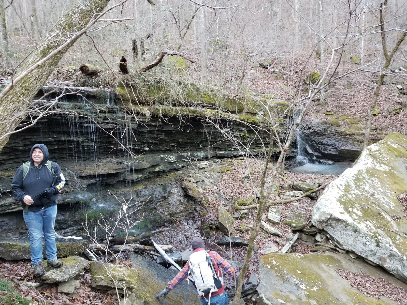 |
| Falls #6 |
 |
| Falls #9 |
 |
| Falls #10 |
 After Falls #11 there is a long stretch, well over a mile, before you hit another waterfall. That doesn't mean it is lacking in natural beauty. This part of the creek has huge rocks that have been shed from the tall solid rock bluffs eons ago, and some of the prettiest creek that you will find anywhere. The section includes the area with that great photo John Moore had posted on Google Earth many years ago. When the creek level is up higher, you may have to climb up on the bluffs on either side to walk down, but today we could go right down the creek and take it all in.
  |
| Graves Creek Slot Falls |
 |
| Dead Pool Falls |
 We did find an old trace road and started hiking that back up the valley. We did come to a logging road at one point that probably would have taken us up to Meadows Knob Road, but we chose to keep hiking upstream, following the old trace road as well as we could. As we hiked up into the upper part of the drainage, we eventually had to just climb straight up and out, getting up to the ridge on the north side, where Meadows Knob Road runs. We hiked back along that road to Pilot Rock Mountain Road for over 2 miles before getting back to where we had parked the Jeep. This is a really nice area that I want to get back to, but I'll have to do some thinking on a better way to get in and out while maximizing the hiking time down on the creek itself.
  |
| Graves Creek GPS tracks Red - Upper Graves Creek (today's hike) Blue - Lower Graves Creek |
Love that creek. My maiden name is Graves, by the way.
ReplyDeleteDitto on the creek. One of the best. Your maiden name?
DeleteMaiden name...just an excuse to claim ownership.
ReplyDelete