GPS Coordinates: (Latitude, Longitude, Elevation)
Parking Location (Sand Cave): 35.54491 -92.90199, 1100 ft
Parking Location (Waterfalls): 35.54849 -92.89378, 1279 ft
Sand Cave: 35.54430, -92.90148, 1059 ft
Falls #1: 35.54135 -92.90110, 881 ft.
Falls #2: 35.54208 -92.89472, 1032 ft.
Sand Cave Falls: 35.54114 -92.89268, 1126 ft.
Falls #4: 35.54131 -92.89254, 1142 ft.
Sand Cave Quintuple Falls: 35.54121 -92.89229, 1202 ft.
Falls #10: 35.54677 -92.89185, 1195 ft.
Pet-Friendly: Dogs off leash should be okay. Dogs on leash will make it difficult to access many of these areas, but could be done.
Motorcycle Friendly: No. Parking is off Lindsey Mountain Motorway. This is a not-so-good dirt road many miles down other dirt roads. Not recommended for street bikes and cruisers.
Hiking Statistics: From top to bottom, the Blue Hole SIA is about 1000 feet of elevation change. Today, Jim, Dan, and I hiked 2.12 miles with a highest to lowest elevation change of fewer than 400 feet. This was all bushwhacking, although there is an old trace road we could follow a short distance. Overall I would call this a moderate bushwhack. We were hiking for 1 hour and 37 minutes on the track at the bottom of this post.
GPS files (.gpx format) - Maps of the GPS track are at the bottom of this post.
 |
| Sand Cave Hollow Falls (today's hike) |
 |
| Sand Cave Hollow Falls on March 31 hike Photo by Dan Frew |
One of the reasons I decided to write this blog was to keep track of my various explorations and learn from them. Ideally, every time I go to an area I will find something that will help me the next time I visit the area. This blog also helps me pass that information on to others. On our first hike in Sand Cave Hollow, I noted that the waterfalls that were worth the trek were all in the upper part of the hollow, and that we could get to that area directly from Lindsey Mountain Motorway fairly easily. Today, we did exactly that. We started out heading directly to Falls #10 and found it at the top of the north prong in Sand Hollow. Unfortunately, the water flow in this one was somewhat lower than it was in March. That did not bode well for the waterfalls on the rim of the other prong, but we headed toward them anyway.
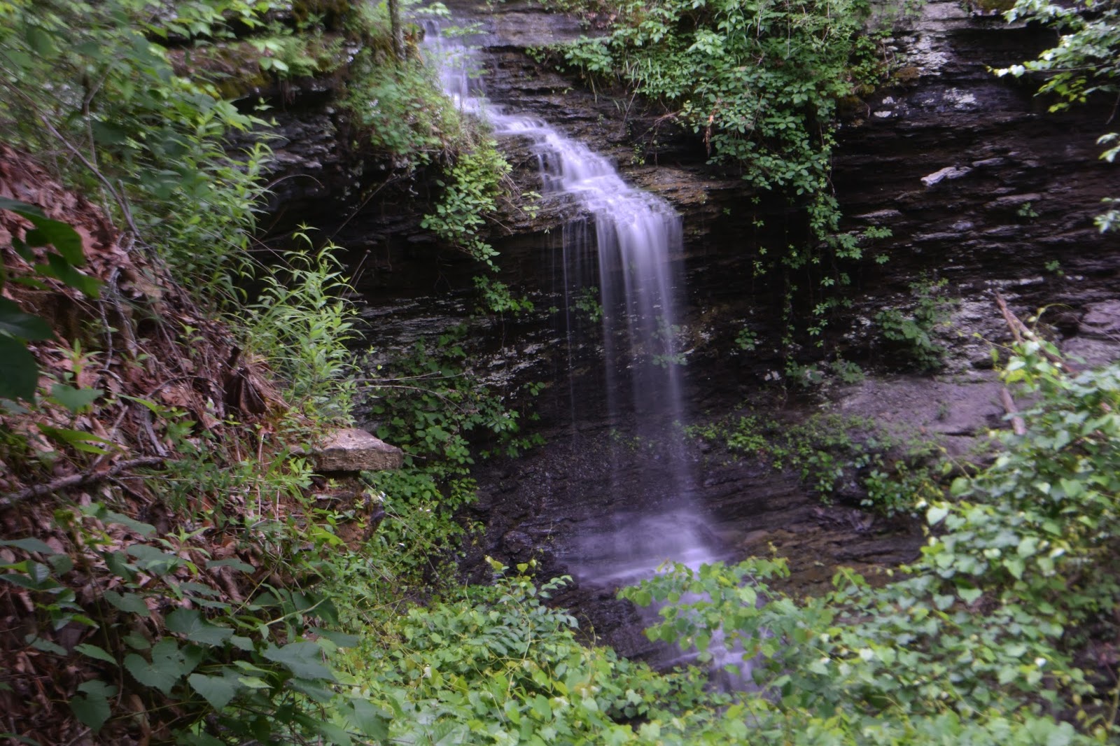 |
| Sand Cave Hollow Falls |
Despite the lower water flow in the creek, we remembered Sand Cave Hollow Falls as one of those waterfalls that seemed to have more flow than the creek had either upstream or downstream. We dropped down the creek a short distance to it, and found the flow today greatly diminished, but it was still a nice looking waterfall. After taking a few photos, we headed back to the parking location, this time following the old trace road along the rim of the bluffline. We were a little disappointed at the relatively low water flow, but should have expected it. This area is gripped in the driest spring that I can remember in the 25 years I have lived here. I will still be coming back to visit this place, but next time I'll wait for much wetter conditions AND "leaves off" season.
 |
| Sand Cave Hollow GPS Track 5/18/2016 |
No comments:
Post a Comment