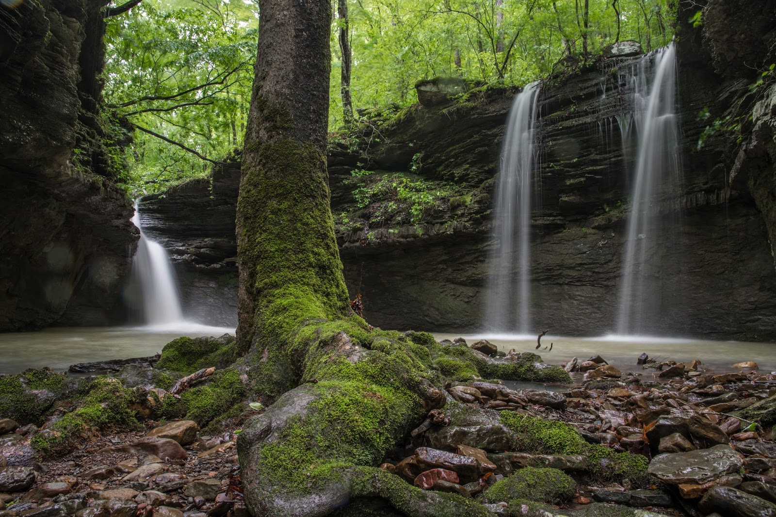
Friday, May 5, 2017

Middle Cow Creek East and SE prongs, Ozarks between Fort Douglas and Limestone, Arkansas

5/5/2017 - Waterfalls in the East and Southeast Prongs of Middle Cow Creek

GPS Coordinates:  (Latitude,  Longitude,  Elevation)
  Parking Location #3:  35.71682   -93.30549, 1622 ft.
  Middle Cow Falls:  35.73534   -93.30909, 1031 ft.
  Bluffline Break:  35.71996   -93.30312, 1423 ft.
  Falls #1:  35.71977   -93.30286, 1431 ft.
  Falls #2:  35.72022   -93.30292, 1392 ft.
  Falls #3:  35.72102   -93.30315, 1352 ft.
  Falls #14:  35.72100   -93.30296, 1356 ft.
  Falls #4:  35.72461   -93.30638, 1184 ft.
  Falls #5:  35.71921   -93.31180, 1148 ft.
  Falls #6:  35.71438   -93.31111, 1248 ft.
  Falls #7:  35.71322   -93.31046, 1259 ft.
  Falls #8:  35.71325   -93.30983, 1278 ft.
  Falls #9:  35.71324   -93.30822, 1387 ft.
  Falls #10:  35.71339   -93.30768, 1406 ft.
  Falls #11:  35.71323   -93.30666, 1479 ft.
  Wraith Falls:  35.71275   -93.30613, 1505 ft.
  Falls #13:  35.71291   -93.30615, 1501 ft.
  Falls #26:  35.71198   -93.30493, 
  Logging road fork:  35.71759   -93.30394, 1654 ft.

Pet Friendly: Dogs off leash should be OK.  If your dog needs to be on a leash, it is doable but difficult because this is all bushwhacking.

Motorcycle Friendly: No, not at all friendly to your big bike.  The two parking locations today are several miles down dirt roads.

Hiking Statistics:  The Middle Cow Creek valley is only about 800 feet from top to bottom.  On today's hike, we had a highest-to-lowest elevation difference of 598 feet.  Boomer and I hiked a total of 4.86 miles, in 4.5 hours.  The terrain varied from open to somewhat overgrown, with a low slope, along Middle Cow Creek itself.  In the prongs, it was very rugged and very steep.  In the southeast prong there was relatively little undergrowth, but in the east prong, it was pretty overgrown, making the bushwhack uphill all that more difficult.  I would rate this a difficult bushwhack.


GPS files (.gpx format) - See maps at the bottom of this blog post
  Cow Creek Basin Waypoints
  Middle Cow Creek - today's hike track

Wraith Falls (21 feet)
I had spent some time hiking the Middle Cow Creek valley before, exploring most of the upper prongs and the main creek all the way down to its confluence with Cow Creek.  If you find the references to different "cow" creeks confusing, just look at the map at the bottom of this post showing what I call the Cow Creek Basin, encompassing Cow Creek (west and north), Little Cow Creek (east), and Middle Cow Creek (in the middle of those two, naturally).  My previous hikes in this valley were in winter "leaves off" season, and were during a period in which the Ozarks were suffering for rain, so the creeks did not really have enough flow to make the waterfalls as nice as they should be.  I had placed this area on my list of areas to go back to when things were wetter, and we have finally received enough rain to move the needle on Ozark stream flows.   So today, Boomer the Magnificent Mountain Dog (he insists I call him that) and I loaded up the FJ and headed north.


Falls #10
I was only planning on hiking two of the prongs today, the big easternmost prong and the southeast upper prong.  By "upper", I mean higher upstream, not north on the map.  I had refined my parking locations quite a bit, and now have four different parking locations, depending on which parts of this fairly large valley I want to hike.  Today, we headed for parking location #3, between the two prongs I wanted to check out.  There are some tributary creeks and another small upper prong that I have yet to explore fully, but from my previous visits I knew that most of the waterfalls were in the upper prongs, and Middle Cow Falls was way down at the north end of the valley by itself.  To see directions, parking locations, etc. for those other parts of the valley, you can look at my previous blog posts:
  - Entire Middle Cow Creek valley and eastern prongs blog post
  - Southwestern upper prongs and west tributaries blog post

Falls #9
To get there, From the community of Pelsor (Sand Gap), go 16.2 miles south on Highway 123, then turn right onto FR-1003, aka Johnson County CR-5741.  This is 3.3 miles past the Haw Creek Campground.  If you are coming from the other direction on Highway 123, this junction is 10.5 miles north of Hagerville  
- Go north on CR-5741 for 5.7 miles, then 
- Turn right on CR-5680, also known as Pine Ridge Road.   
- Go 1.0 miles on Pine Ridge Road, and turn left (north) onto FS-1202A.  This is also called Jimmy Ridge Road or Jim's Ridge Road, for Jim Stone, who had a homestead here.
- Go 0.8 miles on FS-1202A, then turn left onto a Jeep road.  As you might guess from the name, when I say Jeep road, I mean it.  You need a decent 4WD vehicle with good ground clearance.  If you don't have one, park here and walk the rest of the way.  FS-1202A is a better road, and somewhat maintained, but depending on your vehicle you might want to park on Pine Ridge Road.
- After you turn onto the Jeep road, go 0.3 miles and turn left at the fork in the Jeep road.  Go down this old road to a large berm and park there.  This is parking location #3 and is a good spot between the big east prong and the southeast prong.  


Small Cascade Above Falls #8
From this parking location, we could hike down either prong and back up the other.  On my last visit, I hiked down the big easternmost prong, down the creek all the way to Middle Cow Falls, and back up the southeast upper prong.  That worked really well, so of course, I thought I would mix things up and reverse my route, going clockwise around the prongs.  As another lesson learned, that turned out to be NOT the way to do it this time of year.  During "leaves off" season, the hike down the east prong is not bad at all.  It is still rugged terrain, but you are hiking downhill, not climbing, and without all the spring and summer vegetation it is not that unpleasant.  This time of year, however, the combination of very rugged terrain, climbing steeply, and undergrowth that is thick in parts of this prong, all add up to a not-so-pleasant hiking experience.


Falls #11
From the berm, Boomer and I hiked over to the southeast prong.  The old road we had followed to the parking location continues on to a food plot, which I am sure is why the forest service keeps the path brush-hogged.  On the other side of the food plot, there is an old trace road that does not show up on any of the old Forest Service maps and is barely discernible now.  It is easy to lose this trace road, but I told Boomer to "lead", and that's just what he does.  He knows the old trace road is the best path, and he will attempt to lead me down it.  It looked like this old trace road had extended around the tops of the upper prongs last time, so I decided to stay on it to the very top of the southeast prong.  The last time I was here, I found the trace road after my climb out from Wraith Falls.  When looking at the maps after that trip, I was wondering if there might not be more waterfalls higher up.


Falls #26
At the top of the southeast prong, the creek was just a trickle, and we started hiking right downstream along the creek.  I was surprised at how rapidly the flow picked up in the stream.  I was also pleasantly surprised with how little undergrowth there was along the creek, even high in the drainage where it normally gets quite thick.  We soon came to a new find, Falls #26, a smaller waterfall high in this prong about a tenth of a mile upstream of Wraith Falls.  We continued hiking downstream, and before long came to the top of Wraith Falls.  When I first found this one, it only had a trickle of flow over the waterfall but had streams of water dripping off the bluff on the right side.  My wife Bethany, who is also my "namer of waterfalls" (I long ago ran out of appropriate names) saw the photos of it and immediately said "That looks like Wraith Falls.  Is there a Wraith Falls?"  Well, now there is.  Out of all the picturesque waterfalls I have found in this valley, this one and Middle Cow Falls are the only ones with names.  So far, at any rate; stay tuned.


Wraith Falls (upper half)
The top portion of Wraith Falls, as it turns out, is quite spectacular looking by itself.  There is a shelf next to it that provides a good tripod spot.  After taking some photos, we continued down on the left to an easy break that allowed us to come back upstream to the base of the waterfall.  This is kind of a neat waterfall in that there are several perspectives it can be shot from, and none of them bad.  It almost looks like a different waterfall depending on where you shoot it from.  I should also note a couple of really nice features of this prong.  This is what I would call the main prong of Middle Cow Creek, with definitely the highest flow of any of the prongs.  It is also quite shady and open along the creek.  Today, we had bright sunshine all day, with low humidity and not a cloud to be seen anywhere.  Yet, I didn't have that much trouble with the sun blowing out the tops of the waterfalls in my photos because, for the most part, they were shaded.  Around each of the major waterfalls in this prong, there are large trees, primarily umbrella magnolias, that provide almost total shade.


Falls #13
We stayed on the left side of Wraith Falls as we hiked downstream just a few yards, where there is a really good bluffline break that slopes right down and around under the bluff.  After spending some time taking in this great little waterfall, we went just around the bluff on the right to Falls #13.  Falls #13 is a small waterfall, about nine feet high, flowing over the same bluff as Wraith Falls, just around the corner from it.  When you come down the bluff to get to the base of Wraith Falls, you can see it.  From there, we hiked downstream on the right (east) side to Falls #11.  Once you drop below Wraith Falls, I have found the east side of this prong to be the best for finding bluffline breaks and hiking in general.  On Falls #11 and Falls #10, you have to go quite a bit downstream to find the breaks, then go back upstream to the base of the waterfall.  The acoustics at Falls #11 is a little weird.  The bluff on the right catches the sound and redirects it back into the grotto, making it sound like the rumbling of a jet engine.


Falls #10
Heading downstream to Falls #10, Boomer and I found our bluffline break and headed upstream to the base of the waterfall.  The waterfalls are close enough together in this drainage that if you add up the hike down to an access point and back to the base of the waterfall, you end up hiking double the distance.  Unnamed Falls #10 may need a name pretty soon.  This one is only 26 feet tall but is one of the coolest waterfalls I have ever experienced.   I mean cool both colloquially and literally.  Almost cold, in fact, even though it was a warm sunny day today.  The grotto at the base of Falls #10 is very different than it was when I was here in winter.  The large umbrella magnolias completely shade the area, both shielding from the sun and hindering any undergrowth from sprouting.  The entire area is deeply shaded and very open under the high canopy of the trees.  As the waterfall hits the rocks below, it kicks up a fine mist, and the falling water creates a breeze that blows it out into the ground level of the grotto.  That provides quite a bit of adiabatic cooling.  It was noticeably cooler here.  Back in the day, when folks lived all through these hollows, what a great area this must have been to chill out at during the dog days of summer.


Falls #9
The mist I mentioned was not just at Falls #10, although it is more noticeable there.  If you look at several of the photos of waterfalls in this prong, you can see "God beams" of light making its way through the foliage of the canopy above, lighting up the mist in a beam.  Dragging ourselves away from Falls #10, Boomer and I went downstream to Falls #9.  This is a pretty cool (colloquially) waterfall as well, kind of corkscrewing down as it cascades steeply throughout its fall.  There are a number of smaller cascades just downstream that add to the whole effect.  Despite a lot of frothing water and about 3/4 inches of rain a little over a day ago, the water throughout this creek has been exceptionally clear.


Falls #8
Downstream from Falls #9, there is a small but incredibly picturesque waterfall before you get to Falls #8.  On my first trip through the area, I didn't think it was big or special enough to be "photo worthy", but it certainly was today.  Falls #8, as well, is relatively small compared to its brethren (sistren?) upstream, but today had enough flow to look great.  Just downstream of Falls #8 is the confluence of this southeast prong with the other upper prongs, flowing into the combined Middle Cow Creek.  I went upstream just far enough to photograph Falls #7 in the west prongs since it was only a stone's throw away.  Boomer and I then turned downstream to hike down Middle Cow Creek to its juncture with the large east prong.  


Falls #7
The entire hike down the southeast prong was not too bad at all, as the canopy of trees kept it all shaded, and there was minimal undergrowth because of that.  As you can see on the map below, the upper prongs all flow together at about the same point, but the east prong runs almost parallel to Middle Cow Creek, flowing into it a full mile below the juncture of the upper prongs.  In "leaves off" season, it is, of course, a lot more open and therefore much easier hiking.  This time of year, it is more challenging due to bushwhacking through the undergrowth, but we did find an old trace road running along the creek that makes the hiking at least a little easier.  It crosses the creek several times, going to the side of the creek that is inside the curves.  Boomer was able to lead and keep track of it much better than I could have.  This is a faint trace road from the days of mules and wagons, and not on any of the old Forest Service maps.


Falls #5
Along the mile of hiking along Middle Cow Creek to the east prong, there are a couple of small waterfalls along the way, Falls #6 and Falls #5.  Just downstream of the upper prongs juncture and Falls #6, there is another nice little waterfall, Falls #22, just up a tributary creek on the left (west).  I had intended to check that out this trip and forgot all about it until I was well downstream.  At Falls #5, there is another short waterfall in a side drainage just to the west.  After turning up the east prong, we immediately started noticing the much denser undergrowth and rugged terrain in this prong relative to the southeast prong we had just hiked down.  The half mile plus from the juncture of the east prong and Middle Cow Creek up to Falls #2 was twice as tiring as the four miles we had hiked up to that point.  


Falls #4
Falls #4 is about a quarter mile up the east prong, and we stopped to take some photos.  This is a pretty little waterfall in a side drainage that runs through foliage, preventing a good photograph this time of year, but nonetheless is nice to experience.  Heading back upstream, the east prong gets both steeper and rougher, and the spring greenery does not help the climb up this drainage.  We made our way up to Falls #3 and Falls #14, both in the same side drainage, and found the flow in them to still be disappointing.  Continuing upstream, we soon came to Falls #2.  This one is pretty but was very wet and slippery all around the waterfall on both sides of the grotto, as well as quite steep.  It is a real challenge to avoid slipping on your butt in the mud here, and I failed that challenge miserably.  To his credit, Boomer did not laugh.  At least, not out loud.


Falls #2
Continuing up to Falls #1, I remembered from my previous visit that the bench above Falls #2 on the west side was somewhat sloped, so we made sure we went up the left (east) side to get above the waterfall and to the base of Falls #1, just a few yards upstream.  Falls #1 does not have the flow that the big waterfalls in the southeast prong have, but it is the largest at about 42 feet tall.  The bluffline break between it and Falls #2 on the right (west) side was much more difficult to go up than it had been to come down through on my previous visit, but we managed.  I continued to go upstream from Falls #1 for a distance, just to satisfy myself that we had not overlooked another waterfall higher up in the drainage.  


Falls #1 (42 feet)
We climbed up the bluff out of the drainage and into the dense thicket of maple and birch trees I had run into on my first visit here.  It is even denser this time of year, but at least we didn't run into any briers or blackberries, and it is only 20 to 30 yards through the thicket until you get to the logging road.  After the amount of effort to climb up through the east prong this time of year, I'm re-thinking whether it is even worth it.  Falls #1 and Falls #2 are very nice, but are grouped closely together at the top to the drainage, and are much more easily accessible just by going down from the logging road and right back up after you see them.  The southeast prong is definitely the one to hike back UP through, as the climb is broken up more with big waterfalls and there is less challenging terrain and hardly any undergrowth.  The next time I do this hike, I will explore the center prong, which I have yet to do, or I'll hike down the southwest prong and back up the southeast prong.

Boomer - always showing off
We completed our hike down the Jeep road to where we parked and headed for home.  Boomer and I had a great day in the wilderness, and I got to cross another one off my "go back to when we get rain" list.  We still need more rain to get back to normal, but it all looked great today.  I will come back and do some more exploring, as well as check out the southwest prongs with wet weather and green scenery.  All in all, I would call this difficult bushwhacking conditions this time of year, and in winter I would rate it as a moderate bushwhack.  I would recommend this to anyone in decent physical condition, but I would leave the kids at home for this one.  As you can see by the photo at right, dogs should be just fine.  Boomer would always rather be in the water splashing and swimming, but when we see a log like this, we practice his "mount" command.  He puts up with me and does his best to keep me out of trouble.  He truly is The Magnificent Mountain Dog (TMMD).  There, Boomer, I said it.  Hopefully, he won't get all big-headed when he reads this.
GPS Track for today's hike
Red - Hike Track
Green - Jeep Road
Orange - Pine Ridge Road/Jim's Ridge Road (FS-1202A)


Previous Hikes in the Middle Cow Creek Valley
Orange - Forest Service Roads
Green - old trace roads ("Jeep roads")
Red/Blue - Hiking tracks
Cow Creek(left and top), Middle Cow Creek (middle, of course) and Little Cow Creek (right)
Orange - Forest Service Roads
Green - old trace roads ("Jeep roads")
Red/Blue - Hiking tracks

Thursday, May 4, 2017

Little Cow Creek Polyfoss, Ozarks between Fort Douglas and Limestone, Arkansas

5/4/2017 - Little Cow Creek

GPS Coordinates: (Latitude, Longitude, Elevation)  
  Parking Location: 35.72578   -93.28148,  1318 ft.
  Bluffline break (east): 35.73007 -93.28952,  951 ft.  
  Little Cow Falls (5 Waterfalls): 35.72959 -93.28977,  961 ft. 
  Elsie Falls: 35.72975 -93.29030,  1016 ft.
  Norman Falls: 35.72983 -93.29095,  1053 ft.
  Cincinnati Freedom Falls: 35.72676 -93.28989,  995 ft.
  Little Cow Creek Cascade: 35.72624 -93.29025,  1006 ft.
  Falls #5: 35.72219 -93.29110  1118 ft.
  Falls #6: 35.72606 -93.29034,  1009 ft.  
  Bluffline Break (west): 35.72847 -93.28967,  968 ft.
  Queenie Falls: 35.72816 -93.28943,  968 ft.
  Falls #8:  35.72797   -93.28817,  1076 ft.
  Ormsby Cascades:  35.72986   -93.29051,  1029 ft.

Pet Friendly: Dogs off leash should be OK. If your dog needs to be on a leash, it is doable but difficult because this is all bushwhack hiking. There are some steep bluffline breaks.  Boomer has been here several times without problems.

Motorcycle Friendly: No, not at all friendly to your big bike. The parking
location is several miles down dirt roads.

Hiking Statistics: The Little Cow Creek watershed is just over 1100 feet elevation change from top to bottom.  Today I hiked 3.05 miles with a highest-to-lowest difference of only 481 feet. Due to the ruggedness of the terrain and the box canyon between Little Cow Falls and Cincinnati Freedom Falls, there are a couple of climbs down below blufflines and back up.  This is a rugged area, and the bluffline breaks you need are somewhat steep but manageable if you are careful. There are no trails, but it is relatively easy bushwhacking in most areas.  Overall, I would rate this a moderate bushwhack. 

GPS files (.gpx format) - maps with GPS tracks are at the bottom of this post
  Cow Creek area waypoints
  Little Cow Creek track

Update 11/15/2019 - Last winter, there was tornado damage in the woods along Pine Ridge Road where the parking location is.  They have logged the downed trees around the parking spot, and it is actually easier to park there now.  The very top of the hike-down drainage has a few downed trees still, but it is not difficult to get past them.  Below the top of the hike-down drainage, nothing was damaged. 

Cincinnati Freedom Falls
I have made a few trips into the Little Cow Creek valley, and by now I have my route firmly tattooed in my brain.  I had been wanting to get back to this splendid chunk of Ozarks wilderness for some time.  My last hike into the area was last November, and I had only seen the area with a relatively low flow and no greenery.  Even in those conditions it a beautiful place, so I was eager to see what it would be like in spring greenery and springtime water levels.  This is what I would call a "photographer's waterfall area" as there is a lot of diverse subject matter in a beautiful setting.  Today looked like I had hit the waterfall hunter's trifecta; rain, cloudy skies, and cool temperatures.  We have had some recent rains, and the area got over a half inch of rain last night.  The cold front that brought the rain in was still here.  It lightly rained most of the time Boomer (our German Shepherd) and I were hiking, and temperatures were in the 40s all morning.


Little Cow Falls Grotto
On my first trip here, I ended up hiking over seven miles of what I would call difficult bushwhacking, at times very difficult.  I hiked from the mouth of the valley all the way upstream to where the creek split into two prongs.  The main creek was almost dry at that point, so I focused on exploring that main creek segment and the major tributaries on each side.  You can see the route of that initial exploration at the bottom of this post (in blue).  While I did find a number of really nice waterfalls, or what would be nice waterfalls when there was actually some water, all of the largest and most picturesque waterfalls were grouped in a relatively small part of the valley.  In fact, once I found the best parking location and route to drop down to Little Cow Creek, all the major water features were within a quarter mile of that point on the creek.  


Little Cow East Falls
Additionally, the main creek actually had good flow even when I visited in the depths of a major drought.  All of the major waterfalls are nice in their own way, but my two favorites, Cincinnati Freedom Falls and Little Cow Falls, are on Little Cow Creek itself, so should be good for a go-to hike when we get into dryer times.  With a watershed covering as large an area as this valley has, the main creek seems to keep a pretty steady flow even in dry times.  After I looked at all the data from the first exploration, I moved my parking location and explored the two major drainages around Cincinnati Freedom Falls for routes to and from the locus of all the major waterfalls.  That worked out very well, and I refined my hiking route to what I used today. 


Norman Falls
To get to the parking location, the driving directions are not that complicated.    - From the community of Pelsor (Sand Gap), go 16.2 miles south on Highway 123, then turn right onto FR-1003, aka Johnson County CR-5741.  This is 3.3 miles past the Haw Creek Campground.  If you are coming from the other direction on Highway 123, this junction is 10.5 miles north of Hagerville.
  - Go north on CR-5741 for 5.7 miles, then 
  - Turn right on CR-5680, also known as Pine Ridge Road.  
  - Go 3.5 miles on Pine Ridge Road, and turn left (west) onto a Jeep road.  This area immediately off Pine Ridge Road has been used as a campsite at some point in the past.  The area is lousy with deer and turkey, but I have never seen anyone else in this valley, nor any signs of hunters.  Instead of following the Jeep road around to the left, bear to the right along an old trace road and park.  This was a logging road many years ago and has a berm across it now.  I park right at the berm.


Little Cow Falls
From this parking location, head down into the drainage directly below you (west), away from Pine Ridge Road.  This is the large side drainage that flows over the bluffline at Queenie Falls, right between Cincinnati Freedom Falls and Little Cow Falls.  The top of the drainage is literally just a few yards from the parking location.  Unlike most small creeks, bushwhacking along this one is fairly easy.  If you have an aversion to walking along the creek, you can follow it higher along the bluff on the right (north) side.  There is less undergrowth down along the creek.  On the ridge above this side drainage, the saplings and other growth get fairly thick, and if you hike down to Little Cow Creek up on the bluff, you will also miss the smaller waterfalls along the way.  Follow this side drainage all the way down to the large bluffline towering over Little Cow Creek.  Along the way, there are numerous smaller waterfalls, and one, Unnamed Falls #8, that is about 10 feet tall.


Queenie Falls
There are large bluffs on both sides of the creek for the entire quarter mile between Little Cow Falls and Cincinnati Freedom Falls, and bluffline breaks are few and far between.  I have included GPS coordinates above for a bluffline break on each side of the creek, but be aware that these are doable but certainly not what you would call good bluffline breaks.  To get below the blufflines, look to the right (downstream) of the top of Queenie Falls.  There is a break there you can climb down, then make your way along the base of the bluff toward Queenie Falls.  On all my previous visits, Queenie Falls did not have enough flow to look very good.  Today, it was certainly photo-worthy.


Little Cow Falls Grotto
You'll notice that many of the new waterfall finds here already have names, which is something highly unusual for me.  The "namer of waterfalls", my wife Bethany, thought I should keep with tradition in the Cow Creek basin and name all of the waterfall finds for famous cows.  I don't know a lot of famous cows, but one I remember is the story of Cincinnati Freedom.  I'm a big freedom lover, so I gave that name to the waterfall I thought was the biggest and most impressive in this area.  I won't bore you with a lot of detail on these names, but you can follow the links on each to see where the names come from.  Queenie the cow was Cincinnati Freedom's BFF at the famous cow refuge in New York where she lived out her life after becoming a celebrity, so I gave that name to this waterfall nearby.  


Cincinnati Freedom Falls
Once you make your way below the bluffline, head upstream and you will be able to see Cincinnati Freedom Falls at the head of the canyon almost immediately.  The canyon has huge overhangs on each side that seem to amplify the sound from the waterfall.  This is a beautiful waterfall with a large pool and a couple of smaller streams spilling over the west rim of the bluff into the pool as well.  Being on the main creek, Cincinnati Freedom Falls gets all of the water in the entire drainage above it funneled over the waterfall so it will maintain a nice flow even in dry times like this.   On my first visit, there was much less flow, but the water was crystal clear.   From the top of the waterfall, the pool looked like it was 8-10 feet deep.  It's difficult for me to size the height of the waterfall without something next to it to scale it to, but I would estimate it to be in the 30-foot range.


Elsie Falls
Today was looking like a great day to visit this little polyfoss area.  I could have lived without the rain, but I did appreciate the cloud cover.  I ended up having to wade through the creeks a few times anyway, so I ended up pretty much soaked despite having had the foresight to take a heavy raincoat along.  Unfortunately, as I was taking some photos of Cincinnati Freedom Falls, that "perfect day" scenario started to unravel.  I noticed the battery indicator on my camera had turned red, meaning I had a critically low battery level.  I had forgotten to fully charge the battery in the camera before leaving, but no worries; after all, that's why I keep a spare battery in the pack, right?  Unfortunately (there's that bad word again), I had just returned from a long trip to the Texas Hill Country and the spare battery was in a different camera bag, not my sling pack.  Aaarrrgh!  What a rookie mistake!  I enabled 'Airplane mode' on the camera to save some battery, and started just turning the camera on long enough to get a shot or two of each waterfall.  Unfortunately (again!) there are a lot of waterfalls here, and I still ran out of battery before we were done, but I got a shot of almost all of them.  The photos you see here are the first or second take on each one because that's all I ended up with.


Little Cow West Falls
From my previous exploration, I knew there were only a few smaller waterfalls upstream, so from Cincinnati Freedom Falls I headed downstream to Little Cow Falls.  The top of Little Cow Falls is only a quarter of a mile downstream from Cincinnati Freedom Falls.  There are actually five waterfalls here, but the two on the west side are fed from the same side drainage, and one of the two on the east side is seepage from the same side drainage that feeds the waterfall outside of the grotto containing the other waterfalls.  So, depending on how you look at it, I guess you could say there are three to five waterfalls here.  I simply refer to the one actually on Little Cow Creek as Little Cow Falls, and the others as Little Cow West Falls or Little Cow East Falls.  I'm a simple man, and there just aren't enough famous cows to name waterfalls after.


Little Cow East Falls
You can hike down the right (east) side of the grotto, cross the side drainage that feeds Little Cow East Falls, and look for the bluffline break just downstream.  Like the bluffline break at Queenie Falls, it is steep and slippery, but it is usable.  I have now slipped and fallen on my butt at each of these so I can vouch for the steepness and slipperiness.  Oddly enough, it was wetter and slippery today than any of my other visits, and I didn't fall on my butt once today.  Maybe I'm learning.  While not nearly as tall as the grotto at Cincinnati Freedom Falls, the one at Little Cow Falls is more enclosed.  You have to pass behind the other waterfall from the east drainage to get into and through the entryway into this circular grotto.  Even with the higher flow rates today, the mouth of the grotto is wide enough to drain adequately, and Boomer and I were able to get into the grotto to the small island just inside.  I had to stand in shin-deep or knee-deep water to get some shots, but I was already soaked from my toes to my waist.


Maudine Ormsby Cascades (Middle Drop)
After climbing the bluff on each side to get back to the top of Little Cow Falls, I found that what works best for me is going back up the way I came down, next to Little Cow East Falls.  Circling back around, when you are opposite from Little Cow West Falls, look up and you will see Elsie Falls pouring over the next bluffline, much taller than the waterfalls below it.  This time of year, it may be somewhat obscured with greenery.  Boomer and I crossed Little Cow Creek at the top of Little Cow Falls and headed up this tributary to the west.  Check out Little Cow Falls from the top before heading up the side drainage toward Elsie Falls.  It has a slot at the top, causing it to jet out into the grotto.  I think this one looks as good or better from the top as it does from the base.  Little Cow Creek funnels into a slot just before entering the grotto, then cascades down a steep slot before spilling out over Little Cow Falls into the grotto.


Elsie Falls
Elsie Falls, named for Elsie the Cow, is fairly tall, about 24 feet tall, and had decent flow today.  On my first hike, I was surprised to find any flow at all here in a side drainage, so I followed this drainage for a good distance upstream.  It is fairly wide and goes a half mile back toward Jim's Ridge to the west, so it has a lot of area to collect water from.  From Elsie Falls, You can go above the bluff on the left and headed toward Norman Falls, another find from my initial trip here.  Norman Falls is only about a hundred yards upstream, and along the way, there is yet another string of small waterfalls that I didn't even notice on my
Ormsby Cascades (lower drop)
initial exploration because the creek was dry at this point.  It is small but very pretty, and definitely "photo worthy", so I decided to name it Ormsby Cascades, in honor of Maudine Ormsby, the prettiest little heifer to be made homecoming queen at Ohio State University.  I'm a big OU Sooner fan myself, but many of our relatives are from Ohio and are rabid Buckeye fans so they will get a kick out of this.  Please, before any of you slam me in the comments for being politically incorrect or disrespectful for calling Maudine a "heifer", please follow the link and read her story.  I am not, in fact, politically correct.  But this isn't one of the times I'm practicing my incorrectness.


Norman Falls on 10/29/2016
Notice the trough eroded
into the rock from the normal
jet of water over this waterfall.
Norman Falls is named for Norman the cow, of course, and is only coincidentally the hometown of my OU Sooners.  Yes, I know Norman is a boys name.  But in the sequel movie, it is quite obvious that Norman is a cow.  Last fall, it barely had a  trickle of flow, and today it looked much better.  It is still, however, somewhat subpar and you can tell what a more normal flow rate for this drainage would be.  Look at the photo from last fall and you can see where it has carved out the rock in the bottom of the pool below.  That is where the flow coming over Norman Falls normally falls, jetting out a few feet more from the current base. It has carved a good sized bathtub in the pool, right out of solid sandstone.  This, at least, gives me an idea of just how great this area might be when we get back to normal spring wetness.  We get the occasional rains to keep the Ozarks green, but overall we have been in an extended drought for about five years.

Norman Falls today
The flow is much better with the recent rain,
but clearly not as much as the "normal" spring water flow
that carved out the trough in the bottom of the pool
From Norman Falls, I headed back.  You can go right down the spur, keeping to the right of the drainage, and it will take you right to the top of Little Cow Falls.  From there, cross the creek and either get above the next bluffline by climbing the embankment here or going back upstream to Queenie Falls and going up through the steeper bluffline break.  In either case, hiking back along the creek in the drainage that feeds Queenie Falls is definitely the way to hike out to the parking location.  This is about as good as bushwhacking gets.  There is a minimum of undergrowth and briars and is fairly smooth with a low slope all the way back up to the parking location.  I literally hiked along the creek all the way to the top of the drainage and could see the FJ through the trees when I got to the top.  Actually, about half the time I hiked IN(in the creek; it is only an inch or two deep, with some pools you can step around.


Little Cow Falls Grotto
The Little Cow Creek valley is rapidly becoming one of my favorites, I would say it is definitely my favorite recently discovered area.  I have explored a good deal of this valley now, and although there are some nice water features and other scenery in the rest of the valley, I don't know that they are worth the extra effort.  But for the numerous waterfalls that I visited today, this hike has a tremendous payload for such a short and relatively easy hike.  I'm sure I'll be back to this one many more times.  This is highly recommended if you are a "no trails" kind of hiker and don't mind a little bushwhacking.  It is all bushwhack, as there are no trails, but it is not that difficult if you stick to the route I have outlined.  


Queenie Falls
I suspect once other waterfall chasers start coming here and experiencing what I saw today, it will become much more popular before long.  It wouldn't surprise me to see a volunteer trail down along the creek I hike to get from the parking location to Little Cow Creek.  I have seen that occur at other waterfall hiking locations that are now becoming better known.  If you are one of those people that enjoy places like this and appreciate the guidance I publish in this blog, please do me one big favor;  LEAVE NO TRACE.  This valley is pristine Natural State goodness, and that above all else is what makes it such a wonderful area.  If I start seeing places I find and blog about become trashed up, I will cease publishing this blog.  I'll still write about my adventures for my benefit, and give people I know and trust detailed directions, but I will not be a party to destroying the sanctity of the Ozarks that I love so much.  If you agree with these sentiments and do the best you can to leave these areas as you found them, thank you.
GPS track for Little Cow Creek
Blue - GPS track for initial exploration
Red - GPS track major water features in Little Cow Creek
Green - Jeep/ATV trail to upper prongs


Thursday, April 13, 2017

Meyer Branch Waterfalls, Ozarks north of Hector, Arkansas

4/13/2017 - Rock Wall Falls and other Meyer Branch waterfalls
  
Pet Friendly: Dogs off leash should be OK.  If your dog needs to be on a leash, it is doable but difficult because this is all a bushwhack hike.

Motorcycle Friendly: No, not that friendly to your big bike unless you park on Highway 27 and hike in on the access road to the parking location.

Hiking Statistics:  We hiked a total of 3.73 miles, with a highest to lowest elevation change of 505 feet. The hike out from the second hollow was steep, coming back to the road a little over a mile from the parking location.  This is a moderate bushwhack.

GPS files (.gpx format) - Maps of the GPS track are at the bottom of this post.
  Bear Hollow Area Waypoints
  Meyer Branch GPS track 4-13-2017


GPS Coordinates:  (Latitude,  Longitude,  Elevation)
  Parking Location:  35.61428   -92.90222, 1326 ft
  Unnamed Falls #1:  35.61759   -92.89964, 1243 ft.
  Unnamed Falls #2:  35.61813   -92.89995, 1162 ft.
  Unnamed Falls #3:  35.61829   -92.90135, 1111 ft.
  Unnamed Falls #4:  35.61838   -92.90159, 1104 ft.
  Unnamed Falls #5:  35.61886   -92.90382, 1024 ft.
  Unnamed Falls #6:  35.61933   -92.90558, 928 ft.
  Unnamed Falls #7:  35.61834   -92.90674, 830 ft.
  Rock Wall Falls:  35.61220   -92.90479, 1084 ft.
  Unnamed Falls #9:  35.61052   -92.90344, 1197 ft.
  Unnamed Falls #10:  35.61037   -92.90289, 1207 ft.


Rock Wall Falls
My hiking companions, Dan Frew and David Dedman, and I started out today to hike a different hollow, a promising one that none of us had yet explored.  Unfortunately, that area turned out to be a bust.  It happens; you never know what you might find in these remote parts of the Ozarks, and you never know if you will find nothing.  After getting back to the vehicles, the "so where do we go now?" question came up.  As it turned out, we were not that far from Meyer Branch, a major tributary of the Middle Fork of the Illinois Bayou.  I had seen Dan's photos and put this area on my list to go see, but had yet to go.  Dan and David had both hiked the loop we hiked today, but both liked it so much they jumped on the chance to take me there.  Today, we hiked a loop of the two southern most drainages on the east side of Meyer Branch.  


Falls #4
To get there, from "The Store" (actually a gas station, not a store, although it does have food) at the corner of Highway 27 and Pine Street in Hector, go 14.4 miles north on Highway 27.  Turn left onto the Jeep road.  Note - if you don't have a vehicle with good ground clearance, you may want to park on the Highway and walk.  Proceed with your best judgment for the vehicle you have.  Follow the Jeep road for less than a mile to a clearing for the parking location at 35.61428, -92.90222.  This is roughly midway between the two drainages we hiked through, and about 250 feet in elevation below Highway 27, which is about where the creeks in these drainages start having significant flow.


Falls #2
Since it is a big loop down one drainage and back up the other, I suppose you could hike either clockwise or counter-clockwise, as viewed on the map at the bottom of this post.  We hiked counterclockwise, which left us with the two largest and nicest waterfalls at the end of the hike.  We hiked north, keeping mostly on the level, and down into our first drainage where it splits into two prongs.  The south prong has a waterfall, Falls #1, just before it flows into the main creek, but this one had very little flow today.  Even with the heavy rain a couple of weeks ago, the creeks in the Ozarks were already starting to dry up.  Going down that feeder creek to the main creek in the drainage, there is a nice two-tiered waterfall, Falls #2, in the main creek right at the junction.


Looking out the tunnel to access Falls #4
From Falls #2, we hiked straight downstream.  A couple hundred yards downstream, we passed Falls #3, a small waterfall spilling off a rock jutting out from the creek bed.  Only a hundred feet or so downstream from that is Falls #4, a smaller waterfall, but unique in a number of ways.  It is only about seven feet tall but cascades down a stairstep type waterfall with thick moss everywhere.  To get to the base of this one, look to the left as you face downstream.  There is a hole in the rocks there, a tunnel that you can climb down through to access the base of the waterfall.  Once done, you have to go back up to the top of Falls #4 through the same tunnel.  The bluffs on each side are too steep and slippery to climb, and downstream, a big pool fills the creek bed from side to side.  Once we scrambled back up through the tunnel, we crossed the top of Falls #4 and continued downstream.


Falls #6
Another 200+ yards downstream is Falls #5, a wide two-tiered waterfall that I'm sure will be very pretty with a good deal more flow, but today there just was not much going over this waterfall.  Judging from the flow downstream and upstream, it appears part of the creek goes underground at this point, to resurface before it flows into Meyer Branch.  Right where this drainage flows into Meyer Branch is where we found Falls #6.  Getting to the base of Falls #6, however, is a little bit of a challenge.  The bluff along the bank of Meyer Branch here is too high to climb down, so you have to hike downstream over a hundred yards to find a place you can climb down to the creek and go back upstream to Falls #6.


Lower Drop of Falls #7
Hiking downstream on Meyer Branch, Falls #7 is about a quarter of the way to the next drainage that we would be hiking on our return loop.  Falls #7 is a pretty waterfall right on Meyer Branch with two small drops, about five yards apart.  Today, we could cross Meyer Branch in a number of places because the creek level was not too high.  There is a huge flat rock downstream that provides an easy crossing with normal creek levels, but during wet times when the creek is high, you will want to stay on the left (east) side.  That is the side the return drainage is in.  Along the way, there is another nice waterfall in a side drainage, but it is definitely a wet weather waterfall, and only had a trickle today.


The Rock Wall
The next large drainage on the east side is the southernmost drainage flowing into Meyer Branch.  We turned up this drainage and hiked upstream.  This is a pretty Ozark stream, so you don't notice that by the time you get to the waterfall Dan named Rock Wall Falls, you have climbed almost half of the climb out to the parking area.  Rock Wall Falls is about a third of a mile upstream on this drainage from the confluence with Meyer Branch.  When Dan first explored this hollow, the first thing he noticed was a large, long, stacked rock wall along the creek.  It appears that this wall was built as a berm wall, with earth backfilled behind it and flat on top to make a building site.  I'm sure at some point, some industrious pioneer family stacked the berm wall and built a cabin here.  I can only imagine waking up to the view of Rock Wall Falls outside the window.  At any rate, any cabin that may have been built here has long ago disintegrated, but Rock Wall Falls seemed like a logical name for this beautiful waterfall.  I estimated it to be around 38 feet tall, falling into a beautiful blue-green pool.


Falls #10
Rock Wall Falls has a high, sheer bluffline on the right as you face upstream, but on the left is a slope that you can take to get above the bluffline and the top of Rock Wall Falls.  Be very careful as you go around the top.  The view is spectacular, but it is steep and was very slippery even today.  It's a long way down, and the pool is only a couple of feet deep.  Upstream of Rock Wall Falls, there is Falls #9, a series of little falls that are very picturesque.  A short distance further upstream is Falls #10, a classic looking Ozark waterfall in the 16-foot range.  This one also has a break to climb above the bluffline on the left (north) side.  As you climb through the access, you come across an old trace road.  We followed this old trace road as it hooks sharply to the left when you are adjacent to the top of Falls #10.  This old road is pretty rough, but still much better hiking up the mountain that a pure bushwhack.  We followed it all the way up the mountain and over to our parking location.  


Rock Wall Falls
This is a hike I plan to do again.  I have put it on my "revisit when there is more water" list.  Rock Wall Falls and Falls #10 alone make it a worthwhile hike and seem to have decent flow all the time.  They would make a good out-and-back hike when conditions are not quite wet enough to make the northern drainage worthwhile.  The entire loop is some pretty nice countryside and makes for a pleasant hike.  It is a little rough in places, and I would rate it as moderate bushwhacking conditions.  The first drainage we hiked on our downstream part of the loop also had some nice waterfalls.  However, as I mentioned, this drainage has less water, so I'll wait for some fairly wet conditions before I return.
Meyer Branch GPS track